
Executive Summary
Belize City, home to 65,222 people,1“Midyear estimates by administrative area and sex, 2011 – 2024”, Statistical Institute of Belize. Accessed December 6, 2024. is the country’s largest city, principal port, and commercial hub. The city is located on a small peninsula at the mouth of the Belize River, and much of the city lies at or below sea level and is characterized by numerous freshwater streams and wetlands.2Li, C., Roy, S. S., Grant, R., & Rhode-Barbarigos, L. (2023). Analysis of the spatial and temporal patterns in land use land cover in Belize city from 1991 to 2021. Remote Sensing Applications: Society and Environment, 32,101000, doi: https://doi.org/10.1016/j.rsase.2023.101000 Belize City served as the capital until 1970, when the capital was moved to Belmopan following extensive damage to Belize City caused by Hurricane Hattie in 1961.
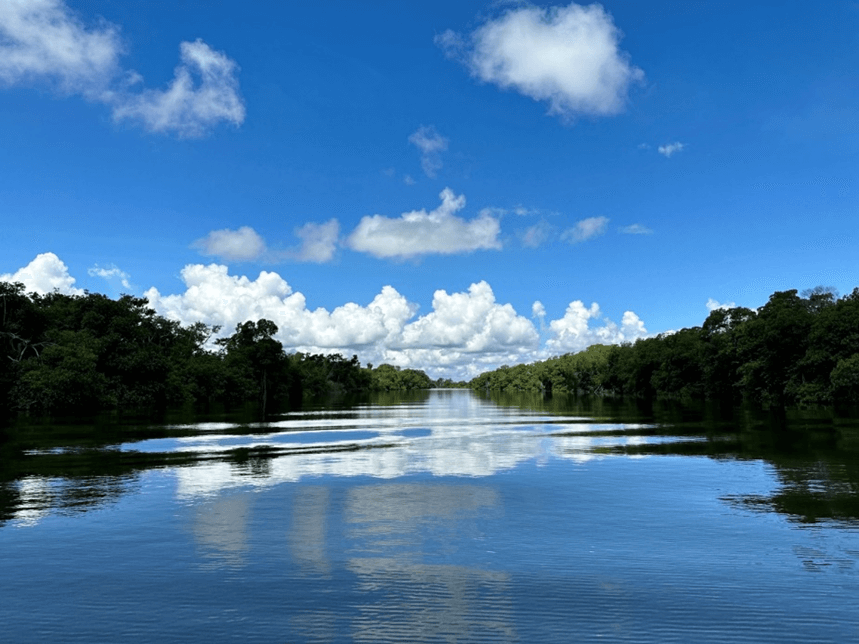
Mangrove forests on the banks of the mouth of the Belize River. Credit: Natalie Fiertz.
This Climate and Ocean Risk Vulnerability Initiative (CORVI) assessment describes a detailed road map to address the greatest risks and vulnerabilities facing Belize City. The assessment has identified three major clusters of risk and vulnerability3A complete list of the risk indicators used for this assessment is provided in Appendix 1. in Belize City:
- Increasing susceptibility to flooding;
- Rising impacts of extreme marine and terrestrial heat events;
- A fragile economy vulnerable to climate shocks.
The CORVI methodology4Details about the CORVI methodology are provided in Appendix 3. builds on national-level data and fills information gaps through extensive surveys and interviews5A list of organizations represented in this assessment (which included 93 expert surveys and 20 interviews) is provided in Appendix 2. with local experts. This subnational data creates a more complete picture of the local and regional climate risks and vulnerabilities.6Rouleau T, Stuart J, Call M, Yozell S, Yoshioka N, Maekawa M and Fiertz N (2022) The climate and ocean risk vulnerability index: Measuring coastal city resilience to inform action. Front. Sustain. Cities 4:884212. doi: 10.3389/frsc.2022.884212
Risk Cluster 1: Increasing Vulnerability to Flooding
The first cluster of risk for Belize City describes how the city is becoming increasingly vulnerable to flooding and extreme weather events. Experts rated the Total Number of People Affected by Extreme Weather Events as the highest risk in this assessment (score of 9.37)7All risk scores are out of 10.00; see Appendix 3 for more details about the risk score calculations. and the Percent of People Living Below 5 Meters Above Sea Level (score of 8.73) as the second-highest risk, reflecting Belize City’s low-lying topography on a delta at the mouth of the Belize River. This topography leaves the city highly vulnerable to flooding from storm surge (coastal flooding), swollen rivers (fluvial flooding), and high levels of rainfall that exceed the absorptive capacity of the ground and drainage systems (pluvial flooding). This vulnerability is also reflected in several of the assessment’s other highest risk indicators, including Percent of Metro Area at Risk of Flooding (medium-high risk, score of 7.17). This vulnerability is widely recognized by the local and national governments, and they have taken important steps to reduce the vulnerability, including installing pumping stations — to pump out floodwaters — as well as constructing new canals. Several factors, however, will contribute to an increasing level of vulnerability in the future. First, sea levels will continue to rise, highlighted in Projected Change in Sea Level Rise (medium-high risk, score of 6.80). In addition to the direct impacts of a projected rise in sea levels of 0.47 meters between 2040 and 2065, this could lead to storm surge of nearly six meters during a Category 5 hurricane. A Category 5 hurricane8IDOM & IH Cantabira (2017). Consulting engagement: disaster risk and climate change vulnerability assessment for Belize city. Inter-American Development Bank. would far exceed Belize City’s existing seawalls, which have a maximum height of one meter. Coastal Erosion (medium-high risk, score of 7.10) will contribute to increased levels of relative sea level rise, further exacerbating these impacts. An increasing Level of Shoreline Development (medium-high risk, score of 6.53) will increase the value of the assets exposed to coastal flooding and may also contribute to the destruction of protective coastal ecosystems, especially mangroves. Mangroves play an important role in reducing storm surge and wind damage where they still exist, and many of them are located on privately owned lands. Belize City has also lacked a coherent plan for managing the influx of domestic and international migrants, reflected in the Percent of International Migrants Living in Country (medium-high risk, score of 7.17). Some of these migrants end up building informal settlements by clearing mangroves or wetlands, increasing the city’s vulnerability to all types of flooding.
Risk Cluster 2: Economy Vulnerability to Climate Shocks
The second risk cluster provides context to how Belize’s national economy is vulnerable to growing climate impacts. Experts rated Market Losses from Extreme Weather Events (score of 7.93) as a high risk, and all of the survey respondents expect losses to grow over the next ten years. These losses include loss and damage to Belize’s tourism assets, 60 to 70 percent of which are located on or near the coast, where they are vulnerable to hazards such as sea level rise, hurricanes, storm surge, and ocean warming.9Hansen Partnership Pty Ltd, & the University of Belize (2023). Belize tourism & conservation adaptation plans and national sustainable tourism master plan update for Belize 2030 (NSTMP). University of Melbourne Landscape Architecture Program. The tourism sector is a major employer in Belize, accounting for over 40 percent of employment according to the World Travel and Tourism Council,10“Belize Travel & Tourism Economic Impact Factsheet”. World Travel & Tourism Council. https://researchhub.wttc.org/factsheets/belize reflected in the Percent of People Employed in Tourism (high risk, score of 8.45), the third-highest risk score in this assessment. The country has developed a National Sustainable Tourism Master Plan and implemented conservation policies to protect its key tourism attractions, such as the creation of new marine protected areas around the Belize Barrier Reef Reserve System. Short-term threats to Belize’s tourism economy, such as hurricanes, as well as long-term threats, such as ocean warming, could increase the country’s National Unemployment Rate (medium-high risk, score of 6.95), which remains above eight percent in 2023, well above the regional average.11“Unemployment, total (% of total labor force) (modeled ILO estimate)”. World Bank Open Data. https://data.worldbank.org/indicator/SL.UEM.TOTL.ZS?locations=BZ-ZJ-XJ This would place a serious financial burden on a government already struggling with high debt levels, reflected in Debt Ratio (high risk, score of 7.95), the fourth-highest risk in this assessment. Although the government of Belize has succeeded in reducing public debt significantly in recent years thanks to a strong post-pandemic economic recovery, public fiscal reforms, and a debt-for-nature swap known as the Belize Blue Bond. Local stakeholders highlighted how this elevated level of debt shapes Belize’s strategy for investment in climate adaptation projects. Recovery costs from a severe extreme weather event also has the potential to increase Belize’s debt. Belize’s comparatively low level of National GDP per Capita (high risk, score of 7.55) also reduces the government’s financial resources and means that individuals and businesses have fewer resources to respond to climate events and build resilience.
Risk Cluster 3: Rising Impacts of Extreme Heat
The third cluster of risk and vulnerability relates to the impacts of extreme heat on both land and sea. Extreme heat on land has multiple negative impacts on human health, reflected by Total Number of Extreme Heat Events (high risk, score of 7.93). Although experts rated the direct Mortality Attributed to Heat (medium risk, score of 4.60) as only a medium risk, heat stress also exacerbates underlying non-communicable illnesses including cardiovascular disease, diabetes, and asthma.12“Heat and Health”. World Health Organization. May 28, 2024. https://www.who.int/news-room/fact-sheets/detail/climate-change-heat-and-health Experts rated the Mortality Rate Attributed to Non-Communicable Diseases (medium-high risk, score of 6.96) as a medium-high risk, suggesting that Belize’s public health system is likely to experience an increase in the burden of non-communicable disease as extreme heat becomes more frequent and sustained. This elevated burden is likely to affect tourists in Belize in addition to the country’s residents. Belize’s maritime areas are also experiencing increased levels of heat, reflected in the Change in Sea Surface Temperatures (high risk, score of 7.69). This rise in ocean temperatures is having destabilizing impacts on Belize’s maritime ecosystems. One of the most damaging such impacts is the increased Incidence of High Sargassum Abundance (high risk, score of 7.81) which can lead to erosion, loss of habitat, and hypoxia — or oxygen depletion — in the water, which in turn can lead to the death of marine life and further harm the ecosystem.13“Blue Resilience: The Approaches to the Sargassum Crisis in the Caribbean”. UN Environment Programme. April 27, 2023. https://www.unep.org/cep/news/blogpost/blue-resilience-approaches-sargassum-crisis-caribbean Additionally, high concentrations of sargassum on beaches can release toxic hydrogen sulfide gas into the air, which can cause respiratory problems for residents and tourists.14Programme, U. N. E., Programme, C. E., & Lopez, I. C. (2021). Sargassum White Paper: Turning the Crisis into an Opportunity. These impacts will increase Belize City’s vulnerability to storm surge and extreme weather events, while also harming Belize’s tourism economy. Rising ocean temperatures is also harming Nearshore Fish Stock Status (medium risk, score of 6.57), contributing to the decline in the value of Belize’s fishing industry from 128 million Belizean dollars (BZE) in 2014 to 28.6 million BZE in 2017.15Statistical Institute of Belize (SIB) (2019). Annual Report 2018-2019. https://sib.org.bz/publications/annual-reports/, retrieved August 25, 2023.
Summary of Priority Recommendations
Based on the above risks and vulnerabilities, three areas of action were developed to prioritize climate resilience in Belize City. Local leaders should continue to work with global financial institutions, international development organizations, and the United Nations to access climate funds to implement these recommendations and support Belize City’s sustainable blue economy.
Invest in Nature-Based Solutions to Strengthen Flood Management
Investments in green spaces in flood-prone areas can improve the capacity of Belize City to absorb and retain floodwaters, reducing the impact of flooding. These projects would also have co-benefits, including habitat provision, water purification, biodiversity protection, and protection from extreme heat. They should be informed and complemented by strengthened knowledge of flooding vulnerability, drainage planning, and supportive policy reforms.
- Conduct a comprehensive mapping of flood vulnerability in Belize City to identify areas that are more vulnerable to pluvial and fluvial flooding.
- Assess the value of flooding prevention and other ecosystem services provided by currently existing mangroves, wetlands, and savannahs in and around Belize City.
- Update Belize City’s master drainage plan to inform investments in flood management solutions.
- Reform land use policy and design zoning regulations to protect existing ecosystems that reduce flooding impacts.
- Protect and restore natural ecosystems to increase the absorptive capacity of the land in and around Belize City.
- Pilot innovative institutions to efficiently leverage available resources, including carbon credits, community land trusts,16Grannis, Jessica. “Community-Driven Climate Solutions: How Public-Private Partnerships with Land Trusts Can Advance Climate ActionPartnerships with Land Trusts Can Advance Climate Action”. William & Mary Environmental Law and Policy Review. July 2020. https://scholarship.law.wm.edu/cgi/viewcontent.cgi?article=1763&context=wmelpr and voluntary property acquisition programs (also known as buyouts).
Prepare for and Support Growth in Outlying Communities
Support for the economic development and improved provision of basic services in the communities outside of Belize City could help encourage the relocation of migration patterns toward those communities, reducing the burden on Belize City’s built and natural infrastructure and mitigating its vulnerability to climate hazards.
- Map vulnerability in the greater Belize City area to flooding, extreme heat, and other climate hazards and identify low vulnerability areas to support voluntary population relocation.
- Develop an integrated regional plan to incentivize growth in, and relocation towards, identified low vulnerability areas. Ensure that this planning is responsive to changing contexts on the ground and local population needs.
- Develop drainage plans for outlying communities to reduce their vulnerability to flooding and increase their climate resilience.
- Improve provision of basic services in targeted communities, with a particular emphasis on education, healthcare, and solid waste management.
- Strengthen climate-resilient transportation infrastructure and increase frequency and availability of public transportation between Belize City and surrounding communities.
- Provide job training, loans to micro-, small, and medium enterprises, business development support, and preferential tax treatments to support job growth in outlying communities.
Strengthen Institutional Capacity for Climate Resilience
Belize City’s climate risk will continue to grow in the coming years and decades as temperatures rise and extreme weather events become more intense and more frequent. The threats posed by climate hazards will also interact in unpredictable ways with ecological, economic, and social developments in Belize. These changes demand an institutional architecture that is technically sophisticated, coordinated, and responsive to changing conditions and risks.
- Support data sharing to improve coordination between government agencies and promote a risk-informed public. Promote interoperability between data platforms currently under development.
- Consider a single, integrated data platform for climate risk under the National Climate Change Office or the Statistical Institute of Belize and integrate data sharing mandates into government agency workplans.
- Create a platform to share information on proposed, ongoing, and completed climate resilience projects.
- Build in-country technical capacity for key agencies, with a focus on climate data collection, analysis, and synthesis.
- Strengthen the disaster review capacity of the National Emergency Management Office to review disaster preparedness, response, and recovery actions in the wake of an extreme weather event and offer recommendations and technical assistance to improve policies, operational structures, and actions across key actors.
- Bolster institutional communication in Belize’s disaster early warning system by supporting a multi-hazard, impact-based forecasting approach and implementing the National Framework for Weather and Climate Services.
Provide support to the tourism industry to increase climate resilience through business continuity planning and recovery loans to improve recovery after extreme weather events.
CORVI Analysis
Ecological Risk
Belize City lies at the mouth of the Belize River and Haulover Creek. Its low-lying terrain features rivers, creeks, and estuarine areas, with parts of the city below sea level.17DOM & IH Cantabira (2017). Consulting engagement: disaster risk and climate change vulnerability assessment for Belize City. Inter-American Development Bank. The city serves as a gateway to major tourist attractions like the Great Blue Hole, located within a UNESCO World Heritage Site. Mangroves, coral reefs, and seagrass beds along the coastline serve as essential protection against coastal erosion, hurricanes, and storm surges. Healthy coastal and marine ecosystems can play an essential role in reducing the impacts of climate change. This is especially the case when considering the vulnerability of Belize City to flooding from hurricanes and heavy precipitation events.
- The CLIMATE category (expert weighted average score of 5.99) highlights the threats to Belize City from a wide range of climate hazards. High risk scores were calculated for several climate indicators, including People Affected by Extreme Weather Events (high risk, score of 9.37), Total Number of Extreme Heat Events (high risk, score of 7.82), and Change in Sea Surface Temperature (high risk, score of 7.69). The Total Number of Wet Days received a medium-high risk score of 6.13, emphasizing the rising impact of climate hazards. Cases of Vector-Borne Disease Infections (score of 5.67) and Mortality Rate Attributed to Non-Communicable Diseases (score of 6.96) received medium-high risk scores, indicating increasing concerns about the impacts of climate change on human health.
- In the GEOLOGY/WATER category (expert weighted average score of 5.18), medium-high risk scores were identified for the Percent of Metro Area at Risk of Flooding (score of 7.17), Rate of Coastal Erosion (score of 7.10), Projected Change in Sea-Level Rise (score of 6.80), Degree of Saltwater Intrusion in Coastal Aquifers (score of 5.60), and Percent of Bodies of Water with High Water Quality (score of 5.00). The combination of these medium-high risks highlights the vulnerabilities of Belize City’s low-lying natural geography.
- In the ECOSYSTEMS category (expert weighted average score of 4.86), a high risk score highlights Belize City’s emerging and increasing challenges related to high Sargassum Abundance (score of 7.81). Medium-high risk scores were also identified for Level of Seagrass Bed Coverage (score of 6.35), Health of Existing Seagrass Beds (score of 5.73), Percent of GDP Protected by Seagrass Beds (score of 5.59), and Health of Existing Coral Reefs (score of 5.08), indicating the role of the decline of seagrass bed and coral reef ecosystems.
- The results in the FISHERIES category (expert weighted average score of 4.52) show the decline of the coastal fisheries in and around Belize City. Medium-high risk scores were recorded for Nearshore Fish Stock Status (score of 6.57) and Fish Consumption per Capita (score of 6.53).
CORVI’s ecological risk indicators reflect vulnerabilities from hurricanes, extreme rain, extreme heat, coastal erosion, and sea level rise. Belize City’s low-lying topography means that many of these events — particularly flooding from heavy rains, swollen rivers, and surging seas — have impacts across the city, reflected in the Total Number of People Affected by Extreme Weather Events (high risk, score of 9.37), which local experts rated the highest risk in this assessment.
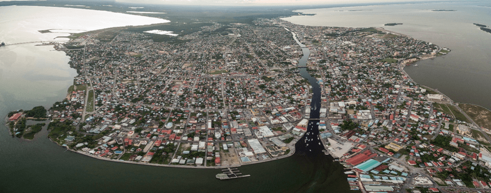
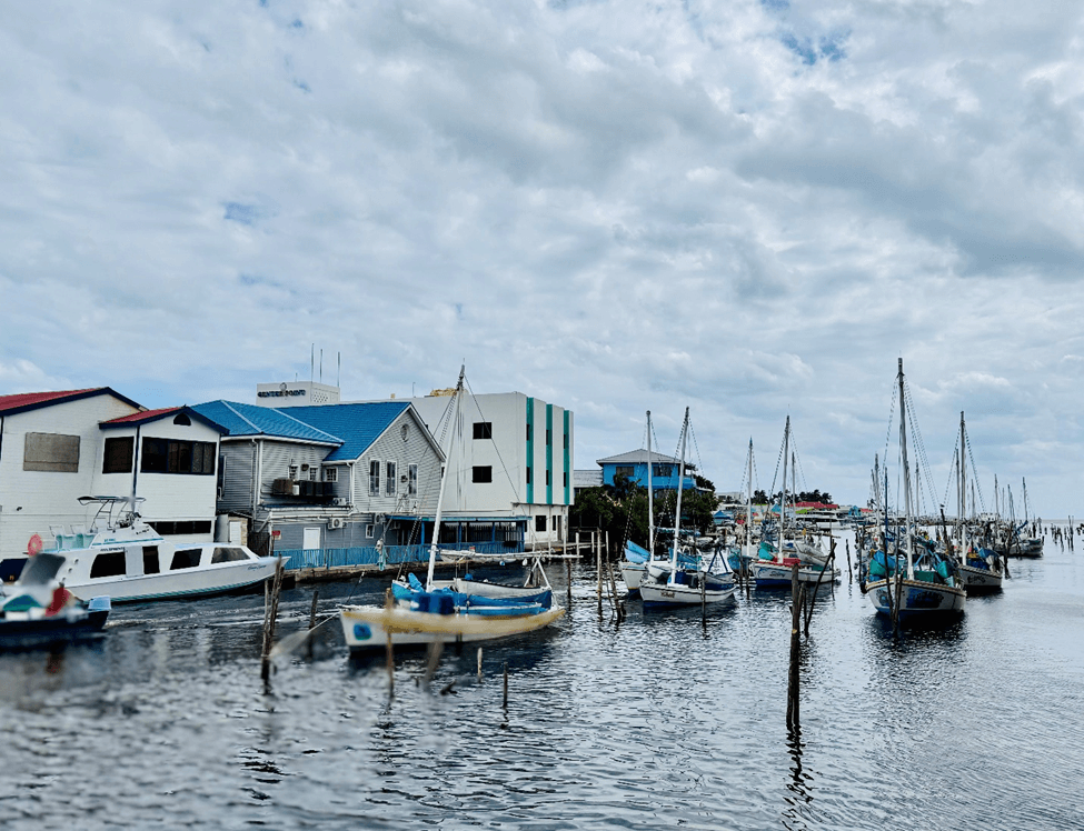
Belize City. Credit: photosounds, December 2017. Shutterstock.
Low-lying terrain features of Belize City, such as riverbeds and lagoons, increase vulnerability to riverine and coastal flooding.18Ibid. Approximately 40 percent of Belize City is covered in wetlands, which can help to reduce vulnerabilities to flooding and storm surge.19IDOM. (2017). Consulting engagement: Urban growth study. Inter-American Development Bank. Nonetheless, low-lying areas and areas near the water, including Haulover Creek, Belize River, West and East Collet Canals, and Faber’s Lagoon, are at high risk of flooding. This low-lying topography across much of the city is reflected in the Percent of Metro Area at Risk of Flooding (medium-high risk, score of 7.17). Several interview respondents highlighted flooding as one of the major challenges facing the city, underscoring its frequency and severity.
High risk scores for the Total Number of Extreme Heat Events (score of 7.82) and Change in Sea Surface Temperature (score of 7.69) reflect concerns of increased vulnerability from increased terrestrial heat and warming waters. Models predict that during the 2060s, air temperatures in Belize City are expected to increase by approximately two degrees Celsius.20National Climate Change Office, Ministry of Agriculture, Fisheries, Forestry, the Environment and Sustainable Development, Belize’s Third National Communication to the United Nations Framework Convention on Climate Change, 2016. An increase in the number of heatwave days has already been observed; Belize experienced 8.8 more heatwave days per year between 2016 and 2020 compared to the period from 1986 to 2005.21IPCC, Climate Change 2022: Impacts, Adaptation and Vulnerability – Contribution of Working Group II to the Sixth Assessment Report of the Intergovernmental Panel on Climate Change (Cambridge University Press, 2022), https://doi.org/10.1017/9781009325844. Extreme heat events may affect human health. Issues such as heat stroke, heat exhaustion, and dehydration are directly attributable to extreme heat, and will likely become more frequent in the future, although local experts rated Mortality Attributed to Heat (medium risk, score of 4.60) as a relatively lower risk. Extreme heat also worsens non-communicable diseases such as cardiovascular illness, respiratory disease, diabetes, and kidney disease,22“Extreme Heat,” U.S. Department of Health and Human Services, last reviewed November 5, 2024, https://www.hhs.gov/climate-change-health-equity-environmental-justice/climate-change-health-equity/climate-health-outlook/extreme-heat/index.html. reflected in Mortality Rate Attributed to Non-Communicable Diseases (medium-high risk, score of 6.96). The elderly population, both residents and tourists, are most vulnerable to these types of diseases.
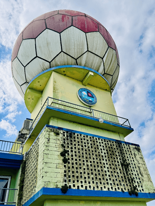
Office of the National Meteorological Service of Belize. Credit: Carolyn Gruber, December 2024.
The rainy season and precipitation patterns of Belize City are also predicted to change in the future. Rainfall in the original main rainy season months, from May to July, is expected to decrease, while the monthly rainfall in October and November, toward the end of the rainy season, is projected to increase by more than 55 millimeters by the 2060s,23National Climate Change Office, Ministry of Agriculture, Fisheries, Forestry, the Environment and Sustainable Development, Belize’s Third National Communication to the United Nations Framework Convention on Climate Change, 2016. reflected in Total Number of Wet Days (medium-high risk, score of 6.13). The increase in precipitation is likely to increase the spread of vector-borne disease, reflected in Cases of Vector-Borne Disease Infections (medium-high risk, score of 5.67). The incidence of dengue fever in Belize, for example, has trended upward over the past two decades, according to the Pan-American Health Organization (PAHO).24Dengue Incidence Rate by 100,000 Habitants for the Countries and Territories of the Americas, (2024), distributed by the Health Information Platform of the Americas, https://www3.paho.org/data/index.php/es/temas/indicadores-dengue/dengue-nacional/240-dengue-incidencia.html. While there is significant year-to-year variability in reported cases, in 2022, dengue affected nearly 1,300 out of every 100,000 people in Belize – the highest rate of incidence in the PAHO records, which go back to 1980. The 13 years with the highest incidence rate have all occurred since 2012.25Ibid. The country has made important progress against other diseases, however. Most significantly, the World Health Organization declared Belize officially malaria-free in 2019 thanks to strong and sustained surveillance, vector control, and investment in trained health workers.26Lisa Schnirring, “Belize Achieves WHO Malaria-free Status,” News Brief, Center for Infectious Disease Research and Policy, University of Minnesota, June 21, 2023, https://www.cidrap.umn.edu/dengue/belize-achieves-who-malaria-free-status .
Belize City coastline. Credit: Natalie Fiertz, October 2023.
Projected changes in sea-level rise (medium-high risk, score of 6.80) also present an increasing climate hazard to Belize City. From 2040 to 2065, sea levels are expected to rise by 0.47 meters, potentially leading to 5.87 meters of storm surge during a Category 5 hurricane, which could result in significant flooding across much of the city. 27IDOM and Cantabira, Consulting Engagement: Disaster Risk. To protect the low-lying coastal areas of Belize City from the sea-level rise and flooding caused by storm surges, the Government of Belize has constructed seawalls to cover part of the coastline. However, these seawalls are only about one meter high, with some even lower; this may not be sufficient protection in the near future. The construction of these seawalls has led to beach erosion, as wave energy is increased in areas adjacent to the seawalls. The erosion has prompted new measures to protect beaches, such as replanting mangroves, which is reflected in the medium-high risk score for the Rate of Coastal Erosion (score of 7.10). Furthermore, sea-level rise is expected to increase saltwater intrusion into freshwater resources, which is reflected in the scores for the Degree of Saltwater Intrusion in Coastal Aquifers (medium-high risk, score of 5.60) and Percent of Bodies of Water with High Water Quality (medium risk, score of 5.00).
Local experts rated Incidence of High Sargassum Abundance (high risk, score of 7.81) as the third highest ecological risk for Belize City, reflecting an emerging issue that has been a growing crisis throughout the Caribbean since 2011.28United Nations Environment Programme – Caribbean Environment Programme, Sargassum White Paper. While small quantities of sargassum can be ecologically beneficial, the accumulation and decay of large quantities of sargassum has wide-ranging ecological harms. It can obstruct navigation for fishing boats entering and exiting ports and beaches. High concentrations of sargassum on beaches can also release toxic hydrogen sulfide, which can cause respiratory problems for residents and tourists.29United Nations Environment Programme – Caribbean Environment Programme, Sargassum White Paper. Hydrogen sulfide can also kill mangroves, contributing to the decline of these protective ecosystems.30Sean McCoon, “Rotting Sargassum Seaweed Overwhelms Tobago Mangroves,” Cari-Bois Environmental News Network, September 15, 2021, https://www.caribois.org/2021/09/rotting-sargassum-seaweed-overwhelms-tobago-mangroves/. High concentrations of sargassum also trap marine litter, block light from reaching marine species, increase water temperatures, and host potentially harmful bacteria colonies.31María Mónica Monsalve Sánchez and Krista Campbell, “A Decade of Sargassum Damage Is Suffocating Caribbean Ecosystems,” El País, April 12, 2024, https://english.elpais.com/science-tech/2024-04-12/a-decade-of-sargassum-damage-is-suffocating-caribbean-ecosystems.html. All of these damage corals and numerous fish species, degrading the marine ecosystems that attract tourists, protect the coastline, and are critical for fishers. Even the process of removing sargassum from beaches can be detrimental, as the use of heavy machinery can increase coastal erosion.32Monsalve Sánchez and Campbell, “A Decade of Sargassum Damage.” Belize is trying innovative approaches to address the challenges associated with sargassum, including developing a pilot project in 2023 to convert sargassum into biofuel.33“Belize to Launch Project to Make Biofuel from Seaweed Clogging Caribbean Coasts,” Reuters, October 3, 2023, https://www.reuters.com/business/environment/belize-launch-project-make-biofuel-seaweed-clogging-caribbean-coasts-2023-10-03/.
Concerns related to seagrass beds are indicated by the medium-high risk scores for the Level of Seagrass Bed Coverage (score of 6.35), Health of Existing Sea Grass Beds (score of 5.73), and Percent of GDP Protected by Sea Grass Beds (score of 5.59). Seagrass beds support one of the main marine ecosystems in the country, covering 1,500 square kilometers along Belize’s coastline. Seagrass ecosystems offer essential goods and services to coastal communities; they stabilize sediments, protect coastlines, support fisheries, mitigate climate change, and maintain biodiversity. At the national level, 41.6 percent of seagrass beds are within protected areas.34Government of Belize, Sixth National Report for Convention on Biological Diversity Belize, 2019. However, these seagrass beds are increasingly impacted by tourism development, polluted outflows from the Belize River, and urbanization.35World Wildlife Fund (WWF Mesoamerica), Seagrass Conservation and Protection in Belize – Guidelines for Management, Conservation and Protection, 2022.
The ocean provides livelihoods for nearly 200,000 Belizeans, with coral reefs contributing to 15 percent of Belize’s GDP.36S. Nawaz, N. Bood, and V. Shal, Natural Heritage, Natural Wealth: Highlighting the Economic Benefits of the Belize Barrier Reef Reserve System World Heritage Site, Technical Report, World Wildlife Fund (WWF), 2017. This includes approximately $15 million USD from the fishing sector and $200 million USD from the tourism sector. However, both commercial and herbivorous fishes in the coral reef declined by 50 percent during the COVID-19 pandemic.37M. McField, M. Soto, N. Craig, A. Giró, C. Guerrero, I. Drysdale, M. R. Flores, I. M. Castillo, P. Kramer, and S. Canty, 2022 Mesoamerican Reef Report Card, Healthy Reefs Initiative, 2022,. www.healthyreefs.org. In March 2020 in Belize, the pandemic led to movement restrictions, a tourism shutdown, and widespread job losses. This economic decline pushed many toward the fisheries sector for livelihoods and subsistence, which is reflected in the Health of Existing Coral Reefs (medium-high risk, score of 5.08).
Belize lost over five percent of its mangrove coverage between 1980 and 2017.38Belize Mangrove Alliance – Action Plan 2022–2027, https://www.mangrovealliance.org/wp-content/uploads/2022/09/BMA-Action-Plan_Final.pdf . Mangroves protect against storm surge, with research showing that sufficiently robust mangrove forests can reduce wave energy by up to 66 percent.39P. Menéndez, I. J. Losada, S. Torres-Ortega et al., “The Global Flood Protection Benefits of Mangroves,” Scientific Reports 10, article no. 4404 (2020), https://www.nature.com/articles/s41598-020-61136-6. The government has taken steps to reverse Belize’s mangrove loss, reflected in Level of Mangrove Coverage (medium risk, score of 4.25). Of the remaining mangroves, 16.6 percent are protected as of 2019,40Belize Mangrove Alliance – Action Plan. and a multi-stakeholder coalition of the public sector, civil society, academia, and local communities forms the Belize Mangrove Alliance, which has developed an Action Plan for 2022–2027 to increase mangrove protection and health. Belize City, however, has lost mangrove coverage around much of the city as a result of urbanization and development, increasing the city’s vulnerability to storm surge, wind damage, and coastal erosion.
The fishing sector contributes about five percent of Belize’s GDP,41Government of Belize, Sixth National Report. significantly lower than tourism’s 30 percent. Finfish are the primary focus of the domestic market for consumption, while the export market depends on spiny lobster (Panulirus argus) and queen conch (Strombus gigas).42OCEANA, State of Belize Fisheries Report 2020 (2021), https://belize.oceana.org/reports/state-of-belize-fisheries-report-2020/. Commercial and artisanal fishing occurs on nearshore coral reef and seagrass bed ecosystems and is conducted by small-scale coastal fishers. According to the latest annual report from the Statistical Institute of Belize, the GDP of the fishing industry decreased from 128 million Belizean dollars (BZE) in 2014 to 28.6 million BZE in 2017,43Statistical Institute of Belize, Annual Report 2018-2019. reflected in Nearshore Fish Stock Status (medium-high risk, score of 6.57). Several conservation and management measures have been implemented in Belize, including restrictions on fishing near coral reefs, which are reflected in lower scores for the Percent of Fisheries Managed Sustainably (medium risk, score of 3.85) and the Level of Unreported Catch Estimates (low risk, score of 2.27). The effects of climate change on fisheries may be underestimated as a result of the lack of efficient fisheries data, including details on harvests.
Economic Risk
Climate change poses serious risks to the economy of Belize City and to the broader national economy. Strong efforts by local leaders to build climate resilience in the low-lying, flood-prone city are constrained by financial and technical capacity limitations, including high levels of public debt. Belize City is critical to the economic health of the country, both as a hub for tourists traveling along the coast and throughout broader Belize, as well as through its local job growth and economic development.
- The ECONOMICS category (expert weighted average score of 6.32) is characterized by high risk scores for Belize’s Debt Ratio (score of 7.95), Market Losses from Extreme Weather Events (score of 7.93), and National GDP per Capita (score of 7.55), highlighting the risk of a vicious cycle in which extreme weather increases debt, reducing the resources to build climate resilience and leaving the city vulnerable to future extreme weather events.
- The INFRASTRUCTURE category (expert weighted average score of 5.30) includes the highest risk score in the Economics Risk area, the Percent of People Living Below 5 Meters Above Sea Level (high risk, score of 8.73). It also includes medium-high risk scores around the Level of Shoreline Development (score of 6.53) and Percent of Low-Income Housing in Relation to Flood Zones (score of 6.31), underscoring how Belize City’s low-lying topography increases its vulnerability to flooding.
- The MAJOR INDUSTRIES category (expert weighted average score of 4.68) includes medium-high risk scores for Diversity of Lodging Types (score of 5.73) and Percent of National Economy Based in Agriculture (score of 5.15). All other indicators in this category are medium risk, including Percent of National Economy Based in Tourism (score of 4.28), suggesting that local experts expect current efforts are effective in building climate resilience in the sector.
Belize’s key industries are agriculture, seafood products, and tourism. Although these industries do not have a major presence within the boundaries of Belize City, they are linked to the resilience of Belize City in two principal ways. First, Belize City is an important transport hub. Tourists transit through Belize City en route to destinations throughout the country, while agricultural goods — especially those grown in the north and center of the country — are shipped through the city’s port. Second, losses to these industries could destabilize the national economy and increase migration into Belize City, putting increased stress on the city’s infrastructure and increasing its vulnerability.
Key agricultural products for Belize include raw sugar (20 percent of exports in 2022), bananas (10 percent of exports), and citrus products, while exports of fish and other seafood products account for another 13 percent.44Observatory of Economic Complexity, https://oec.world/en/profile/country/blz?depthSelector1=HS4Depth Despite their large share of exports, agriculture and fishing account for only nine percent of GDP.45World Bank, OECD, “Agriculture, Forestry, and Fishing, Value Added (% of GDP) – Belize,” https://data.worldbank.org/indicator/NV.AGR.TOTL.ZS?locations=BZ&view=chart. The role of agriculture as an important economic sector for Belize is reflected in Percent of National Economy Based in Agriculture (medium-high risk, score of 5.15).
Research is mixed on the likely impacts of climate change on Belize’s agriculture. A Food and Agriculture Organization study found that the country faces a projected loss in production of 10 to 20 percent.46Roble Sabrie, Luis Loyola, and Jacopo Monzini, “Priority Areas for Irrigation Investments in Belize,” FAO Investment Centre Country Highlights, No. 23, 2024, https://openknowledge.fao.org/server/api/core/bitstreams/19e82bcc-7a93-4886-8f77-eb4bb2a5235b/content. These impacts are due primarily to increased frequency and intensity of extreme weather events, particularly hurricanes and drought. Studies on the projected impacts of climate change on Belize’s key crops of banana47Varun Varma and Daniel P. Bebber, “Climate Change Impacts on Banana Yields Around the World,” Nature Climate Change 9, no. 10, 2019, https://www.ncbi.nlm.nih.gov/pmc/articles/PMC6774771/. and sugarcane48Thiago Vizine Da Cruz and Ricardo Luiz Machado, “Measure Climate Change’s Impact on Different Sugarcane Varieties Production in the South of Goiás,” Scientific Reports 13, article no. 11637 (2023), https://www.nature.com/articles/s41598-023-36582-7; A. D. Baez-Gonzalez, J. R. Kiniry, M. N. Meki et al., “Potential Impact of Future Climate Change on Sugarcane Under Dryland Conditions in Mexico,” Journal of Agronomy and Crop Science 2018, https://doi.org/10.1111/jac.12278. suggest that changes in average temperature and precipitation may increase yield of both crops. Interviewees also specifically noted the threat that ocean acidification poses to lobster and queen conch,49Interview with representative of the Belize Chamber of Commerce. which are the two most valuable fisheries industries in the country. Queen conch exports doubled in quantity from 200 metric tons to 400 metric tons between 2003 and 2018, and the value of those exports tripled over the same period.50https://earthjournalism.net/stories/revisiting-the-science-of-conch-maturity-five-years-later-in-belize
Belize’s banana crop is almost entirely made up of a single species, Cavendish bananas, which are threatened by Fusarium wilt tropical race 4 (TR4).51https://reliefweb.int/report/belize/taiwan-technical-mission-belize-introduced-taiwans-formosana-aaa-enhance-capability-belize-bananas-resist-fusarium-tr4-banana TR4 is a fungal disease that has devastated Cavendish bananas in Asia and that spread to Latin America in 2021.52https://www.iaea.org/newscenter/pressreleases/iaea-trains-latin-american-scientists-in-fighting-banana-disease Beyond production, Belize faces growing risks from food security, reflected in the Percent of Population Experiencing Moderate or Severe Food Insecurity (medium-high risk, score of 5.13). The share of the population facing moderate or severe food insecurity has grown from 35.7 percent to 45.5 percent between 2018 and 2021.53https://data.worldbank.org/indicator/SN.ITK.MSFI.ZS?locations=BZ
The Belize tourism sector experienced rapid growth from 13.3 percent to 27.1 percent of GDP between 2000 and 2019.54IDOM. (2017). Consulting engagement: Urban Growth Study. Inter-American Development Bank. The number of tourist arrivals also doubled over the decade between 2008 and 2018,55https://data.worldbank.org/indicator/ST.INT.ARVL?locations=BZ and tourism makes up 30 percent of Belize’s economy.56https://researchhub.wttc.org/factsheets/belize Overnight tourist arrivals have recovered strongly after the pandemic, and visitors through the first seven months of 2024 have exceeded visitors over the same period in 2019.57https://www.belizetourismboard.org/belize-tourism/statistics/, accessed September 4, 2024 Cruise ship arrivals in 2023, however, are still 23 percent below 2019.58https://www.globalpropertyguide.com/caribbean/belize/price-history Belize City has accounted for 14 percent of all tourist visits in 2024, up slightly from 11 percent in 2019.59https://www.belizetourismboard.org/belize-tourism/statistics/, accessed September 4, 2024 This makes the city Belize’s third largest tourist destination, behind San Pedro (Ambergris Caye), Belize’s largest offshore island, and Cayo District, which includes inland archeological sites. Local experts rated Diversity of Lodging Types as amedium-high risk (score of 5.73), likely reflecting the growth of rental living spaces like Airbnb, but household overcrowding is significantly lower in Belize District (~4 percent) than in more rural areas like Toledo District (~22 percent).60https://www.globalpropertyguide.com/caribbean/belize/price-history
Belize’s National Sustainable Tourism Master Plan (NSTMP) outlines the country’s strategy to develop its tourism sector through 2030.61https://tourism.gov.bz/resources/nstmp/ The NSTMP includes specific strategies for each of eight most important tourism areas in the country. Although it only includes a high-level assessment of how climate impacts may affect Belize’s tourism sector, its focus on urban renovation as the strategy for Belize City presents an opportunity to address the climate vulnerabilities identified in this assessment. Experts rated the risk for the Percent of National Economy Based in Tourism (medium risk, score of 4.28) as relatively low, suggesting that they expect current resilience planning to be successful in building climate resilience in the tourism sector.
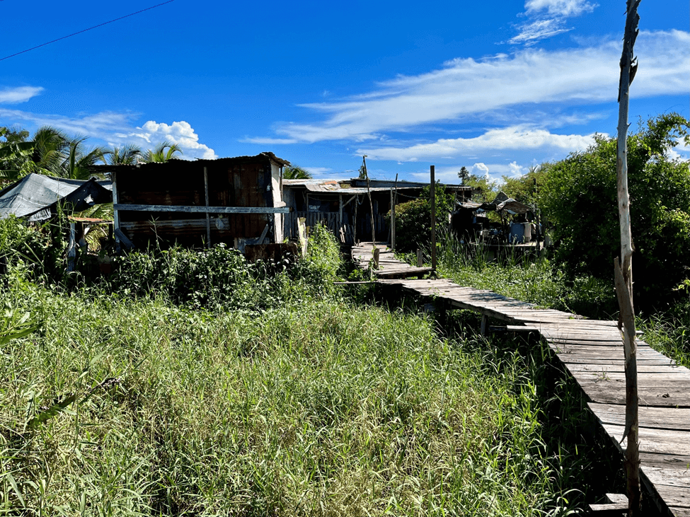
London Bridges informal settlements. Credit: Natalie Fiertz, October 2023.
The most critical such vulnerability is the city’s susceptibility to flooding. Belize City is in a low-lying coastal area, reflected in Percent of People Living Below 5 Meters Above Sea Level (high risk, score of 8.73), the highest risk score in the Economic Risk section. Its location near the mouth of the Belize River means that the city is exposed to severe coastal, pluvial, and fluvial flooding. The loss of mangroves and wetlands in Belize City increases the city’s vulnerability to flooding. The premium on space in the city resulting from its rapid urbanization and tourism development, reflected in Level of Shoreline Development (medium-high risk, score of 6.53), drives the loss of these ecosystems. Mangroves and wetlands are converted to tourism development,62Interview with representative of the forest department, Ministry of Sustainable Development, Climate Change, and Disaster Risk Management. residential zones (as in the Belama neighborhoods),63Ibid. and informal housing for new migrants. Interviewees highlighted areas like Krooman Lagoon and London Bridges, both in southern Belize City, as examples of the way these types of urban expansion threaten coastal ecosystems. Lower-income areas of the city, most notably the Faber’s Road Extension area in the southern part of Belize City, are also often geographically more susceptible to flooding,64https://documents.worldbank.org/en/publication/documents-reports/documentdetail/099072424063528128/p18106415fe0390e31847713b5e9882cbe2 reflected in Percent of Low-Income Housing in Relation to Flood Zones (medium-high risk, score of 6.31).
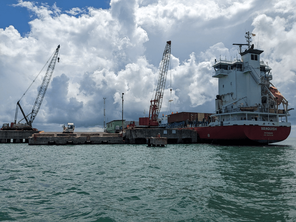
Belize City port. Credit: Natalie Fiertz, October 2023.
The Faber’s Road Extension area is also the location of Belize City’s existing wastewater treatment facility. The facility was completed in 1979, and continued population growth in the city requires its expansion and upgrade,65https://documents.worldbank.org/en/publication/documents-reports/documentdetail/099072424063528128/p18106415fe0390e31847713b5e9882cbe2 reflected in Proportion of Wastewater Safely Treated (medium-high risk, score of 5.56). An upgrade is also necessary to reduce the risk of damage to surrounding wetlands and residents from polluted overflow, which would further increase the area’s vulnerability to flooding. In July 2024, the World Bank and Belize Water Services began the environmental and social assessment for the upgrade of the facility.66Ibid. The port is also located near the Faber’s Road Extension area, and local experts rated the Level of Resilience for Ports and Shipping a medium-high risk (score of 5.54), highlighting the multiple and potentially compounding risks faced by the area.
The city’s high level of vulnerability to flooding and to tropical storm winds is reflected in Market Losses from Extreme Weather Events (high risk, score of 7.93). Even popular areas, such as Princess Margaret Drive in the Hangar area, are completely inundated with the rising tide.67Interview with the mayor of Belize City. The government has implemented important regulations to help mitigate this vulnerability, including a 66-foot setback from the coastline and building regulations to reduce wind damage.68Stakeholder meeting, October 2023. Enforcement of the setback is not consistent, but the building regulations, which apply to new construction and rebuilding efforts, successfully reduced damage from Hurricane Lisa in 2022.69Ibid. Local experts rated the risk of the Level of Housing Damage from Extreme Weather Events (medium-high risk, score of 5.52) higher than the Level of Commercial Infrastructure Damage from Extreme Weather Events (medium risk, score of 4.91), suggesting a higher level of vulnerability for residential structures and areas.
In 2018–2019, the government invested USD $8.9 million in domestic public finance for resilience-building projects.70NDC (2021). Belize-updated nationally determined contribution. https://unfccc.int/sites/default/files/NDC/2022-06/Belize%20Updated%20NDC.pdf, retrieve August 25, 2023. However, its investments are limited by the country’s high Debt Ratio (high risk, score of 7.95) and a National GDP per Capita (high risk, score of 7.55) of under $8,000.71https://data.worldbank.org/indicator/NY.GDP.PCAP.CD?locations=BZ-CR-MX. Accessed September 10, 2024. This is less than 60 percent of Mexico’s GDP per capita and below 50 percent of Costa Rica’s.72Ibid.
Hurricane Earl in 2016 cost Belize 11 percent of its GDP and led to an overall debt of 100 percent of its GDP.73https://www.elibrary.imf.org/view/journals/002/2018/329/002.2018.issue-329-en.xml The government succeeded in bringing debt down in the following years, but it spiked again in 2020 to 102 percent of GDP. A strong economic recovery, government fiscal reforms, and a debt-for-nature swap with the Nature Conservancy helped reduce the debt again, to 67.1 percent in 2022.74https://www.imf.org/en/News/Articles/2024/02/27/cs22724-belize-staff-concluding-statement-of-the-2024-article-iv-mission In January 2022, the prime minister established the Blue Bond and Finance Permanence Unit within the Office of the Prime Minister to coordinate the delivery of Belize’s commitments under the Blue Bond Agreements. The agreement has reduced the country’s national debt by 12 percent, lowered debt servicing costs, and increased the country’s long-term investment in ocean conservation for the next 20 years, with a commitment to protect up to 30 percent of Belize’s ocean.75Interview with representative of Blue Bond and Project Finance for Permanence (PFP) Coordination Unit The 2024 International Monetary Fund (IMF) assessment, however, found that “debt dynamics have become more difficult,” and projects that public debt will fall slowly in the coming years, remaining above 58 percent in 2029.76Ibid.
Local experts also identified the National Unemployment Rate as a medium-high risk (score of 6.95). This suggests that the International Labor Organization’s (ILO’s) estimate of an 8.3 percent rate of unemployment in 202377https://data.worldbank.org/indicator/SL.UEM.TOTL.ZS?locations=BZ&view=chart. Accessed September 11, 2024. is more reflective of the situation on the ground than the IMF’s estimate of 3.4 percent.78https://www.imf.org/en/News/Articles/2024/02/27/cs22724-belize-staff-concluding-statement-of-the-2024-article-iv-mission Local businesses in Belize City, however, also report increasing difficulties in finding and retaining workers, driven in part by the recent growth in the business process outsourcing sector (such as customer service).79https://nearshoreamericas.com/unemployment-rises-in-belize-while-businesses-cry-for-workers/ This suggests a bifurcated labor force in which businesses compete for a small share of sufficiently skilled workers even as the labor participation rate sits at 66 percent, below the regional average.80https://data.worldbank.org/indicator/SL.TLF.ACTI.ZS?locations=BZ-ZJ-XJ. Accessed September 11, 2024.
The ILO81https://www.ilo.org/sites/default/files/wcmsp5/groups/public/@ed_emp/documents/publication/wcms_645572.pdf and the Inter-American Development Bank82https://www.preventionweb.net/media/96966/download?startDownload=20240911 note that climate impacts — including heat stress, extreme weather events, and loss of ecosystem services — will reduce working hours and employment. They also note that well-designed adaptation policies can create jobs both directly and by reducing climate impacts. This includes social protection policies such as “cash transfers and public employment programmes.”83https://www.ilo.org/sites/default/files/wcmsp5/groups/public/@ed_emp/documents/publication/wcms_645572.pdf Belize’s labor market dynamics also contribute to a high Level of Informal Economy (medium-high risk, score of 6.01), which accounts for between 40 and 47 percent of Belize’s economy.84https://www.worldbank.org/en/research/brief/informal-economy-database Businesses in the informal sector are often less able to take steps to reduce their vulnerability to climate impacts, and they also generate less tax revenue, limiting the government’s ability to invest in climate adaptation.
Given the constraints on available financing, the Government of Belize is actively seeking funding opportunities to enhance infrastructure and systems that bolster climate resilience.85Interview with representative of Belize Water Services. The National Climate Change Office and the Climate Finance Unit are also engaging with institutions such as the Green Climate Fund, the Global Environment Facility, the Adaptation Fund, the Inter-American Development Bank, the World Bank, and others to seek opportunities for grant and highly concessional loan financing for climate resilience solutions.
Interviewees specifically noted the work to build and strengthen a multi-hazard early-warning system for the Belize watershed, including Belize City.86Interview with representative of the Ministry of Economy Development. This includes water-level sensors on the Belize River, which can give residents of Belize City several hours’ warning of fluvial flooding.87Interview with representative of the National Hydrological Service. Cooperation between different departments, such as the planning and sanitation departments, is crucial in these and other efforts to address issues such as flooding and using GIS mapping and inspections to identify vulnerable areas.88Interview with representative of the City Planning Office of Belize City.
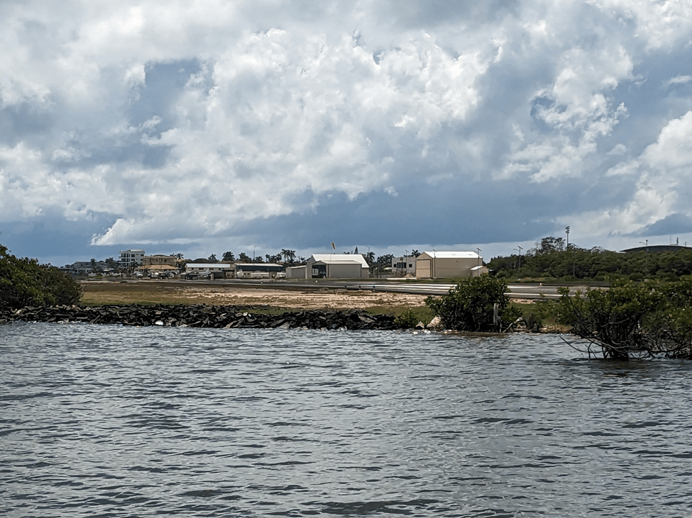
Sir Barrey Bowen Municipal Airport. Credit: Natalie Fiertz, October 2023.
These efforts also aim to strengthen Belize City’s infrastructure. Several interviewees noted the importance of projects like the Climate Vulnerability Reduction Program, which is described in greater detail in the Status of Resilience Planning section of this report. Local experts rated some key indicators, such as the Level of Water Distribution Infrastructure Resilience (medium risk, score of 3.80) and Percent of Population with Adequate Access to Electricity (medium risk, score of 3.21), as relatively low priority, suggesting that existing efforts have successfully built resilience in these areas. Conversely, the Level of Resilience for Airports (medium-high risk, score of 5.20) suggests more work is needed to protect airports from climate impacts. Belize City’s primary airport, Philip SW Goldson International Airport, is protected by riverine forests. Two roads, the Philip Goldson Highway and the George Price Highway, connect the airport to the city. Both highways run very close to the Belize River and are at risk of flooding, blocking access to the airport. Sir Barry Bowen Municipal Airport, which is located in the northern part of Belize City and serves local Belizean tourist destinations, sits on the edge of the Caribbean Sea, with very minimal protection in some areas.
Social Risk
Because Belize City is Belize’s principal city and the gateway into the rest of the country, its vulnerability to climate risk has far-reaching effects. The risk scores in this section highlight the large role of Belize’s climate-vulnerable tourism sector, the impacts of increasing population on the city’s ecosystems and infrastructure, and challenges around funding for and consistent implementation of climate resilience projects.
- The STABILITY category (expert weighted average score of 4.99) includes the highest risk indicator in the Political Risk area, the Percent of People Employed in Tourism (high risk, score of 8.45), which highlights the importance of direct and indirect employment in a climate-vulnerable industry. A medium-high risk score for the Number of Years that the Current Government Structure Has Been in Place (score of 6.44) reflects the impact of political turnover on policy consistency.
- The GOVERNANCE category (expert weighted average score of 4.95) emphasizes challenges around securing funding climate resilience projects in Investment in Climate Resiliency Development Projects (medium-high risk, score of 6.24). Medium-high risk scores for Rule of Law (score of 6.24) and Capacity of Ethics Enforcement Bodies (score of 5.18) highlight local concerns around institutional integrity in Belize.
- In the SOCIAL/DEMOGRAPHICS category (expert weighted average score of 4.73), medium-high risk scores in Percent of International Migrants Living in Country (score of 7.17) and Percent of Urban Population Below 30 Years of Age (score of 5.53) highlight the way that immigration and population growth increase pressure on the city’s ecosystems and infrastructure, increasing its vulnerability to climate impacts. A medium-high risk score for Percent of Population Below Poverty Line (score of 5.23) underscores how limited resources and economic opportunities can shape both individual- and community-level vulnerability to climate change.
Launched in 2010, the Belize City Master Plan Project ambitiously aims to create a “renewed” and climate-resilient Belize City.89Belize City Council. Belize City Master Plan. https://www.belizecitycouncil.org/belize.php?mp_id=1, retrieved June 8, 2024. To support this vision, Belize has developed policy frameworks for climate adaptation. Priority sectors include coastal and marine resources, agriculture, water resources, tourism, fisheries and aquaculture, human health, and forestry.90NDC (2021). Belize-updated nationally determined contribution, retrieve June 8, 2024.https://unfccc.int/sites/default/files/NDC/2022-06/Belize%20Updated%20NDC.pdf This planning is reflected in the comparatively low risk score for National Climate Adaptation Plan (medium risk, score of 4.80). The Climate Resilient Infrastructure Project, for example, enhances the resilience of road infrastructure.91World Bank Group (2014). Belize – Climate Resilient Infrastructure Project (English). https://documents.worldbank.org/en/publication/documents-reports/documentdetail/938171468014410229/belize-climate-resilient-infrastructure-project, retrieve June 8, 2024. Even for the city’s major streets, however, drainage remains a challenge.92Interview with representative of the National Meteorological Service of Belize.
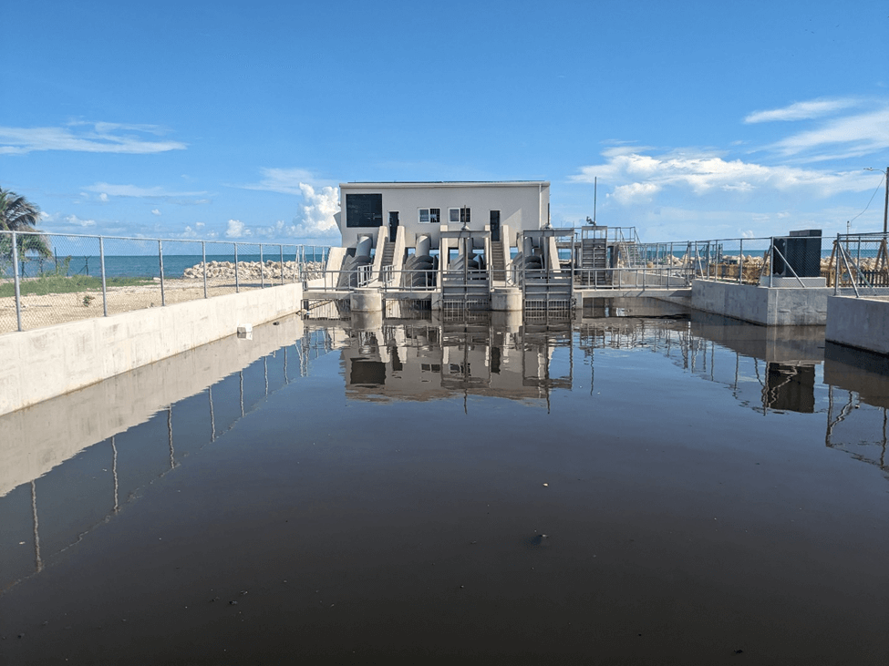
Belize City pumping station. Credit: Natalie Fiertz, October 2023.
Technical and financial limitations are a key barrier to addressing these types of gaps and other climate vulnerabilities in Belize City.93Green Climate Fund (GCF) Readiness-Belize (2022). Building capacity for climate resilient infrastructure and sustainable urban land management and strengthening the capacity of the Ministry of Economic Development for pre-Accreditation to the Green Climate Fund. https://www.greenclimate.fund/sites/default/files/document/20221128-belize-pact-proposal.pdf, retrieve June 8, 2024. Several interviewees from both the municipal and national governments highlighted the importance of limited funding,94Interview with representatives of Belize City Council and of local government. reflected in Investment in Climate Resiliency Development Projects (medium-high risk, score of 6.24).95Interview with representative of the Sustainable Development Unit. Interviewees noted that limited funding is often spread across multiple agencies such as National Hydrological Service and the National Meteorological Service – and across multiple geographic areas.96Workshop participants, December 2024.
Several interviewees also noted challenges around limited public support due to limited public awareness,97Interview with environmental engineer in Belize City. impeding consistent, long-term implementation of resilience projects.98Interview with representative of the Sustainable Development Unit. Local experts also rated Number of Years that the Current Government Structure Has Been in Place as a medium-high risk (score of 6.44), suggesting that institutional turnover may also inhibit consistent, long-term implementation.
Local experts also highlighted concerns about institutional integrity in Belize, rating the Rule of Law (score of 6.24) and Capacity of Ethics Enforcement Bodies (score of 5.18) as medium-high risks. Although Belize has anti-corruption laws such as the Prevention of Corruption in Public Life Act, enforcement is inconsistent.99US Department of State. 2023 Investment climate statements: Belize. https://www.state.gov/reports/2023-investment-climate-statements/belize/, retrieved June 8, 2024. The Act requires public officials to make financial disclosures annually for review by the Integrity Commission, but the Commission reportedly does not function effectively, and there is little opportunity for the public to challenge these disclosures.100Freedom House. Freedom in the world 2021-Belize. https://freedomhouse.org/country/belize/freedom-world/2021, retrieved June 8, 2024. There have also been extended vacancies on the Commission and other key oversight bodies.101US Department of State. 2023 Investment climate statements: Belize. https://www.state.gov/reports/2023-investment-climate-statements/belize/, retrieved June 8, 2024. For example, the position of Auditor General was vacant for more than one year in 2021 and 2022.102Ibid.
Several recent high-profile cases highlight these challenges, but also potentially offer promise for stronger enforcement. In February 2020, John Saldivar, former Minister of National Security and Defense and head of the United Democratic Party (UDP) at the time, was “implicated in a U.S. federal fraud trial in Utah, involving a conspiracy to obtain biofuel tax credits on false pretenses.”103https://www.worldpoliticsreview.com/how-corruption-and-covid-19-are-upending-the-belize-election/?one-time-read-code=52382172737341960429 The case prompted Saldivar to resign as head of UDP and from the cabinet and drew large protests in Belize City.104Ibid. The UDP suffered a major defeat in general elections held in November of that year, which saw Voter Turnout (medium risk, score of 3.40) of 82 percent. As a result of the trial, the U.S. State Department barred Saldivar from entering the United States in 2022.105https://www.sanpedrosun.com/politics-and-government/2022/11/15/former-government-minister-john-saldivar-accused-of-significant-corruption-barred-from-the-usa/ That same year, former Minister of Works Rene Montero was arrested on charges of corruption.106https://www.breakingbelizenews.com/2023/11/08/former-minister-of-works-rene-montero-sr-faces-willful-oppression-charge-in-high-court/
Local experts rated the Level of Perceived Transparency within Government (medium risk, score of 4.85) as a lesser concern, suggesting that the government generally engages in policymaking with openness and transparency. However, in January 2020, the Supreme Court highlighted that the government of Prime Minister Dean Barrow (in office February 8, 2008–November 12, 2020) spent more than 1.3 billion BZE of public funds without prior approval from Parliament, equal to over 30 percent of Belize’s GDP.107Robert Looney, “In Belize, Corruption and COVID-19 Imperil the Ruling Party’s Reelection Hopes, World Politics Review, October 16, 2020, https://www.worldpoliticsreview.com/how-corruption-and-covid-19-are-upending-the-belize-election/.
The Belize Open Government Steering Committee was established in 2020 to advance open government through multi-stakeholder dialogue.108R. Iriani, A. Robin, M. Mora, M. Lonati, and J. Vila, Belize Open Government Action Plan, The Trust for the Americas, & Organization of American States (OAS), 2020. It includes six representatives from government agencies and five representatives from civil society organizations, providing an important avenue to enhance Civil Society Participation (medium risk, score of 3.96) in decision-making.
Tourism is the most important source of employment in Belize. The Percent of People Employed in Tourism (high risk, score of 8.45) is over 40 percent, and the World Travel and Tourism Council projects that it will grow to over 50 percent by 2034.109https://researchhub.wttc.org/factsheets/belize Local experts identified this as the biggest risk in the Political Risk section. Direct employment in the tourism sector before the COVID-19 pandemic accounted for 13.4 percent of total employment, rising to 37.3 percent when considering indirect employment, according to the International Monetary Fund.110J. T. Chow, Tourism in Belize: Ensuring Sustained Growth, International Monetary Fund, 2019.
The waterfront in Belize City. Credit: Carolyn Gruber, December 2024
Between 60 and 70 percent of Belize’s tourism assets are on or near the coast, making them vulnerable to climate hazards such as sea level rise, hurricanes, storm surge, and ocean warming. In addition, the growing tourism industry has contributed to the degradation of key coastal and marine ecosystems, reducing the sector’s resilience to climate impacts.111Hansen Partnership Pty Ltd and the University of Belize, Belize Tourism & Conservation. In response, the government has developed a National Sustainable Tourism Master Plan (NSTMP). Growth in overnight tourist arrivals has been almost three times higher than projections in the original 2011 NSTMP.112J. T. S. Chow, IMF Working Paper (wp/19/267) – Tourism in Belize: Ensuring Sustained Growth, International Monetary Fund, 2019. The government updated the NSTMP between 2022 and 2024. To help support the long-term health of its tourism sector, Belize has implemented several key conservation policies around the Mesoamerican Reef, including the creation of new marine protected areas.113https://news.mongabay.com/2024/05/in-belize-flawed-conservation-measures-threaten-small-scale-fishers-livelihoods-commentary/ Limited political will and a prioritization of short-term gains from growth of the tourism sector, however, continue to pose challenges for effective ecological protection and conservation.114https://www.sciencedirect.com/science/article/abs/pii/S0308597X20308897
Another challenge to the effective implementation of policies for ecological protection in and around Belize City is unmanaged migration into the city. Migrants from both elsewhere in Belize and from neighboring countries move to the city because of its better job opportunities and better infrastructure, including access to education and healthcare. Some of these migrants build informal settlements by clearcutting local mangroves and wetlands. These environmentally destructive activities increase the vulnerability of Belize City to coastal flooding, reflected in Percent of International Migrants Living in Country (medium-high risk, score of 7.17). The lack of public services in these settlements, such as electricity and waste management, also harms the health of the surrounding ecosystems. International immigrants accounted for 17 percent of the population in 2020,115Integral Human Development, Belize, https://migrants-refugees.va/country-profile/belize/, retrieved July 25, 2024. primarily from Guatemala, Honduras, and El Salvador. Although Belize has the Immigration Act (Chapter 156, revised in 2011 and amended in 2023), it has no dedicated migration strategy.116D. Williams and Ministry of Human Development, Families & Indigenous People’ Affairs, International Migration in the Caribbean: Opportunities and Challenges for Sustainable Development: The Belize Case, 2023, Comisión Económica para América Latinay el Caribe, https://www.cepal.org/sites/default/files/events/files/dylan_williams_slides.pdf, retrieved June 8, 2024. Continued population growth driven by a young population, reflected in Percent of Urban Population Below 30 Years of Age (medium-high risk, score of 5.53), will continue to put pressure on Belize City’s ecosystems and infrastructure.
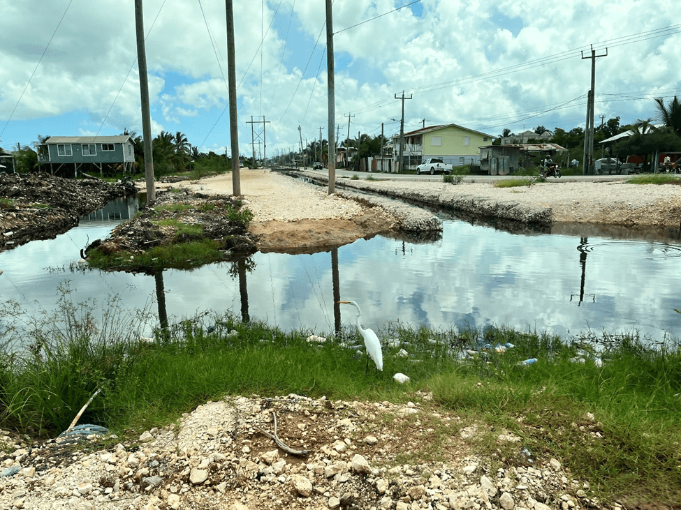
Canals in low-lying areas. Credit: Carolyn Gruber, October 2023.
Elevated levels of poverty also contribute to climate vulnerability in Belize City, reflected in Percent of Population Below Poverty Line (medium-high risk, score of 5.23). Communities with high levels of poverty, like Monkey River and Gales Point, are often the most vulnerable to climate impacts.117Interview with representative of the Sustainable Development Unit. Interviewees noted that Monkey River, in particular, suffers from a high rate of coastal erosion.118Interview with representative of the Sustainable Development Unit. These communities also often lack the capacity to implement resilience projects and are excluded from decision-making.119Interview with representative of the Sustainable Development Unit. Furthermore, poverty drives people toward environmentally destructive activities, such as illegal fishing, which further increases the vulnerability of the city.120Interview with representative of the Sustainable Development Unit. Interviewees also noted that the lack of economic opportunities and access to services has reduced the viability of settlements located in less hazard-prone areas, such as Hattieville.121Interview with representative of the Statistical Institute of Belize.
The Status of Resilience Planning
Belize has two principal national frameworks that describe the country’s approach to building climate resilience, both published in 2021. The first is the country’s updated Nationally Determined Contribution (NDC) under the Paris Agreement. The NDC lays out a total of 44 adaptation target actions across eight sectors, with a total estimated cost of $318 million, outlined in the table below. The document notes that $172.4 million has already been committed, leaving a funding gap of $145.8 million.122NDC (2021). Belize-updated nationally determined contribution. https://unfccc.int/sites/default/files/NDC/2022-06/Belize%20Updated%20NDC.pdf.
[table “100” not found /]Belize’s National Climate Change Policy, Strategy, and Action Plan (NCCPSAP) presents a five-year plan, from 2021 through 2025, to mitigate greenhouse gas emissions and build climate resilience. The NCCPSAP includes actions to strengthen adaptation across 13 sectors. These cover the same eight sectors as the NDC and add Disaster Risk Management, Education, Energy, Transportation, and Waste Management. For Belize District, within which Belize City is located, the NCCPSAP identifies the main risks as river overflows, sea level rise, saltwater intrusion, ocean acidification, and ocean warming.
The government has taken important steps to mainstream its climate adaptation objectives into its operations. The government established the Belize National Climate Change Committee in 2009 and created the National Climate Change Office in 2012. The NCCPSAP also explicitly identifies the responsibilities of the other ministries to implement the government’s plans. Several adaptation targets are also integrated into other planning documents, including #PlanBelize, which guides the country’s development strategy through 2026, and the National Sustainable Tourism Master Plan for Belize.
These efforts are supported by robust strategies to engage climate finance institutions, exemplified by the Climate Finance Strategy of Belize, 2021–2026 and the Green Climate Fund Strategic Framework and Country Programme, 2022–2026. The government has also developed sector-specific adaptation plans for coastal areas and fisheries, freshwater, and agriculture. However, Belize’s approach to adaptation is often fragmented, and there is a lack of coordination between government departments. Interviewees noted, for example, that the Port Authority was not consulted during the development of the coastal and fisheries adaptation plan.123Interview with representative of the Belize Port Authority.
Belize also benefits from its network of protected areas across its land and waters, the National Protected Areas System. The National Protected Areas System protects 36.6 percent of the country’s land and 10.8 percent of its marine environment and is characterized by a high level of co-management, a model that has received high praise internationally.124B. Mitchell, Z. Walker, and P. Walker. (2017). A governance spectrum: protected areas in Belize. PARKS, 23(1), 45-60. Thirty percent of mangroves and over 40 percent of both corals and seagrasses are within protected areas.125Bloomberg Philanthropes and Ocean Initiative. Belize. https://30×30.skytruth.org/progress-tracker/BLZ?layers=6%2C7&settings=%7B%22bbox%22%3A%5B-402.33%2C-83.79%2C255.75%2C83.79%5D%2C%22labels%22%3Atrue%7D&layer-settings=%7B%7D. Nearest to Belize City are the Burdon Canal nature reserve and Swallow Caye wildlife sanctuary just offshore. Also critical to the city are the protected areas around Turneffe Atoll (just over 30 kilometers offshore) and the Crooked Tree Wildlife Sanctuary in the Belize River watershed. The regulations that protect the National Protected Areas System, however, have been criticized as outdated and ineffective, particularly in the face of expanding tourism and other development priorities.126M. L. D. Palomares. (May, 30, 2024). In Belize, flawed conservation measures threaten small-scale fishers’ livelihoods(commentary). https://news.mongabay.com/2024/05/in-belize-flawed-conservation-measures-threaten-small-scale-fishers-livelihoods-commentary/. In Crooked Tree, for example, local stakeholders highlighted causeways that inhibited the ability of the wetlands to manage floodwaters from the Belize River, thereby increasing flooding downstream in Belize City.127Interview with from Galen University.
Belize is taking action to further strengthen the protection of key ecosystems. Belize’s blue bond agreement included an expansion of Biodiversity Protection Zones to cover 30 percent of Belize’s oceans, now enshrined in the Belize Sustainable Ocean Plan (BSOP). Belize launched the planning process for the BSOP in November 2022, and it is expected to be finalized by 2026. In addition, the Belize Mangrove Alliance Action Plan 2022–2027 aims to bring together an alliance of national organizations, civil society, key public sector organizations, local communities, and academic institutions to strengthen protections for mangroves in Belize.128WWF (2022). Belize mangrove alliance action plan(2022-2027). https://www.mangrovealliance.org/wp-content/uploads/2022/09/BMA-Action-Plan_Final.pdf. The Mesoamerican Reef Fund launched a parametric insurance program to rapidly pay out funds for coral reef repair after a hurricane; the first pay-out happened on November 2, 2022, when Hurricane Lisa hit the reefs of Turneffe Atoll.129Ocean Risk and Resilience Action Alliance. Financing reef resilience to extreme climate events. https://oceanriskalliance.org/project/financing-reef-resilience-to-extreme-climate-events/. The World Bank has also supported strengthening Belize’s marine protected areas, including around Turneffe Atoll, through the BZ Marine Conservation Climate Adaptation project.130IEG Review Team. Belize-BZ marine conserv climate adaptation(English). Washington, D.C.: World Bank Group. https://documents.worldbank.org/en/publication/documents-reports/documentdetail/158711625019941733/belize-bz-marine-conserv-climate-adaptation.
Climate adaptation projects in Belize City have focused on improving flood management in the city. The most important such project is the Climate Vulnerability Reduction Program (CVRP) funded by the Inter-American Development Bank. The CVRP includes two components. The first is a series of infrastructure investments — including a pumping station, floodgates, and improvements to West and East Collet Canals — to reduce flooding in southern Belize City around Orange Street.131IDB (December, 6, 2017). Belize to reduce climate vulnerability with IDB assistance. https://www.iadb.org/en/news/belize-reduce-climate-vulnerability-idb-assistance. The Yarborough pumping station was inaugurated in October 2023,132Amandala (October, 15, 2023). The pump station will reduge downtown Belize City flooding. https://amandala.com.bz/news/10-million-yarborough-pump-station-officially-inaugurated/. with management turned over to the Belize City Council. Local stakeholders noted that the city has not yet seen sufficiently heavy rainfall to test the station’s effectiveness. They also highlighted concerns around canals previously constructed to manage flooding in the Belama Phase 1–4 residential districts. Instead, during high tide those canals reportedly fill with water that becomes stagnant.133Interview with in-country research team. Additionally, water still frequently covers neighboring streets, like Apollo Street, inhibiting transit into and out of these areas. Some repairs to the pumping station have also required overseas technical support.134Interview with representative of the Belize City government. The second component of the CVRP aims to improve disaster risk information sharing, including the development of a web-based platform that will form the foundation of a National Climate Risk Information System.135IDB (December, 6, 2017). Belize to reduce climate vulnerability with IDB assistance. https://www.iadb.org/en/news/belize-reduce-climate-vulnerability-idb-assistance.
The national and local governments also continue to explore new solutions to strengthen climate resilience in and around Belize City. The national government has installed a pilot automatic water quality monitoring system in Saltwater Caye and is working to quantify the economic value of ecosystem services in Belize.136Interview with representative of the Belize Fisheries Department. The Belize City Council, supported by the European Union and UN Development Programme, is piloting electric public transportation and solar photovoltaic installations on municipal offices.137Interview with representative of the Belize City government.
Challenges to Resilience Planning and Action
Several factors hinder resilience planning and action in Belize City. One of the most significant is securing adequate funding, a problem exacerbated by the city’s reliance on central government funding. Although the city receives direct revenue from property taxes, building permits, and traffic enforcement, most of its funding is provided by transfers from the central government. Municipalities also do not have full project autonomy and depend on the central government for project approval, which can delay implementation and limit the municipalities’ responsiveness to changing local conditions. Social and economic vulnerabilities also complicate resilience efforts. Many of the city’s residents live in flood-prone and water catchment areas, and often lack basic services like electricity, sewer systems, and clean drinking water.
Priority Recommendations to Build Resilience
Belize City faces high and growing risks from both extreme weather events — particularly hurricanes, extreme precipitation events, and extreme heat events — and long-term changes, such as warming ocean temperatures and increasing abundance of sargassum. This CORVI assessment highlights how high public debt, an economic reliance on coastal and marine tourism, and limited available financial resources exacerbate Belize City’s vulnerability to climate impacts. Unmanaged migration into Belize City and increased development also compounds these risks. Protective coastal ecosystems such as mangroves are often cleared to make way for housing and other construction, contributing to coastal erosion and increasing vulnerability to storm surge. The expansion of the built environment in Belize City also reduces the absorptive capacity of the ground, amplifying the extent and damage of flooding. It also increases the urban heat island effect, further raising the temperature and worsening illnesses like cardiovascular disease, diabetes, and asthma.
Invest in Nature-Based Solutions to Strengthen Flood Management
Belize City faces increasing risks from coastal, riverine, and pluvial (rainfall-driven) flooding. While gray infrastructure, such as seawalls and levees, may help reduce one type of flooding (coastal and riverine, respectively), they have several downsides. They are costly, increase erosion, reduce biodiversity, limit public access to beaches and other coastal areas, unduly reduce perceptions of risk and increase development behind such structures, and are difficult to change if risk levels exceed projections.138https://www.climatechangenews.com/2022/03/03/scientists-warn-seawalls-can-make-rising-waters-worse-in-the-long-run/ Belize City may benefit more from investing in increasing its absorptive capacity to allow the ground to absorb, retain, and slowly release floodwaters.139https://www.adb.org/sites/default/files/publication/838386/adb-brief-222-sponge-cities-prc.pdf The “sponge cities” are an emerging model for doing this effectively.140https://climatechampions.unfccc.int/what-are-sponge-cities-and-how-can-they-prevent-floods/ This type of investment can provide significant benefits in reducing flooding; one study estimates that every one percentage point increase in the coverage of impervious surfaces (e.g., roads, sidewalks, parking lots) increases the magnitude of flooding by 3.3 percent.141Erica Gies, Water Always Wins: Thriving in an Age of Drought and Deluge (University of Chicago Press, 2022), 188. Investments in nature-based solutions should be informed by improved understanding of flooding risk and drainage planning. Supportive policy and institutions can also increase the success of nature-based solutions.
Strengthen Knowledge and Planning
- Conduct a comprehensive mapping of flooding vulnerability in Belize City to identify areas most prone to coastal, fluvial, and pluvial flooding. Stakeholders in the December 2024 workshop noted that existing maps date back to 2014 and need to be updated. The National Hydrological Service and the Belize City Council should take the lead to do so. Since satellite data typically does not have sufficient resolution for cities,142Water Always Wins: Thriving in an Age of Drought and Deluge, p 195 other technical, such as the use of Lidar sensors and participatory mapping processes, can help fill the gap. External partners, such as the Humanitarian OpenStreetMap Team,143“Disasters & Climate Resilience”. Humanitarian OpenStreetMap. https://www.hotosm.org/impact-areas/disaster-risk-reduction/ have expertise that is particularly valuable in mapping flooding potential in densely populated areas where geospatial data is often the least effective. This mapping should be supported by investment in dynamic flood modeling that is responsive to changing weather conditions.
- Assess the value of flooding prevention and other ecosystem services provided by currently existing mangroves, wetlands, and savannahs in and around Belize City. This assessment should expand on the pilot ecosystem services assessment conducted in cooperation with Stanford University’s Natural Capital Project,144https://naturalcapitalproject.stanford.edu/sites/g/files/sbiybj25256/files/media/file/3ps-project-fact-sheet-belize.pdf which focuses on coastal and marine assets. Developing key performance indicators along with monitoring, reporting, and verification processes will help the Government of Belize access finance to implement nature-based solutions and develop regulations that are responsive to changes in ecosystem health and coverage.
- Update Belize City’s master drainage plan to inform investments in flood management solutions. The current master drainage plan was launched in 2011 as part of the Belize City Master Plan, with the support of the Inter-American Development Bank.145“Belize City Master Plan”. Belize City Council. https://www.belizecitycouncil.org/belize.php?mp_id=1 The Belize City Council, in cooperation with national agencies such as the National Hydrological Service, should update this plan to account for population growth, urban expansion, updated climate projections, evaluations of the value of local ecosystems, and updated mapping of flooding vulnerability.
Design Supportive Policy
- Reform land use policy and design zoning regulations to protect existing ecosystems that reduce flooding impacts. The Ministry of Natural Resources, Petroleum, and Mining’s updating of the National Land Use Policy is currently in the final drafting stage. The Ministry should cooperate with the Ministry of Sustainable Development, Climate Change, and Disaster Risk Management to ensure that the revised policy promotes the protection of key terrestrial and marine ecosystems. In addition, the Protected Areas Conservation Trust has developed draft legislation to guide settlement patterns as part of an integrated coastal development framework. Belize City currently does not have zoning regulations. Such regulations could help restrict development on the existing ecosystems identified as being most important to managing flooding in Belize City. These types of restrictions would be particularly valuable on the margins of Belize City, where urban expansion is currently occurring. The Lands Department, which issues land titles, and Belize City Council, which issues building permits, should coordinate to enforce restrictions on clearing ecosystems for new development. Reforms to building permits could also include stronger housing design regulations to reduce the vulnerability of Belize’s housing stock to high winds.
- Protect and restore natural ecosystems to increase the absorptive capacity of the land in Belize City. Increasing the ability of inland areas to absorb and retain excessive water from heavy rains, swollen rivers, and flooded coastlines is critical to strengthening Belize City’s resilience to flooding. This is particularly important as climate change increases the quantity of rain from hurricanes and intense rainfall events.146https://science.nasa.gov/earth/climate-change/a-force-of-nature-hurricanes-in-a-changing-climate/ Increased local absorption throughout the city would also reduce the pressure on the city’s water management infrastructure. Wetlands, parks, rain gardens, green roofs, bioswales,147Bioswales are long, linear strips of vegetation in an urban setting used to collect runoff water. See https://www.ctc-n.org/technologies/bioswales. and other greenways are all critical ways of increasing ground absorptive capacity,148https://www.adb.org/sites/default/files/publication/838386/adb-brief-222-sponge-cities-prc.pdf and have successfully been used in cities such as Nairobi, Mumbai, and Singapore to reduce the impacts of flooding.149https://climatechampions.unfccc.int/what-are-sponge-cities-and-how-can-they-prevent-floods/ These types of solutions are also often more cost-effective than seawalls and other gray infrastructure, while providing additional benefits such as water filtration, carbon sequestration, and animal habitat,150https://news.mongabay.com/short-article/2024/10/marshes-are-cost-effective-for-protecting-coasts-study/ and reducing the urban heat island effect. Given the high costs of acquiring currently utilized land to restore ecosystems, protection of existing ecosystems should be a high priority, and should be integrated into the “urban renovation” called for in the National Sustainable Tourism Master Plan. The Blue Bond and Finance Permanence Unit could build on its experience promoting nature-based solutions, with the support of the National Climate Change Office and the Ministry of Economic Development (MED). The MED could build on the World Bank Belize Blue Cities and Beyond Project,151https://projects.worldbank.org/en/projects-operations/project-detail/P181064 scheduled to start in January 2025, which aims to strengthen Belize’s coastal and blue economy, increase safe water supply, and reduce land-based pollution discharges.
- Pilot innovative institutions to support the protection and restoration of natural ecosystems. Given limited financial and technical resources, the Government of Belize could consider innovative institutional frameworks that may leverage available resources most efficiently.
- One such example is carbon credits. Mangroves and coastal wetlands sequester carbon annually at a rate ten times greater than mature tropical forests, making them an excellent candidate for high-quality carbon credits. Carbon credits often require a large minimum ecosystem size, which means this approach would likely be best suited to support the protection of existing ecosystems on the margins of Belize City.
- Another innovative type of institution is community land trusts (CLTs). CLTs are communal management institutions that develop and steward land for community use, including affordable housing, parks, and community gardens.152https://scholarship.law.wm.edu/cgi/viewcontent.cgi?article=1763&context=wmelpr CLTs can help preserve housing affordability, strengthen community trust and cohesion, support green infrastructure, and advance managed retreat.153Ibid. A useful example of CLTs for Belize City may be the one along the Martín Peña channel in San Juan, Puerto Rico, which was formed in 2004.154https://www.tandfonline.com/doi/full/10.1080/19463138.2022.2096616#abstract CLTs would likely be best suited to protecting smaller-scale nature-based solutions within Belize City.
- Voluntary property acquisition programs, also known as buyouts, may be helpful in acquiring currently utilized land to restore natural ecosystems in Belize City. Research in the United States has estimated that buyouts save five to nine dollars for every dollar spent.155https://www.nature.org/content/dam/tnc/nature/en/documents/Buyouts_Lessons_Learned_Siders_Gerber_Chavez_TNC_Full_Report_2021.pdf However, buyouts can also sometimes be slow, expensive, and difficult to administer.156Ibid. A pilot program in Belize City, drawing on lessons learned from the variety of buyout programs administered over the past three decades in the United States, may help determine whether such an approach could be useful to Belize City.
Prepare for and Support Growth in Outlying Communities
Belize City faces compounding challenges from its low-lying topography and in-migration, both from elsewhere in Belize and from neighboring countries. The city’s location — built on top of the soft soil of a river delta — limits the degree to which it can support increased population density by building upward. This forces people to settle in areas of high vulnerability, such as the low-lying southern part of the city. Migrants also sometimes clear protective ecosystems, such as mangroves, to build informal settlements, thereby increasing the city’s vulnerability to flooding and coastal erosion. The government is investing in protective and absorptive infrastructure, which will help. These efforts, however, need to be complemented by investments in the communities surrounding Belize City, so that the region can accommodate a greater share of the population while still supporting economic growth and sustainable development.
Prepare for Growth in Outlying Communities
- Map climate vulnerability in the greater Belize City area to identify areas most prone to flooding, extreme heat, and other climate hazards. In order to support the move of people away from highly vulnerable areas in Belize City to lower vulnerability areas in outlying communities, the areas of least vulnerability must be identified. Based on the results of this assessment, vulnerability to flooding and extreme heat should be priorities, but outlying communities may have a different vulnerability profile than Belize City. Integrating geospatial data with community knowledge will be most effective in identifying which communities — and which specific areas of each community — are least prone to flooding and other climate hazards. Based on this information, one or a small number of communities should be identified as candidates for the support outlined below, to avoid spreading resources too thinly.
- Develop an integrated regional plan to incentivize growth in, and relocation toward, lower vulnerability areas. The Greater Belize City Initiative provides a foundation for the Belize City Council and municipal governments — supported by the Ministry of Rural Transformation, Community Development, Labor, and Local Government and the National Climate Change Office — to coordinate climate resilience planning and economic development strategies. A regional plan to shift growth toward lower vulnerability areas should also learn from previous efforts to encourage growth in inland areas, such as Mahogany Heights and Blackberry Ridge. It could also learn from Fiji’s Planned Relocation Guidelines157https://fijiclimatechangeportal.gov.fj/wp-content/uploads/2022/01/Planned-Relocation-Guidelines_Fiji.pdf and the Republic of the Marshall Islands’ Pacific Resilience Program II.158https://blogs.worldbank.org/en/climatechange/against-the-rising-tide–the-marshall-islands–national-adaptati This planning should also be structured to allow responsiveness to changing conditions on the ground and to changing needs of residents in outlying communities. The plan could also serve as the foundation for engagement and development between domestic actors and international partners such as multilateral development banks and international climate funders.
- Develop drainage plans for outlying communities to reduce their vulnerability to flooding. Communities identified as targets for relocation and growth will need greater investment in flood management measures, and that investment will need to be guided by informed planning to improve drainage. Local governments in target communities should take the lead, supported by the National Meteorological Service, the National Hydrological Service, andtheMinistry of Rural Transformation, Community Development, Labor, and Local Government.
Support Growth in Outlying Communities
- Improve basic service provision to communities surrounding Belize City, such as Hattieville. Interviewees cited the difficulty in accessing basic services, particularly healthcare and education, as a major driver of migration into Belize City rather than towns like Hattieville. The Ministries of Education and Health should coordinate with the Ministry of Sustainable Development, Climate Change and Disaster Risk Management to ensure that new schools, hospitals, and health clinics are built in areas of low vulnerability to flooding.
- Strengthen transportation infrastructure and expand access to public transportation between Belize City and surrounding communities. While local economic growth is key to driving the development of the smaller towns around Belize City, strengthening transportation linkages would also help. Facilitating daily commuting for residents in outlying communities to and from their employment in Belize City will help shift populations out of high vulnerability areas in Belize City to lower vulnerability areas in the surrounding towns. Interviewees cited two major challenges with the current transportation linkages: flooding of roads and infrequent public transit service. Investing in climate-resilient roads and more frequent public transit can also help improve evacuation efforts during extreme weather events. This can include building on the E-Mobility Pilot Project implemented by the UN Development Programme, Belize City Council, Ministry of Public Utilities, Energy, Logistics, and E-Governance, and Department of Transport.159https://www.undp.org/belize/press-releases/three-inter-district-electric-buses-arrive-belize
- Provide support for economic growth in outlying communities. Interviewees cited the lack of economic opportunities as another key factor limiting the attractiveness of these communities to migrants moving to the Belize City area. The MED should lead this effort in coordination with local governments. International partners such as the World Bank and the Inter-American Development Bank can support climate-resilient development by investing in job training, providing business development support, and making available loans to micro-, small, and medium-sized enterprises through programs such as the World Bank’s International Development Association’s Jobs and Economic Transformation agenda.160https://ida.worldbank.org/en/topics/theme/jobs-and-economic-transformation#1 This support could also include preferential tax treatment of companies — such as business process organizations — that relocate to targeted, climate-resilient communities.
Strengthen Institutional Capacity for Climate Resilience
Belize City’s climate risks will continue to grow and change over the coming years and decades. As global temperatures rise, extreme weather events such as hurricanes, heavy rainfall, and extreme heat events will become more frequent and, in many cases, more intense. The local context will also not remain static, as economic growth, ecological impacts, and social changes — both in Belize City and further afield in the country and its neighbors — will shape how climate hazards impact Belize City and the surrounding areas. Some of these changes will be unforeseeable, and most of them will reverberate throughout Belizean society. This context demands an institutional architecture that can manage the long-term, changing nature of climate risks, and that is far-sighted and responsive.
- Support data sharing to improve coordination around climate resilience actions. Several government agencies either previously have developed or are currently developing data platforms, including the National Climate Change Office; the Ministry of Rural Transformation, Community Development, Labour and Local Government; the Ministry of Blue Economy; and the Statistical Institute of Belize. It is critical that these platforms at least provide interoperability to allow end users to gain an integrated picture of climate risk. A single, user-friendly visualization tool could effectively communicate complex climate risks to government, the private sector, and civil society to inform their decision-making. This type of tool would require a designated lead agency. Participants in the December 2024 workshop suggested that either the National Climate Change Office or the Statistical Institute of Belize would be an appropriate choice. Successful implementation of a shared climate risk data platform would also require that data sharing mandates be integrated into the workplans of agencies across national and local governments.
- Share information on climate resilience projects to address policy and project fragmentation. In addition to climate risk data, a shared platform could host information on proposed, ongoing, and completed climate resilience projects. Several interviewees highlighted fragmentation across agencies and geographies as a major challenge to effective integrated climate resilience. A platform to share information on resilience projects could either be integrated into the data sharing platform or be hosted separately, perhaps by the Climate Finance Unit.
- Build in-country technical capacity for staff in key agencies, with a particular focus on climate data collection, analysis, and synthesis. Sustainable climate resilience for Belize City requires informed, qualified, and experienced personnel. Building and maintaining in-country capacity means driving funding that would typically be spent on external consultants inward. Recruiting new talent and retaining existing experts is necessary to support the sustainable growth of key programs and agencies, like the National Emergency Management Organization, the National Meteorological Service of Belize, and the Ministry of Natural Resources. Building capacity effectively will require a map of government-wide climate deliverables and programs, a comprehensive assessment of existing staff, and an understanding of future growth.
- Strengthen the disaster review capacity of the National Emergency Management Organization (NEMO). A standardized and independent process to review disaster preparedness, response, and recovery actions in the wake of an extreme weather event helps the agency learn lessons from each disaster event and improve its performance in the future. This review process should be able to offer recommendations to improve policies, operational structures, and actions across government and non-government actors, modeled on the U.S. National Transportation Safety Board, which is an independent agency responsible for civil transportation accident investigation.161https://www.nrdc.org/bio/anna-weber/next-step-national-disaster-safety-board NEMO could also offer technical assistance to carry out its recommendations, potentially in partnership with the Belize City Emergency Management Organization and with the support of the Caribbean Disaster Emergency Management Agency.
- Bolster institutional communication in Belize’s disaster early warningsystem to strengthen forecasting and response. Thanks to support from international partners like the Caribbean Catastrophe Risk Insurance Facility,162https://www.ccrif.org/news/ccrif-strengthens-belizes-early-warning-systems-capacity-rainfall-and-climate-forecasting?language_content_entity=en Belize has strong national coverage for rainfall and temperature monitoring. However, its early warning system faces challenges in connecting datapoints to inform and direct on-the-ground action.
- Alerts of high rainfall or extreme heat need to be translated to impacts, such as extent of flooding or harm to public health. The National Meteorological Service and NEMO are moving toward impact-based forecasting, and international partners should provide technical support to help model impacts of multiple types of climate hazards. One example of such support is the multi-hazard impact-based forecasting and early warning system being developed for the Belize River watershed, with the support of the Caribbean Development Bank.163https://www.caribank.org/newsroom/news-and-events/cdb-funds-multi-hazard-impact-based-forecasting-and-early-warning-system-belize-river-watershed
- Early warnings of impacts from an extreme weather event need to be translated into early action to mitigate those impacts. Implementation of the National Framework for Weather and Climate Services should be central to improving early action. The Framework links the government, civil society, international partners, academia, the private sector, and the public for effective use of climate information and services. It was launched in 2018 in partnership with the World Meteorological Organization, but interviewees reported that little progress has been made in the intervening six years.164Interview with representative of the National Meteorological Service.
- Provide planning and financial support to the tourism industry through business continuity planning and recovery loans to improve organizational survival. Data from the U.S/ Federal Emergency Management Agency suggests that 40 percent of businesses without a continuity plan will never reopen following an extreme weather event and 75 percent will fail within three years.165https://www.ready.gov/sites/default/files/2020-04/ready_business_hurricane-toolkit.pdf Business continuity planning helps “protect assets (people, property, operations); sustain the capability to provide goods and services to customers and/or supply chain; maintain cash flow; preserve competitive advantage and reputation; and provide the ability to meet legal, regulatory, financial, and contractual obligations.”166Ibid. Government-provided recovery loans to small businesses after extreme weather events also “reduce exit and bankruptcy, increase employment and revenue, and unlock private credit.”167https://www.census.gov/library/working-papers/2024/adrm/CES-WP-24-20.html This last effect shows that government-provided loans can have a larger impact than their size would suggest by crowding-in investment from the private sector through resolving uncertainty about repair.
Appendices
Appendix 1: Full List of Indicators for CORVI Belize City
Ecological Risk Categories and Indicators
[table “101” not found /]Economic Risk Categories and Indicators
[table “102” not found /]Social Risk Categories and Indicators
[table “103” not found /]Appendix 2: Organizations Surveyed and Interviewed for CORVI Belize City
| Association of Professional Engineers of Belize | Humana People to People Belize |
| Atlantic Bank Ltd | Local Government Department |
| Belize Audubon Society | Ministry of Blue Economy |
| Belize Biltmore Plaza Hotel | Ministry of Economic Development |
| Belize City Council | Ministry of Health and Wellness |
| Belize Electricity Limited | Ministry of Infrastructure Development & Housing |
| Belize Fisheries Department | Ministry of Natural Resources |
| Belize Forest Department | Ministry of Rural Transformation, Community Development, Labour, and Local Government |
| Belize Fund for a Sustainable Future | Ministry of Sustainable Development, Climate Change and Disaster Risk Management |
| Belize Port Authority | Ministry of Tourism and Diaspora Relations |
| Belize Red Cross | National Bank of Belize Limited |
| Belize Sugar Industries | National Climate Change Office |
| Belize Water Services Ltd | National Emergency Management Organization |
| Beltraide | National Garifuna Council |
| Blue Bond and Finance Permanence Unit | National Meteorological Service |
| Bowen & Bowen | Protected Areas Conservation Trust (PACT) |
| BRO Consulting | RW Water Solutions |
| Caribbean Community Climate Change Centre | Social Investment Fund |
| Coastal Zone Management Authority and Institute | Statistical Institute of Belize |
| Danaus Consultants | Sustainable Development Unit |
| Development Finance Corporation Belize | TaiwanICDF |
| Financial Service Commission | The Belize Chamber of Commerce & Industry (BCCI) |
| Fisheries Department | The Nature Conservancy |
| Forest Department | The University of the West Indies |
| Galen University | Turneffe Atoll Sustainability Association |
| Geology & Petroleum Department | University of Belize |
| Government of Belize | Wildlife Conservation Society |
| Healthy Reefs for Healthy People | World Wildlife Fund |
| Hol Chan Marine Reserve |
Appendix 3: The Climate and Ocean Risk Vulnerability Initiative
It is clear that urban coastal areas are likely to experience the earliest onset and potentially most severe impacts from climate change. The risks associated with climate change for specific coastal cities, however, are much more difficult to untangle. In order for coastal cities to efficiently allocate resources and enact effective adaptation strategies, it is critical that they understand their multidimensional climate risk. However, these efforts are impeded by poor and incomplete data.168Alistair Hunt and Paul Watkiss, “Climate Change Impacts and Adaptation in Cities: A Review of the Literature,” Climatic Change 104, no. 1 (2011): 13-49. Data on climate risks is rarely available at the city level, and when it does exist, it is often poorly managed and stored in silos that make it difficult to access and use, even for city government officials.169Jorgelina Hardoy and Gustavo Pandiella, “Urban Poverty and Vulnerability to Climate Change in Latin America,” Environment and Urbanization 21, no. 1 (2009): 203-224. This issue is compounded by technical, financial, and capacity gaps, trapping coastal cities in a vicious cycle where they cannot develop holistic strategies to prioritize investment and access the funds needed to implement resilience actions.
Without data at the appropriate geographic scale, decision-makers are often left with the choice of either waiting for greater data availability or attempting to downscale national-level data, neither of which are ideal solutions for effective climate change adaptation. This problem is particularly acute in small and intermediate cities, which along with absorbing the bulk of East Africa’s future urban population growth, often lack the resources to gather and maintain necessary data.170World Bank, “Demographic Trends and Urbanization,” last modified May 19, 2021, accessed August 16, 2021, https://www.worldbank.org/en/topic/urbandevelopment/publication/demographic-trends-and-urbanization.
Despite these challenges, decision-makers need to act now in the face of uncertainty to build resilience to the climate crisis. To do this, they need tools that will enable them to consider multidimensional climate risks, develop cohesive strategies, and utilize this information to unlock additional climate finance and implement resilience actions.
In response, the Stimson Center developed the Climate and Ocean Risk Vulnerability Initiative (CORVI). CORVI is a decision support tool which compares a diverse range of climate-related risks across the land-seascape to produce a coastal city risk profile. These risks are displayed across 10 categories, grouped under three risk areas: ecological, financial, and political (see figure 2). The 10 categories are in turn made up of close to 100 indicators, covering a range of issues including the vulnerability of vital infrastructure, the health of marine ecosystems, and urbanization dynamics in the chosen coastal city. Each indicator and category are scored using a 1-10 risk scale relative to other cities in the region, offering a simple reference point for decision-makers looking to pinpoint and categorize climate risks. The CORVI risk scores, which form the basis of a coastal city risk profile, are augmented with existing academic and grey literature, government documents, and key informant interviews to develop a comprehensive narrative and understanding of the coastal city’s climate risks and identify priority policy recommendations.

How CORVI is Different
CORVI builds on the work of previous indices but is distinct in three ways.
- Locally Based: Unlike many other indices which tend to focus on the national or regional level, CORVI is city or small island based, providing sub-national level detail on the nature and impact of climate and ocean risks. This focus is based on extensive interviews with potential issuers of the CORVI tool, who noted that climate change is local and the difficulty of down-scaling national level risk and vulnerability data to inform policy action to build climate resilience in specific communities.
- Holistic: CORVI looks across a broad set of ecological, economic, social and political risk factors connected to climate change impacts and that influence vulnerability of coastal cities and their residents. As part of the category and indicator selection process, indicator inclusion was primary based on its ability to capture and explain climate change risks in coastal cities, and not if data was available. This approach promotes a holistic understanding of climate change impacts to coastal cities.
- Data Driven: Through using Structured Expert Judgment (SEJ), CORVI is suited to producing actionable insights in data sparse environments. By combining empirical and survey data across a wide range of indicators, CORVI fill data gaps to provide a holistic assessment, while reducing data availability bias. This approach provides a contextual and data driven assessment of climate and ocean risk vulnerability.

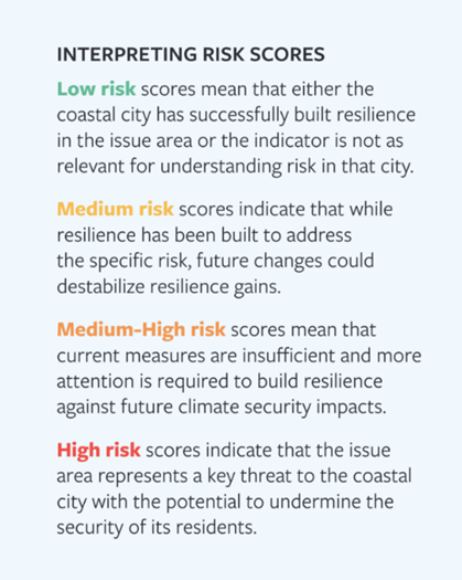
CORVI began in 2018, with the first two assessments – of Castries, Saint Lucia, and Kingston, Jamaica – completed and published in 2020. CORVI is now operating in 16 countries around the world, from the Caribbean to the South Pacific. The project now includes both full assessments, which incorporate around 100 risk indicators distributed across the 10 risk categories, along with rapid assessments, which incorporate 30-35 risk indicators across the same 10 risk categories.
Advancing the Sustainable Development Goals
CORVI also aims to contribute to the delivery of the SDGs – an essential framework to guide lasting, positive change. By providing data and information to measure climate risks in coastal cities, this project supports the delivery of the following SDGs:
CORVI operates in collaboration with national government authorities for every assessment. As a locally driven, comprehensive assessment of ocean and climate risk and vulnerability, the CORVI team engages with a wide range of partners on the ground, including national and local government, the private sector, civil society, and academia.
CORVI Rapid Assessments Completed
- Western Province, Sri Lanka
- Southwestern Urban Corridor, Barbados
- Tarawa, Kiribati
- Dominica
- Mauritius
CORVI Full Assessments Completed
- Basseterre, St. Kitts and Nevis
- Castries, St. Lucia
- Chattogram, Bangladesh
- Dagupan, Philippines
- Dar es Salaam, Tanzania
- Kingston, Jamaica
- Mombasa, Kenya
- Toamasina, Madagascar
- Suva, Fiji
CORVI Assessments Underway
- Aruba
Indicators
To ensure that the CORVI indicator scores provide a holistic risk rating, each is made up of five factors: current, past, and expected trends, the rate of change of the risk, and the impact of this risk on the coastal city.
- The BASELINE measures the current level of risk for each indicator relative to other coastal cities in the region. Baseline data for economic and social indicators is derived from the most recent year of complete data. Climate indicators use a longer time period of 15 years.171Thirty-year time horizons are traditionally used to calculate the seasonal cycle and other long-term averages of climate variables. However, as the climate changes, current conditions are more dissimilar to those from 30 years ago than they are to those from 10 years ago. In this environment, the optimum climate normals (OCN) method can be used to calculate the minimum number of years required to accurately produce the climatological average for climate variables. The National Oceanic and Atmospheric Administration suggests that a 10-year time series for temperature and a 15-year time series for precipitation are acceptable minimum limits to produce an accurate climatology within a non-stationary period. CORVI follows the same limits that NOAA uses in their experimental seasonal forecast product by using a similar 15-year time horizon to measure climate indicators. For more information on OCN, see Daniel S. Wilks and Robert E. Livezey, “Performance of Alternative ‘Normals’ for Tracking Climate Changes, Using Homogenized and Nonhomogenized Seasonal U.S. Surface Temperatures,” Journal of Applied Meteorology and Climatology 52, no. 8 (August 2013): 1677-1687, https://doi.org/10.1175/JAMC-D-13-026.1.
- PAST TREND assesses the trend of risk for the past 10 years, measured from the baseline year. The only exception to the 10-year trend measure are the climate indicators, which use a 15-year trend horizon to account for slow onset changes.
- EXPECTED TREND assesses the anticipated trend of risk in the next 10 years, measured from the baseline year. The only exception to the 10-year trend measure are the climate indicators, which use a 15-year trend horizon to account for slow onset changes.
- MAGNITUDE assesses the degree of expected future trend change relative to other cities in the region. Change that happens quicker than expected is assumed to increase risk when compared to changes that take place over a longer time scale. This assumes that longer time periods of change contribute to less risk, as decision makers have more time to adapt and build resilience.
- Finally, IMPACT assesses the importance of change for each indicator in describing future risk in the coastal city.
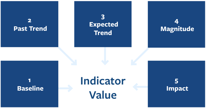
Data Collection and Structured Expert Judgement
To overcome data gaps, CORVI employs structured expert surveys to collect data that is otherwise unavailable. This primary data is combined with secondary data using the approach of structured expert judgement (SEJ) to produce a comparative score for each indicator in the assessment.172For an introduction to structured expert judgment, see Cherie Maestas, “Expert Surveys as a Measurement Tool: Challenges and New Frontiers,” in Lonna Rae Atkeson and R. Michael Alvarez (eds.), The Oxford Handbook of Polling and Survey Methods (Oxford: Oxford University Press, 2018). SEJ is well-established social science technique that seeks to quantify risk when pre-existing secondary data is inadequate. Through interviews and surveys, as well as a series of weighting procedures to ensure data is representative, SEJ allows researchers to quantify topics that might otherwise be challenging to study in such a systematic fashion.
To apply SEJ to CORVI, subject matter experts across academia, government, civil society, and the private sector are identified through research and extensive outreach to stakeholders in the target coastal cities. These experts then refer the project team to other experts and stakeholders with appropriate expertise using “snowball sampling.”173Snowball sampling or chain-referral sampling is a non-probability sampling technique used when samples have traits that are difficult to find. In this sampling technique, existing subjects provide referrals to recruit additional subjects required for a research study. To guard against confirmation bias, survey answers are compared to a regional secondary empirical dataset to weigh the expert responses by utilizing a coherence check.174Abigail Colson and Roger Cooke, “Expert Elicitation: Using the Classical Model to Validate Experts’ Judgements,” Review of Environmental Economics and Policy 12, no. 1 (2018): 113-132. This ensures that experts whose answers do not match secondary data are not weighed as highly as those who do.
This approach has several strengths. First, CORVI incorporates the views of subject matter experts and local stakeholders at each stage of its implementation. This allows the final product to better reflect the specific context which it is seeking to measure and provide more focused information for end users. Second, pairing primary survey data with secondary data through SEJ also allows CORVI to provide insight into risks relating to urban coastal environments that existing secondary datasets do not cover. While the use of SEJ allows CORVI to assess a diverse range of risks, it should not be regarded as a substitute for empirical data collection. Rather, SEJ is best viewed as an alternative research technique specialized to analyzing topics with significant data gaps.175H. Kunreuther, S. Gupta, V. Bosetti, R. Cooke, V. Dutt, M. Ha-Duong, H. Held, J. Llanes-Regueiro, A. Patt, E. Shittu, and E. Weber, “Integrated Risk and Uncertainty Assessment of Climate Change Response Policies,” in O. Edenhofer, R. Pichs-Madruga, Y. Sokona, E. Farahani, S. Kadner, K. Seyboth, A. Adler, I. Baum, S. Brunner, P. Eickemeier, B. Kriemann, J. Savolainen, S. Schlömer, C. von Stechow, T. Zwickel, and J.C. Minx (eds.), Climate Change 2014: Mitigation of Climate Change. Contribution of Working Group III to the Fifth Assessment Report of the Intergovernmental Panel on Climate Change (Cambridge and New York: Cambridge University Press, 2014).


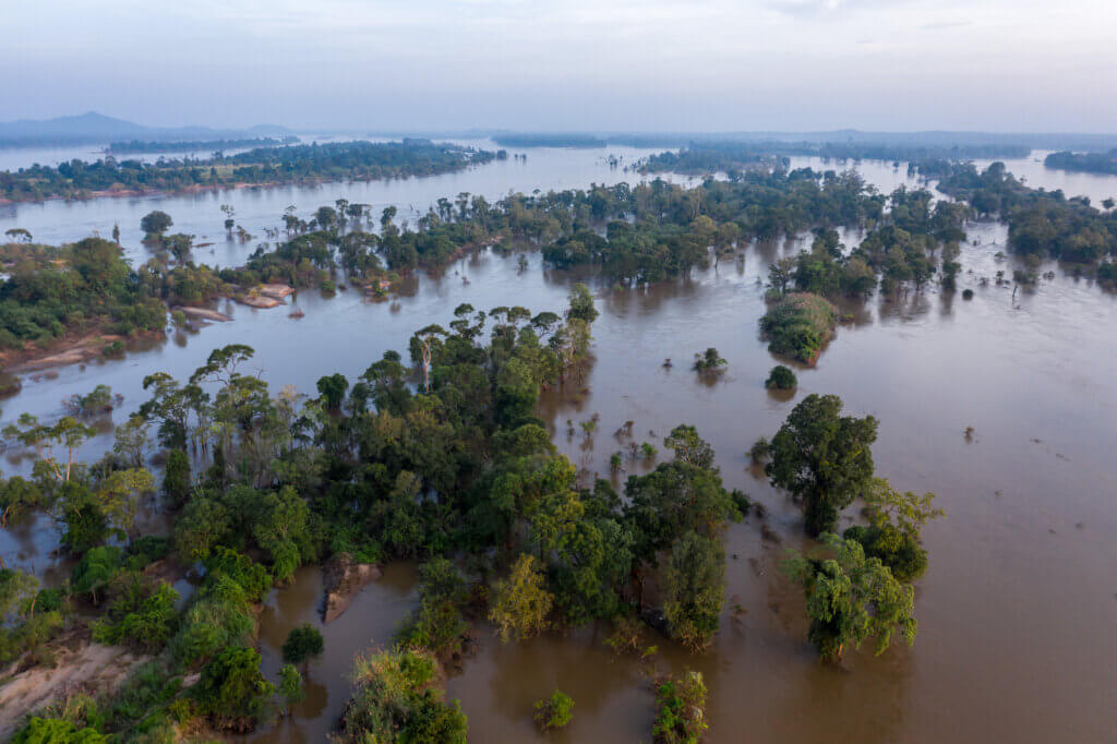


Current Geopolitics Shift Deep-Sea Mining Debates