
This CORVI Climate Risk Summary Report for the ‘urban corridor’ of southern and western Barbados includes the capital city of Bridgetown (see map below).
As risks from climate change to coastal cities continue to increase, governments, public and private investors, and the insurance industry need targeted risk information to prioritize action and build resilience where it matters most. In response, the Stimson Center developed the Climate and Ocean Risk Vulnerability Index (CORVI). CORVI is a decision support tool which compares a diverse range of ecological, economic, and social risks across 10 categories and nearly 100 indicators to produce a holistic coastal urban risk profile. The full CORVI assessment provides a much more in-depth analysis, which requires 15-18 months, while a rapid assessment provides a higher level of analysis in a 6-month timeframe.
This report is one of three CORVI Rapid Assessment Protocol pilot projects taking place in Barbados, Kiribati, and Sri Lanka, developed in partnership with the Commonwealth Secretariat’s Blue Charter program and the Stimson Center, with cooperation and participation by government representatives from each pilot country.1 Note: The project partners would like to thank the Government of Barbados for their support and cooperation as well as the project’s funders, the UK Blue Planet Fund. This pilot CORVI Rapid Assessment is a condensed version of the CORVI methodology.2 Note: To read more about the CORVI methodology, please visit https://stimson.org/project/corvi/resources-research/methodology/ It assesses the 30 highest priority CORVI risk indicators across 10 categories, selected by local stakeholders. Each risk indicator and category are scored using a 1-10 risk scale relative to other locations in the region. The CORVI Climate Risk Summary Report combines these risk scores with information from stakeholder workshops, surveys, and desk research including secondary data to analyze how climate and ocean risks are impacting the study area, in this case, the ‘urban corridor’ of southern and western Barbados. This information is used to develop high-level priority recommendations for the Government of Barbados and other key stakeholders to reduce climate vulnerabilities and work to build a sustainable future.
Further, there is potential to build on the rapid assessment and undertake a future full CORVI risk analysis which offers a more comprehensive profile of the climate risks and more targeted recommendations. The purpose of the rapid assessment is to provide initial high-level findings or results for a country allowing for the development of further climate risk initiatives or progression to the full CORVI assessment.3 Note: For more information on the methodology, please see the section entitled CORVI Rapid Assessments. A complete list of the risk indicators used for the Barbados rapid assessment is provided below. In addition, a list of organizations that responded to surveys is included in the appendix.
Summary Findings
Barbados’ southern and western urban corridor includes Bridgetown, the country’s capital and largest city. The combined population of the parishes of Christ Church, St. James, St. Michael, and St. Peter – the urban corridor runs across all four – is around 180,000 according to the 2010 census. The population of St. Michael parish has been steadily falling for several decades, but the population of St. James to the north and Christ Church to the south have seen their populations grow. The geographic area of the report is the urban corridor bordered by Highway 2A and the ‘ABC Highway’, stretching from Speightstown in the north to Grantley Adams International Airport in the south (see map above).

The CORVI Rapid Assessment highlights significant vulnerabilities in the areas of ecological and financial risk, reflecting the urban corridor’s high level of reliance on coastal and marine activities that are increasingly under threat from climate change. The three highest indicator scores – Number of Extreme Heat Events (8.29), Level of Shoreline Development (7.90), and Rate of Coastal Erosion (7.33) – present a picture that a large proportion of the city’s economic and infrastructural assets, including Deepwater Harbor, hospitals, hotels, coastal highways, desalination plants, and basic service (electricity, health, public safety) infrastructure are increasingly vulnerable to inundation due to coastal and runoff flooding while heatwaves affect both land and sea. The next two highest-risk indicators, the share of industry based in tourism and ports/shipping, respectively, highlight the urban corridor’s reliance on the coastal economy, much of which is vulnerable to the previously noted risks.
The tourism sector and Bridgetown Port are critical not only to the economic prosperity of the southern and western urban corridor but also to the basic needs of its residents. Nearly 40 percent of employment in Barbados is related to tourism.4 Note: Richard Waite and Lauretta Burke, “Maintaining Million-Dollar Reefs and Beaches in Barbados and Beyond,” World Resources Institute, December 19, 2017, https://www.wri.org/insights/maintaining-million-dollar-reefs-and-beaches-barbados-and-beyond. The Port handles 90% of all products imported into Barbados which includes the vast majority of the country’s food, approximately 90% of which is imported.5 Note: Daphne Ewing-Chow, “Agriculture Project Promises To Slash Barbados’ Hefty Food Import Bill,” Forbes, March 25, 2019, accessed March 31, 2022, https://www.forbes.com/sites/daphneewingchow/2019/03/25/agriculture-project-promises-to-slash-barbados-hefty-food-import-bill/. In 2020, there was above 10 percent increase in food prices in several months.6 Note: “Barbados Food Inflation,” Trading Economics, accessed March 24, 2022, https://tradingeconomics.com/barbados/food-inflation. This was due to weather-related supply shocks, and in part to COVID-19 which caused supply chain challenges. The pandemic also caused a significant drop in tourist arrivals, with month-on-month arrivals falling by over 99% between March and April 2020.7 Note: Barbados Statistical Service, “Stay-Over Tourist Arrivals,” accessed March 24, 2022, https://stats.gov.bb/subjects/social-demographic-statistics/visitor-arrivals-statistics/. These events demonstrated the financial fragility of a tourist-based economy and the risks that the island faces were key port infrastructure to be damaged in such a way that severely curtailed the processing of goods or tourists.
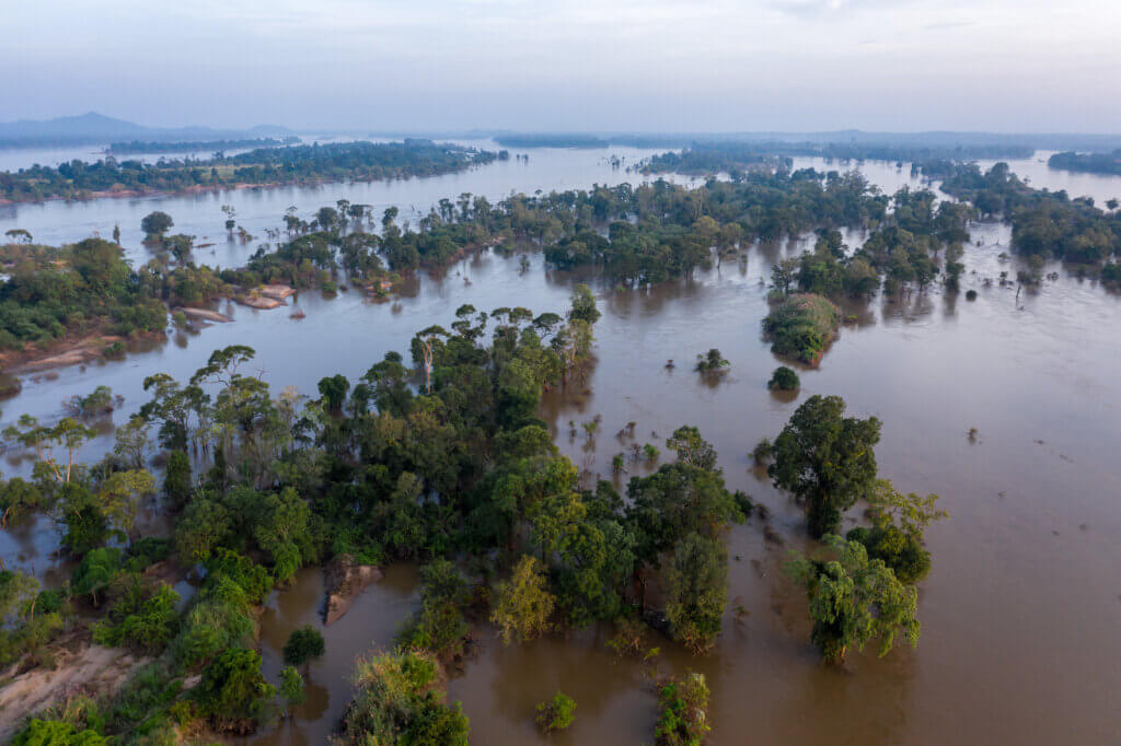
The predominately low-lying topography of the southern and western urban corridor leaves the area vulnerable to flooding and storm surge from heavy rainfall and wind-driven storm wave events. According to reporting by the national government to the IPCC, Barbados historically “experiences a major flooding event approximately every twelve years.”8 Note: Government of Barbados, “Barbados’ Second National Communication Under the United Nations Framework Convention on Climate Change,” United Nations Framework Convention on Climate Change, April 2018, https://www4.unfccc.int/sites/SubmissionsStaging/NationalReports/Documents/4693851_Barbados-NC2-1-Barbados%20SNC%20FINAL%20April%202018.pdf. Significant levels of coastal erosion, especially on Barbados’ southern coast, affect heavily developed tourist precincts.
Natural ecosystem-based defenses, especially coral reefs and seagrasses, have already diminished considerably over the last two decades, due to coral habitat degredation, poor water quality and sedimentation due to polluted run-off from inland sources, habitat damage during storm events and and excessive grazing by sea urchins.9 Note: J A Irvine, H A Oxenford, and R Suckoo, “A Coral Report Card for Barbados: Development, Design and Metadata,” Centre for Resource Management and Environmental Studies, The University of the West Indies, n.d., 52. These ecosystems face further pressures due to climate change, particularly the increased frequency of marine heatwaves.10 Note: Daphne Ewing-Chow, “Marine Heat Waves Are Putting Caribbean Fisheries in Hot Water,” Forbes, September 30, 2020, https://www.forbes.com/sites/daphneewingchow/2020/09/30/marine-heat-waves-are-putting-caribbean-fisheries-in-hot-water/. Terrestrial and marine heatwaves will continue to have further impacts, including greater incidence of harmful algal blooms, driving shifts in the ranges of major fish species and thereby disrupting fishing patterns, affecting the health of the increasing population of elderly citizens, while also undermining the tourism experience.
In the face of increasing climate risks, Barbados has emerged as a world leader in pushing for greater action to both mitigate the effects of climate change and take action to increase resilience against those effects that cannot be avoided. The core of its adaptation effort in recent years has been the Roofs to Reefs Programme, which aims to integrate environmental and economic resilience planning and scale up small-scale adaptation projects. The country has also taken a number of other key steps, including proposing safeguarding more than 30 percent of its exclusive economic zone, establishing and continuously updating its integrated coastal zone management plan establishing a programme of engineered shoreline stabilization and enhancement, building desalination capacity, and the Farmers Empowerment and Enhancement Drive, which aims to revitalize the country’s agricultural sector.
Summary of High-Level Recommendations
To build on these efforts and address the key challenges identified by the CORVI rapid assessment, three priority areas for action have been identified based on an analysis of CORVI the risk scores, stakeholder workshops, and desktop research:
- Build resilience in marine ecosystems. Marine ecosystems can play an important role in reducing coastal vulnerability to extreme weather events and providing co-benefits, including fish habitat and carbon sequestration. The government and its partners should protect existing marine ecosystems and restore degraded ecosystems, especially coral reefs. They should support this effort through mapping of existing and restorable marine ecosystems and enhanced monitoring, including through the Barbados Coral Reef Monitoring Programme. Stakeholders should incorporate these priorities into ongoing planning efforts, including the marine spatial plan being developed with The Nature Conservancy and the Inter-American Development Bank and marine managed areas on the western and southern coasts.
- Diversify the Barbadian economy. Climate change, including shrinking beaches, rising temperatures, and degraded marine ecosystems, increasingly threatens sun, sea, and sand tourism, which is a key part of Barbados’ economy. The government and the private sector should provide targeted support for key sectors. These include manufacturing, agriculture, renewable energy, and diverse forms of tourism. Barbados should build on existing efforts, such as the Farmers Empowerment and Enhancement Drive program, and leverage international support, such as through the new Global Ocean Energy Alliance.
- Develop marine heatwave response measures. Surveys of experts showed marine heatwaves (MHWs) to a very high risk for the study area. The government, private sector, civil society, and academia must work together to build awareness of the risks associated with MHWs and adopt a four-part plan to reduce their impacts. First, improving the health of marine ecosystems will make them more resilient to MHWs. Second, selecting breeding and growth of heat-tolerant coral can reduce the impacts of MHWs, and rising sea temperatures more generally. Third, the government and academic community should work with international partners to improve the early warning of MHWs. Fourth, the government and private sector should develop measures to take when MHWs occur to protect vulnerable ecosystems, such as temporarily restricting fishing or expanding protected areas.
By taking these initial steps, Barbados can continue to strengthen climate resilience to ensure a safe and sustainable future while serving as a leader in climate adaptation, both for other small island developing states and the rest of the world.
Pilot CORVI Rapid Assessments
Island states and coastal cities are at the forefront of the climate crisis. Rising sea levels, extreme storms, and heat events are amplifying the vulnerability of citizens. At the same time, island states and coastal cities face underlying economic and social concerns, such as expanding populations, limited resources, and aging infrastructure, at times compounded by poor governance. These interconnected pressures threaten ocean and land-based ecosystems, which are critical for economic and food security. To combat these systemic risks, decision makers need information to help them prioritize actions to build resilience through climate-smart policies, including increased use of nature-based solutions. However, rigorous data collection and subsequent integrated analysis necessary for the development of successful solutions are resource intensive and out of reach for many Small Island Developing States (SIDS) and developing coastal states.
The Stimson Center and the Commonwealth Secretariat partnered to pilot a rapid climate risk assessment methodology in three Commonwealth countries (Barbados, Kiribati, and Sri Lanka) under the Commonwealth Blue Charter program. The project is based on the cross-cutting methodology of the Climate and Ocean Risk Vulnerability Index (CORVI). Developed by the Stimson Center, CORVI produces comprehensive risk profiles for coastal cities and island states and helps leaders make climate-smart investments designed to build cross-cutting climate resilience in their country. The Commonwealth Secretariat led country engagement, review, and advisory support, while the Stimson Center led the research and conducted the analytical work. An in-country engagement officer was contracted to support the project. She assisted in the selection of diverse experts from the national government along with private sector and NGO stakeholders, who helped identify priority areas of climate risk.
To adapt the CORVI methodology for a rapid assessment, the 97 indicators used in a full CORVI assessment were reduced to thirty, three indicators for each of the ten risk categories (see Figure 1), in consultation with national stakeholders.

Sixty expert surveys, a minimum of three for each of the 10 CORVI risk categories, were collected from 27 subject matter experts in Barbados.11 Note: Experts are defined broadly, as described in USAID’s Climate Vulnerability Assessment: An Annex to the USAID Climate-resilient Development Framework. Experts include key donors, responsible ministries, NGOs, universities, research institutions, local planning and other departments, private sector, sector/livelihood organizations, vulnerable populations, etc. Risk scores for each of the 30 indicators were calculated using expert surveys and pre-existing secondary data collected for the Caribbean during prior full CORVI assessments.

A complete list of the indicators used for the Barbados rapid assessment is provided below. In addition, a list of organizations that provided surveys is included in the appendix.
CORVI Analysis
The following sections provide a greater level of detail on the climate risks faced by the urban corridor of southern and western Barbados delineated by the 30 selected indicators across ecological, financial, and political risk areas.
Ecological Risk
Ecological risks in the study area are concentrated in the categories of Geology/Water and Climate. This is principally due to Barbados’ generally low-lying geography coupled with the country’s limited freshwater availability and increasingly frequent marine heat waves. Fisheries also scored as medium-high risk, as did two of the three indicators selected from the Ecosystems category.
- All three of the selected indicators in the GEOLOGY/WATER category were rated as medium-high risk. The two highest risk indicators in the category, Rate of Coastal Erosion (7.33) and Percent of Metro Area at Risk of Flooding (6.57), illustrate the substantial risks associated with both coastal and runoff flooding.
- In the CLIMATE category, a high risk score for Number of Extreme Heat Events (8.29) reflects the range of impacts that increasingly frequent heat waves are likely to have, particularly on Barbados’ coastal areas. Total Number of Hurricanes (5.56) and Number of Droughts (5.36) were also scored as medium-high risk.
- The FISHERIES categoryshows medium-high risk scores for Nearshore Fish Stock Status (6.69), Capacity of Fisheries Enforcement Institutions (5.75), and Offshore Fish Stock Status (5.26).
- The ECOSYSTEMS category has divergent component scores. There was Medium-high risk scores for Level of Sea Grass Bed Coverage (6.70) and Rate of Occurrence of Harmful Algal Blooms (6.02) while the medium risk score for Health of Existing Coral Reefs (3.35) was the lowest.
Barbados is highly dependent on the ocean economy. The country’s exclusive economic zone (EEZ) is roughly 424 times as large its land area,12 Note: “Barbados Seeks to Lead in Protecting Coastal Waters and the High Seas,” The Pew Charitable Trusts, September 10, 2021, https://pew.org/3EckCh1. and its heavily coastal-based tourism industry makes up nearly 40 percent of employment and of total economic activity.13 Note: Waite and Burke, “Maintaining Million-Dollar Reefs and Beaches in Barbados and Beyond.” In this context, the likely increase in the number of marine heat waves due to climate change poses a serious threat.14 Note: Charlotte Laufkötter, Jakob Zscheischler, and Thomas L. Frölicher, “High-Impact Marine Heatwaves Attributable to Human-Induced Global Warming,” Science 369, no. 6511 (September 2020): 1621–25, https://doi.org/10.1126/science.aba0690. Extreme heat events harm many of the ecosystems on which Barbados relies such as corals and seagrasses. Corals are killed by marine heat waves even faster than by typical bleaching events.15 Note: William P. Leggat et al., “Rapid Coral Decay is Associated with Marine Heatwave Mortality Events on Reefs,” Current Biology 29, no. 16 (August 2019): 2723-2730.e4, https://doi.org/10.1016/j.cub.2019.06.077. In 2008, Barbados suffered a major coral bleaching event, during which buoys recorded temperatures of 30°C at a depth of 60 feet. Seagrasses are now found only in isolated locations around Barbados, having declined considerably over the last two decades, due to poor water quality, excavation of seagrass beds for ‘beach beautification’, and excessive grazing by sea urchins.16 Note: Irvine, Oxenford, and Suckoo, “A Coral Report Card for Barbados:”
Marine heat waves, along with polluted water runoff, can also contribute to the formation of harmful algal blooms (HABs).17 Note: Melissa Denchak and Melanie Sturm- Alum, “Freshwater Harmful Algal Blooms 101,” Natural Resources Defense Council, August 28, 2019, accessed March 23, 2022, https://www.nrdc.org/stories/freshwater-harmful-algal-blooms-101. Workshop participants noted that the Barbadian Ministry of Health has observed an increased number of cases of poisoning associated with HABs, including anecdotal reports of illness associated with home-based fish consumption. There is some indication that the illness may be ciguatera, but further investigation is required to confirm. Also possibly linked to changing climate and oceanographic conditions, in June 2018, Barbados declared a national emergency after its shorelines were covered by sargassum,18 Note: Isabelle Gerretsen, “The Seaweed Bloom That Covered an Ocean,” BBC, November 19, 2020, accessed March 24, 2022, https://www.bbc.com/future/article/20201119-atlantic-ocean-the-largest-seaweed-bloom-in-history. which is not only a health threat for citizens but a negative for the tourism industry. Experts noted that sargassum may also have negative impacts on beach erosion and fishing, but further investigation is necessary. Increasing marine heat waves threaten nearshore and offshore fish stocks by pushing them out of their previous habitats and increasing mortality.19 Note: Dan A. Smale et al., “Marine Heatwaves Threaten Global Biodiversity and the Provision of Ecosystem Services,” Nature Climate Change 9, no. 4 (April 2019): 306–12, https://doi.org/10.1038/s41558-019-0412-1.
Barbados has comparatively low-lying topography that leaves it very vulnerable to coastal and runoff flooding; estimates have suggested that storm surge flooding could extend over 150-300m inland.20 Note: Michelle Mycoo et al., “Human Adaptation to Coastal Hazards in Greater Bridgetown, Barbados,” Frontiers in Environmental Science 9 (May 2021), https://www.frontiersin.org/article/10.3389/fenvs.2021.647788. Barbados has historically experienced major flooding approximately every 12 years.21 Note: Government of Barbados, “Barbados’ Second National Communication.” Experts noted that the gully system has been supplemented with additional stormwater drains to accommodate the high population density of the southwestern urban corridor. However, litter and other solid waste clog the gullies and drains, inhibiting the efficient flow of stormwater and exacerbating the impact of flooding events. The rainfall-induced flooding that occurred on November 29, 2016, for example, overwhelmed drainage infrastructure on the island, inundating properties, and damaging vehicles.22 Note: Ibid.
Coastal erosion exacerbated the vulnerability of the southern and western urban corridor to storm surge flooding, especially on the western coast. Experts highlighted that the window for beaches to recover after winter swell and spring tide seasons and before hurricane season has been shrinking. Both experts surveyed as part of this assessment and research from the Inter-American Development Bank emphasized that the erosion of the area’s beaches increases the vulnerability of the coastal infrastructure that is so critical to the urban corridor’s economy.23 Note: “The Smart Fight Against Beach Erosion and Natural Disasters in Barbados,” Inter-American Development Bank, March 4, 2013, accessed April 22, 2022, https://www.iadb.org/en/news/webstories/2013-03-04/coastal-infrastructure-in-barbados%2C10326.html. Coastal erosion is in part a function of coral reef health, and experts noted that the best way to manage coastal erosion is to improve water quality by improving water recycling and waste water treatment infrastructure on the island.
In recent years, the Barbadian government has taken several steps to strengthen coastal resilience to climate risks, including a plan to safeguard aspirationally more than 30% of its EEZ24 Note: “Barbados Seeks to Lead in Protecting Coastal Waters and the High Seas.” and efforts to protect and restore its coral reefs.25 Note: Julia Rawlins-Bentham, “Effort Underway to Save Barbados’ Coral Reefs,” Barbados Government Information Service (blog), June 15, 2021, https://gisbarbados.gov.bb/blog/effort-underway-to-save-barbados-coral-reefs/. The centerpiece of this effort is the Roofs to Reefs Programme. The plan aims to bring together small-scale, disconnected adaptation projects and integrate environmental and economic resilience planning.26 Note: Joy-Ann Gill, “‘Roofs to Reefs’ is Barbados’ National Resilience Plan,” Barbados Government Information Service (blog), July 13, 2021, https://gisbarbados.gov.bb/blog/roofs-to-reefs-is-barbados-national-resilience-plan/. It aims to leverage innovative financial tools such as green and blue bonds to reinforce homes, increase the use of renewable energy and rainwater harvesting, and restore coral reefs and other nature-based solutions.27 Note: “Barbados PM Mottley Leads the Charge Against Climate Change,” United Nations Environmental Programme, December 7, 2021, https://www.unep.org/news-and-stories/story/barbados-pm-mottley-leads-charge-against-climate-change. In addition, Barbados is one of the only Caribbean countries to have an established Integrated Coastal Zone Management (ICZM) plan and to have an agency dedicated to managing coastal areas and the ocean space and resources.28 Note: Julie Rozenberg et. al., “360o Resilience: A Guide to Prepare the Caribbean for a New Generation of Shocks,” The World Bank, November 17, 2021, https://www.worldbank.org/en/events/2021/11/05/360-resilience-a-guide-to-prepare-the-caribbean-for-a-new-generation-of-shocks#:~:text=Email-,360%C2%B0%20Resilience%3A%20A%20Guide%20to%20Prepare%20the%20Caribbean%20for,to%20those%20shocks%2C%20the%20gaps.
Financial Risk
Like many Caribbean states, Barbados’ economy is heavily dependent on tourism and its principal port, Deepwater Harbor, both of which are highly vulnerable to climate risks. The risks associated with a heavy reliance on tourism were starkly illustrated in 2020; when the covid pandemic hit, and long-stay tourist arrivals fell by 99.8% between February and April,29 Note: Barbados Statistical Service. “Tourist Arrivals” and Barbados’ GDP fell by 14% during the year.30 Note: “World Economic Outlook: Recovery during a Pandemic—Health Concerns, Supply Disruptions, Price Pressures,” International Monetary Fund (October 2021) https://www.imf.org/en/Publications/WEO/Issues/2021/10/12/world-economic-outlook-october-2021#Gdp. The city also faces larger structural economic challenges, including unemployment and a shrinking population in the urban core.
- All of the three selected indicators in the MAJOR INDUSTRIES category scored as medium-high risk. This reflects the large share of the national economy based in tourism (7.07) and in ports and shipping industries (6.67), together with expert concerns around the diversity of lodging types (5.73).
- The INFRASTRUCTURE category includes the highest risk indicator in Financial Risk, the high risk score associated with the level of shoreline development (7.90). Medium risk scores for the resilience of freshwater distribution infrastructure (4.56) and wastewater treatment (3.95) reflect sustained efforts to improve the city’s water management infrastructure.
- The ECONOMICS category shows a medium-high level of risk associated with urban unemployment (6.40) while medium risk scores for the informal economy (4.87) and national GDP per capita (4.30), reflecting Barbados’ mix of structural economic strengths and vulnerabilities.
The large role that Deepwater Harbor plays in the national economy, together with its vulnerability to coastal hazards, makes it a key risk area. In 2018, the Harbor facilitated 80% of the country’s imports, handling over 1.24 million tonnes of cargo.31 Note: David Hinkson, “Port Plays Significant Role,” Barbados Today, October 16, 2019, https://barbadostoday.bb/2019/10/16/port-plays-significant-role/. Increased average temperatures may reduce the number of workable days for the Harbor,32 Note: Mycoo et al., “Human Adaptation to Coastal Hazards in Greater Bridgetown, Barbados.” while the port facilities themselves are vulnerable to damage from extreme weather events like hurricanes – as demonstrated by the destruction of the cruise ship pier in Port Zante in St. Kitts and Nevis in 1998 and again in 1999 – and inundation from storm surge.33 Note: Leonard A Nurse, “The Vulnerability of Caribbean Ports to the Impacts of Climate Change: What Are the Risks?,” United Nations Conference on Trade and Development, September 30, 2011., 22. In 2004, Hurricane Ivan disrupted activities at the port for approximately two weeks, according to experts.
Deepwater Harbor also handles the largest number of tourists per year in the Caribbean, which in 2018 included 453 cruise ships with 800,000 passengers.34 Note: David Hinkson, “Port Plays Significant Role.” These tourists play a vital role in the economy of the city and of the island as a whole. While precise figures vary, the tourism sector is estimated to directly account for 22 percent of Barbados’ GDP,35 Note: Mycoo et al., “Human Adaptation to Coastal Hazards in Greater Bridgetown, Barbados.” while a broader definition of tourism-related activity is estimated to make up nearly 40 percent of employment and economic activity.36 Note: Waite and Burke, “Maintaining Million-Dollar Reefs and Beaches in Barbados and Beyond.” That tourism is largely focused on coastal areas along the western and southern coasts, which are part of the study area of this report.37 Note: Government of Barbados, “Barbados’ Second National Communication Under the United Nations Framework Convention on Climate Change.” Many of the attractions this thriving economy is founded on are at risk as coral reefs degrade, beaches narrow, seawater quality declines, and temperatures rise to uncomfortable levels.
The growth of the large tourism sector has helped drive a very high level of shoreline development in the study area. Approximately 90% of Barbados’ hotels are estimated to be located within 1 km of the high-water mark and less than 20 meters above sea level.38 Note: Michelle Mycoo, “Sustainable Tourism, Climate Change and Sea Level Rise Adaptation Policies in Barbados,” Natural Resources Forum 38, no. 1 (February 2014): 47–57, https://doi.org/10.1111/1477-8947.12033. In its first report to the UNFCCC, the government of Barbados projected that flooding would occur in excess of 1 km inland on much of the island’s southern coast.39 Note: Government of Barbados. “Barbados’ First National Communication to the United Nations Framework Convention on Climate Change.” This coastal inundation zone also contains a wide range of other critical infrastructure, including the port, power stations, hospitals, fuel storage and processing facilities, desalination plants, fire and water services, highways 1 & 7, along with numerous government and commercial offices, small businesses, and residences.40 Note: Ibid.
Since the late 1970s, Barbados has successfully transformed itself from a low-income economy centered around sugar exports to an upper-middle-income economy with one of the highest per capita incomes in the region, driven by tourism and financial services.41 Note: Ibid. In recent years, however, this economic model has begun to show increasing strains. In 2016, national economic growth started slowing and unemployment started rising and in 2020, due to a COVID-19-induced collapse in tourism, GDP plunged by 14 percent. In many ways, these economic challenges are elevated in Bridgetown. Urban unemployment was scored as a medium-high level of risk based on the surveys to subject matter experts and Greater Bridgetown has a greater poverty rate than both the country as a whole and rural areas of Barbados.42 Note: Andrew Downes, et al., “Barbados National Report for the Third United Nations Conference on Housing and Sustainable Urban Development – Habitat III,” December 2015, https://habitat3.org/wp-content/uploads/Habitat-III-Report-Barbados-final.pdf. The core of the city in St. Michael’s parish – while still the most densely populated part of the country – has been declining in population for several decades.43 Note: “Barbados,” City Population, accessed March 25, 2022, https://www.citypopulation.de/Barbados.html.
In the face of these risks, the Barbadian government has taken a number of steps to build economic resilience to climate risks. Projects in cooperation with the Green Climate Fund44 Note: Simon Wilson, “Water Conservation in Barbados: How GCF Is Enhancing Water Security,” Green Climate Fund, October 26, 2021, https://www.greenclimate.fund/story/water-conservation-barbados-how-gcf-enhancing-water-security. and European Investment Bank45 Note: “Barbados: EIB Backs Improved Water Supply and Sanitation,” European Investment Bank, June 19, 2020, accessed March 25, 2022, https://www.eib.org/en/press/all/2020-157-eib-backs-improved-water-supply-and-sanitation-in-barbados. have worked to improve the resilience of freshwater distribution infrastructure and upgrade water supply and wastewater treatment infrastructure, respectively. The country has also worked to reduce the vulnerability of its coastal infrastructure by establishing a minimum building setback for all new buildings along sandy coasts from the high-water mark.46 Note: Mycoo et al., “Human Adaptation to Coastal Hazards in Greater Bridgetown, Barbados.” However, this kind of policy takes considerable time to have effects as a lot of key coastal tourism infrastructure has an economic lifespan of 25 to 30 years.47 Note: Mycoo, “Sustainable Tourism, Climate Change and Sea Level Rise Adaptation Policies in Barbados.”
Political Risk
Political risks in Barbados’ southern and western urban corridor are concentrated in the Governance category, particularly due to access to healthcare. While the risk scores in the categories that make up the political risk area are almost uniformly lower than the risk scores for the other categories under Ecological and Financial risk, there are signs that some of the trends Barbados is experiencing may drive new risks in the future.
- The GOVERNANCE category includes access to healthcare (6.07), which has the highest risk score of the selected indicators in political risk. The capacity of ethic enforcement bodies (5.28) is also rated as medium-high risk, while voter turnout (4.37) is rated as medium risk, but turnout has been slowly falling for years before sharply dropping in 2022.
- In the SOCIAL AND DEMOGRAPHICS category, the medium-high risk associated with the dependency ratio (5.53) reflects the steady aging of the Barbadian population. Urbanization rate (6.65) is also rated as medium-high risk, reflecting Bridgetown’s high population density and the challenges associated with a shrinking urban population. A percent of the population achieving proficiency in literacy and numeracy (2.72) is rated medium risk, reflecting the success in extending basic education services.
- The STABILITY category principally reflects the importance of the fishing industry for employment in Barbados, both artisanal and subsistence fishing (4.53) and commercial fishing (4.30). A number of incidences of civil unrest or instability (1.55) is rated low risk, reflecting the general civic stability of Barbados.
Coverage of essential health services in Barbados is the highest of the CARICOM states and the second highest in the Caribbean, behind only Cuba.48 Note: “UHC Service Coverage Index (SDG 3.8.1),” World Health Organization, accessed March 28, 2022, https://www.who.int/data/gho/indicator-metadata-registry/imr-details/4834#:~:text=Rationale%3A,medicines%20and%20vaccines%20for%20all%E2%80%9D. However, out-of-pocket expenditures as a share of total healthcare spending have been rising since 2004, and now account for almost half of current health expenditure in Barbados.49 Note: “Out-of-pocket expenditure (% of current health expenditure),” The World Bank, accessed March 24, 2022, https://data.worldbank.org/indicator/SH.XPD.OOPC.CH.ZS. This contributes to income-based inequalities in effective access to healthcare. The Barbadian health system is also facing increasing capacity constraints. Although the number of physicians has been rising,50 Note: “Physicians (per 1,000 people),” The World Bank, accessed March 24, 2022, https://data.worldbank.org/indicator/SH.MED.PHYS.ZS. the number of nurses and midwives per capita has fallen by 47 percent between 2000 and 2018 and the number of hospital beds per capita has also been falling, albeit less quickly.51 Note: “Nurses and midwives (per 1,000 people),” The World Bank, accessed March 24, 2022, https://data.worldbank.org/indicator/SH.MED.NUMW.P3. Note: “Hospital beds (per 1,000 people),” The World Bank, accessed March 24, 2022, https://data.worldbank.org/indicator/SH.MED.BEDS.ZS. This suggests that the Barbadian health system will face increasing capacity and fiscal constraints in coming years, even as it faces increasing pressures from new and re-emerging communicable diseases such as chikungunya, Dengue fever, and Zika which will be exacerbated by higher temperatures and greater rainfall,52 Note: “Climate Risk Profile: Eastern and Southern Caribbean,” United States Agency for International Development, October 13, 2021, accessed March 25, 2022, https://www.climatelinks.org/resources/climate-risk-profile-eastern-and-southern-caribbean-0 as well as the rising rate of non-communicable diseases.53 Note: “County Cooperation Strategy at a glance: Barbados,” World Health Organization, last modified May 2018, https://apps.who.int/iris/bitstream/handle/10665/272540/ccsbrief-brb-eng.pdf?sequence=1&isAllowed=y.
The rising rate of non-communicable diseases is driven by the Barbadian diet and the aging of the Barbadian population, with the latter reflected in the dependency ratio. After a multi-decade decline, the dependency ratio began slowly rising again in 2008, and in 2020 was the highest it had been since 2001.54 Note: “Age dependency ratio (% of working-age population),” The World Bank, accessed March 24, 2022, https://data.worldbank.org/indicator/SP.POP.DPND?locations=BB. While the share of the population younger than 15 has continued to fall,55 Note: “Age dependency ratio, young (% of working-age population),” The World Bank, accessed March 24, 2022, https://data.worldbank.org/indicator/SP.POP.DPND.YG. more than a quarter of the population is now over 64.56 Note: “Age dependency ratio, old (% of working-age population),” The World Bank, accessed March 24, 2022, https://data.worldbank.org/indicator/SP.POP.DPND.OL. In addition to the increased strains on the healthcare system, this trend will also shrink tax revenue and increase the burden on the Barbadian social security system. While there have been a series of reforms in recent years to raise the pensionable age, most recently increasing it to 67 in 2018,57 Note: “About Us,” Barbados National Insurance Scheme, accessed March 24, 2022, https://www.nis.gov.bb/about-us/. the fiscal burden of this trend will constrain the government’s ability to respond to acute and chronic climate risks.
Voter Turnout in Barbados had been steadily, if inconsistently, falling from a peak of 81.6 percent in 1971. In 2022, it dropped precipitously, falling by almost one-third from 60.3 percent in 2018 to 41.7 percent. While the COVID-19 pandemic likely drove some of that drop, the fall was considerably larger than that experienced by most other Caribbean countries that held elections during the pandemic. The 2022 election also marked the second consecutive sweep by Prime Minister Mia Mottley and the Barbados Labour Party, winning all 30 seats and taking 69 percent of the vote, down slightly from 73.5 percent in 2018.58 Note: “Barbados: Voter Turnout by Election Type,” International Institute for Democracy and Electoral Assistance, accessed March 24, 2022, https://www.idea.int/data-tools/country-view/58/40.
Barbados is one of the most densely populated countries in the world and Bridgetown is the most densely populated part of the country. However, the population density of the city has been falling, resulting in a high rate of vacant buildings.59 Note: Mycoo et al., “Human Adaptation to Coastal Hazards in Greater Bridgetown, Barbados.” There are two principal drivers of this decline. The first is Barbados’ falling birthrate, which has been falling for decades – Barbados’ fertility rate fell below replacement level fertility in 1980 – but which the government has recently taken steps to address.60 Note: Julia Rawlins-Bentham, “Barbados to Tackle Declining Birth Rate,” Barbados Government Information Service (blog), September 16, 2020, https://gisbarbados.gov.bb/blog/barbados-to-tackle-declining-birth-rate/. The second driver is out-migration from the core Bridgetown area to outlying areas, especially St. James and St. Philip parishes. Experts highlighted that this out-migration is driven both by the costs of living in downtown Bridgetown and the increasing frequency of flooding due to heavy rainfall in the core Bridgetown area over the last 7-10 years.
The decline in Barbados’ urbanization rate stands in contrast to the rising average rate of urbanization for Caribbean small states.61 Note: “Urban population (% of the total population),” The World Bank, accessed March 24, 2022, https://data.worldbank.org/indicator/SP.URB.TOTL.IN.ZS?locations=BB. Although the southwestern parishes of St. Michael (including Bridgetown) and Christ Church still contained a bare majority of the Barbadian population as of 2010, the parishes that were growing the most quickly were St. James and St. Philip.62 Note: “Barbados,” City Population. This comparatively more dispersed population will have several impacts. First, infrastructure costs will be higher for a less dense population, though development in new areas will provide an opportunity to include requirements around solid waste management and improved drainage for new development. Second, increasing development away from the port will make it more difficult for tourists to access, potentially reducing the revenue earned from each tourist. Third, out-migration from Bridgetown will likely leave behind a more vulnerable population less able to cope with the impacts of flooding and other extreme weather events.
High-Level Recommendations to Build Resilience
In the face of significant and growing climate risks, Barbados has emerged as a leader in climate change mitigation and adaptation. Prime Minister Mottley has announced a goal to phase out fossil fuels by 2030 and has overseen a national strategy to plant more than 1 million trees. The Prime Minister also played a leading role in pushing Latin America and the Caribbean to be the first region in the world to agree on the Action Plan for the UN Decade for Ecosystem Restoration.63 Note: “Barbados PM Mottley Leads the Charge against Climate Change,” United Nations Environmental Programme.
Barbados also included an overview of its adaptation plan as part of its 2021 update to its Nationally Determined Contribution (NDC). The principal pillars of the plan are the 2021 Physical Development Plan and the Roofs to Reefs Programme, though it also includes:
- Measures around strengthening water resource management
- Approval of an integrated coastal zone management plan
- Efforts to establish a debt for nature swap
- A Comprehensive Disaster Management Country Work Program
- A National Coastal Risk Information Planning Platform
The NDC update also called for increased international support for adaptation measures and for assessments of vulnerability and support needs to be multidimensional rather than relying on income-based criteria. This CORVI rapid assessment – as well as a full CORVI assessment – aims to help fill this gap by providing an understanding of the environmental, economic, and social dimensions of climate risk in Barbados’ southern and western urban corridor and through furnishing city-level information that climate finance lenders have called for. This rapid assessment provides high-level recommendations while a full CORVI assessment would provide specific, targeted, and concrete recommendations.
Build Resilience in Marine Ecosystems
The high-risk score for shoreline development and the medium-high risk scores for coastal erosion, flooding of Bridgetown’s metropolitan area, and the number of hurricanes reflects the elevated level of vulnerability of Barbados’ southern and western urban corridor to storm surge, flooding, and other extreme weather events. Marine ecosystems can play an important role in reducing vulnerability to these events, forming “lines of defense” against wave energy and water flow,64 Note: Karima Degia, “Coastal Ecosystems and Nature- Based Approaches,” Centre for Resource Management and Environmental Studies, June 8, 2021, 10. while also providing co-benefits including habitat for nearshore fisheries. The Barbadian government, private sector, and civil society should work together to protect existing marine ecosystems, restore degraded marine ecosystems, and improve the health of all marine ecosystems. Discussions with experts has made clear that coral reefs should play the principal role in this effort in the southwestern urban corridor, with other marine ecosystems like seagrasses and mangroves playing a secondary role where appropriate.
The first step in building marine ecosystem resilience should be mapping, both existing marine ecosystems and of areas where restoration projects would have the highest chance of success. The government should also strengthen the Barbados Coral Reef Monitoring Programme to provide an up-to-date picture of the health of existing coral reefs. The government and private sector should work together to improve water recycling and waste water treatment infrastructure in Barbados to improve the quality of the water that is released into the ocean, as polluted runoff and waste water were identified by experts as key threats to the health of Barbados’ coral reefs. The government, supported by other stakeholders, should work to restore coral reefs through techniques such as coral gardening. Based on the mapping effort, the government should also work to restore other marine ecosystems such as seagrasses and mangroves in select areas. The government and its partners should incorporate these priorities into ongoing planning efforts. These include the marine spatial plan that the government is developing with The Nature Conservancy and the Inter-American Development Bank for Barbados’ entire exclusive economic zone and the two marine managed areas the government is developing, one on the western coast from Fitts Village to Weston and one on the southern coast from Pierhead to Rockley.
Diversify Barbados’ Economy
The transition away from a sugar-based economy to one based on tourism has in many ways been very successful for Barbados. The foundations of that economy, however, are increasingly threatened by the effects of climate change, including shrinking beaches, rising temperatures, and degraded marine ecosystems, emphasizing the need for Barbados to better protect its natural assets and diversify its economy. The Barbadian government and the private sector should mobilize investment to promote key sectors, including manufacturing, agriculture, renewable energy, and new forms of tourism. For manufacturing, Barbados should build upon its existing strength in agro-processing; the country has one of the most advanced agro-processing industries in the region.65 Note: Samuel Kruiner, “Opportunities in Agri-Processed Foods for the Region,” Caribbean Export Development Agency, November 2014, accessed June 2, 2022. https://brusselsbriefings.files.wordpress.com/2014/11/regionalbriefing2014_caribbeanagribusinessforum_caribexport_executivesummary.pdf. Its agro-processing sector should also help facilitate the growth of Barbados’ agriculture sector, building on the Farmers Empowerment and Enhancement Drive program, which was launched in 2019. Barbados should also build on the substantial resources it has already devoted to solar energy to grow its renewable energy sector in pursuit of its commitment to reach 100 percent renewable energy by 2030.66 Note: “Barbados National Energy Policy (BNEP) 2019 – 2030,” Government of Barbados, accessed June 2, 2022, https://energy.gov.bb/publications/barbados-national-energy-policy-bnep/. Barbados can also work to leverage the Global Ocean Energy Alliance (GLOEA), which is being formally launched at the 2022 United Nations Ocean Conference in June 2022 and which aims to direct significant investment in developing ocean energy technologies. Growing Barbados’ renewable energy can help drive growth and reduce costly imports of fossil fuels. Finally, the Barbadian government and private sector should promote the growth of alternative types of tourism, such as medical, sports, and business tourism, that are not as vulnerable to climate risks as the currently dominant sun, sea, and sand tourism.
Develop Marine Heatwave Response Measures
Of the 30 indicators selected as part of the Barbados rapid assessment, the one with the highest risk score was the number of extreme heat events. Discussion with experts clarified that this primarily reflects concern around the impacts of marine heat waves (MHWs), particularly on marine ecosystems. In response, Barbadian stakeholders should work on four avenues to reduce the impact of MHWs. First, all stakeholders should work to build resilience and improve the general health of marine ecosystems, as discussed in a previous recommendation, as healthy marine ecosystems are more resilient to the impacts of MHWs than unhealthy marine ecosystems. Second, the Barbadian government should provide support to the selective breeding and growth of heat-tolerant coral to reduce the vulnerability of the country’s coral reefs to MHWs. Third, the government and academic community should work to improve the early warning of MHWs. This should include cooperation with the United States National Oceanic and Atmospheric Administration, which has recently begun making MHW forecasts available through its Physical Sciences Laboratory,67 Note: “New Global Forecasts of Marine Heatwaves Foretell Ecological and Economic Impacts,” NOAA Fisheries, April 21, 2022, https://www.fisheries.noaa.gov/feature-story/new-global-forecasts-marine-heatwaves-foretell-ecological-and-economic-impacts. and the Marine Heatwaves International Working Group. Fourth, the government and the private sector should work together to develop preventative measures to take immediately before, during, and immediately after MHWs. These measures may include restricting fishing in affected areas, which has seen success in restoring blue swimmer crab populations in Australia after a 2011 MHW in the country’s western Shark Bay, and temporarily expanding marine protected areas.68 Note: Jen Monnier, “Marine Heat Waves Are Becoming More Common and Intense. What Can We Do to Minimize Harm?,” PreventionWeb, August 11, 2020, accessed June 2, 2022, https://www.preventionweb.net/news/marine-heat-waves-are-becoming-more-common-and-intense-what-can-we-do-minimize-harm.
Gaps and Limitations
Two key areas of climate risk require further investigation, based on the conversations with experts that took place during this rapid assessment.
The first is freshwater availability. This rapid assessment did include the resilience of freshwater distribution infrastructure, which was scored as a medium risk. The CORVI indicator assessing the continuity of piped water supply, however, was not selected. Water scarcity has historically been a major concern in Barbados and annual freshwater withdrawals peaked at over 100 percent of internal resources in the late 1990s and early 2000s, according to the World Bank.69 Note: “Annual Freshwater Withdrawals, Total (% of Internal Resources) – Barbados,” The World Bank, accessed June 3, 2022, https://data.worldbank.org/indicator/ER.H2O.FWTL.ZS?locations=BB-S3. The government has made efforts to reduce water use and improve water supply infrastructure in recent years, including a project in cooperation with the European Investment Bank, and withdrawals have fallen accordingly. Nonetheless, they remain at the highest level among Caribbean states for which the World Bank has data by a large margin. Further research is required to assess the climate risks associated with freshwater in Barbados’ southwestern urban corridor and what actions can be taken to reduce the area’s vulnerability. A full CORVI assessment could include this area of research.
The second key risk area that requires further investigation is public health. The rapid assessment did include an assessment of access to healthcare, which was scored as a medium-high risk, and briefly noted the reports that the Ministry of Health has received of illness associated with fish consumption. However, there are broader public health implications of climate risk that were not included in the report. A full CORVI assessment would provide the opportunity for a greater level of detail on the two public health issues included in the rapid assessment and would also include an assessment of vector-borne disease.
Appendix 1: Surveyed Organizations
Expert surveys were submitted by individuals from these organizations. 60 surveys were collected for the Barbados rapid assessment.
[table “” not found /]Appendix 2: The Climate and Ocean Risk Vulnerability Index
It is clear that urban coastal areas are likely to experience the earliest onset and potentially most severe impacts from climate change. The risks associated with climate change for specific coastal cities, however, are much more difficult to untangle. In order for coastal cities to efficiently allocate resources and enact effective adaptation strategies, it is critical that they understand their multidimensional climate risk. However, these efforts are impeded by poor and incomplete data.70 Note: Hunt, Alistair, and Paul Watkiss. “Climate change impacts and adaptation in cities: a review of the literature.” Climatic change 104, no. 1 (2011): 13-49. Data on climate risks is rarely available at the city level, and when it does exist, it is often poorly managed and stored in silos that make it difficult to access and use, even for city government officials.71 Note: Hardoy, Jorgelina, and Gustavo Pandiella. “Urban poverty and vulnerability to climate change in Latin America.” Environment and Urbanization 21, no. 1 (2009): 203-224. This issue is compounded by technical, financial, and capacity gaps, trapping coastal cities in a vicious cycle where they cannot develop holistic strategies to prioritize investment and access the funds needed to implement resilience actions.
Without data at the appropriate geographic scale, decision-makers are often left with the choice of either waiting for greater data availability, or attempting to downscale national level data, neither of which are ideal solutions for effective climate change adaptation. This problem is particularly acute in small and intermediate cities, which along with absorbing the bulk of East Africa’s future urban population growth, often lack the resources to gather and maintain necessary data.72 Note: “Demographic Trends and Urbanization,” World Bank, last modified May 19, 2021. Accessed August 16, 2021. https://www.worldbank.org/en/topic/urbandevelopment/publication/demographic-trends-and-urbanization.
Despite these challenges, decision makers need to act now in the face of uncertainty to build resilience to the climate crisis. To do this, they need tools that will enable them to consider multidimensional climate risks, develop cohesive strategies, and utilize this information to unlock additional climate finance and implement resilience actions.
In response, the Stimson Center developed the Climate and Ocean Risk Vulnerability Index (CORVI). CORVI is a decision support tool which compares a diverse range of climate-related risks across the land-seascape to produce a coastal city risk profile.73 Note: Stuart, J and Sally Yozell, 2020, CORVI: Understanding and measuring climate risk, A guide to the Climate and Ocean Risk Vulnerability Index, The Stimson Center, Environmental Security Program. Accessed August 16, 2021. https://stimson.org/2020/corvi-understanding-and-measuring-climate-risk/. These risks are displayed across 10 categories, grouped under three risk areas: ecological, financial, and political (see figure 2). The 10 categories are in turn made up of close to 100 indicators, covering a range of issues including the vulnerability of vital infrastructure, the health of marine ecosystems, and urbanization dynamics in the chosen coastal city. Each indicator and category are scored using a 1-10 risk scale relative to other cities in the region, offering a simple reference point for decision-makers looking to pinpoint and categorize climate risks. The CORVI risk scores, which form the basis of a coastal city risk profile, are augmented with existing academic and grey literature, government documents, and key informant interviews to develop a comprehensive narrative and understanding of the coastal city’s climate risks and identify priority policy recommendations.
CORVI was successfully piloted in the coastal cities of Castries, Saint Lucia and Kingston, Jamaica. These first two CORVI city assessments demonstrated the value of CORVI’s holistic approach in helping leaders and decision makers prioritize actions and smart investments for risk reduction in coastal cities. Despite the challenges posed by COVID0-19, data and recommendations from both risk profiles are beginning to be incorporated into urban resilience planning.
How CORVI is Different
CORVI builds on the work of previous indices but is distinct in three ways.
- City-Based: Unlike many other indices which tend to focus on the national level, CORVI is city-based, providing sub-national level detail on the nature and impact of climate and ocean risks. This focus is based on extensive interviews with potential issuers of the CORVI tool, who noted the difficulty of down-scaling national level risk and vulnerability data to inform policy action to build climate resilience in specific communities.
- Holistic: CORVI looks across a broad set of ecological, financial, and political risk factors connected to climate change impacts and that influence vulnerability of coastal cities and their residents. As part of the category and indicator selection process, indicator inclusion was primarily based on its ability to capture and explain climate change risks in coastal cities, and not if data was available. This approach promotes a holistic understanding of climate change impacts to coastal cities.
- Data Driven: Through utilising SEJ, CORVI is suited to producing actionable insights in data-sparse environments. By combining empirical and survey data across a wide range of indicators, CORVI fills data gaps to provide a holistic assessment, while reducing data availability bias. This approach provides a contextual and data-driven assessment of climate and ocean risk vulnerability.


Advancing the Sustainable Development Goals
CORVI also aims to contribute to the delivery of the SDGs – an essential framework to guide lasting, positive change. By providing data and information to measure climate risks in coastal cities, this project supports the delivery of the following SDGs:

Completed & Ongoing Assessments
In collaboration with a wide range of on-the-ground research institutions, with the support of different levels of governments, eight additional CORVI coastal cities assessments are now underway across the globe. In addition to providing decision makers in the specific city with a complete risk picture, each risk profile is also added to a global database, to improve understanding of regional risk dynamics.
Rapid Assessments Completed
- Southwestern Urban Corridor, Barbados
- Tarawa, Kiribati
- Western Province, Sri Lanka
Assessments completed
- Castries, St. Lucia
- Dar es Salaam, Tanzania
- Kingston, Jamaica
- Mombasa, Kenya
- Suva, Fiji
Assessments underway
- Basseterre, St. Kitts and Nevis
- Chattogram, Bangladesh
- Dagupan, Philippines
Indicators
To ensure that the CORVI indicator scores provide a holistic risk rating, each is made up of five factors: current, past, and expected trends, the rate of change of the risk, and the impact of this risk on the coastal city.
- BASELINE measures the current level of risk for each indicator relative to other coastal cities in the region. Baseline data for economic and social indicators is derived from the most recent year of complete data. Climate indicators use a longer time period of 15 years.74 Note: 30-year time horizons are traditionally used to calculate the seasonal cycle and other long-term averages of climate variables. However, as the climate changes, current conditions are more dissimilar to those from 30 years ago than they are from 10 years ago. In this environment, the optimum climate normals (OCN) method can be used to calculate the minimum number of years required to accurately produce the climatological average for climate variables. The National Oceanic and Atmospheric Administration suggests that a 10-year time series for temperature and a 15-year time series for precipitation are acceptable minimum limits to produce accurate climatology within a non-stationary period. CORVI follows the same limits that NOAA uses in their experimental seasonal forecast product by using a similar 15-year time horizon to measure climate indicators. For more information on OCN, see Wilks 2013.
- PAST TREND assesses the trend of risk for the past 10 years, measured from the baseline year. The only exception to the 10-year trend measure are the climate indicators, which use a 15-year trend horizon to account for slow onset changes.
- EXPECTED TREND assesses the anticipated trend of risk in the next 10 years, measured from the baseline year. The only exception to the 10-year trend measure is the climate indicators, which use a 15-year trend horizon to account for slow onset changes.
- MAGNITUDE assesses the degree of expected future trend change relative to other cities in the region. Change that happens quicker than expected is assumed to increase risk when compared to changes that take place over a longer time scale. This assumes that longer time periods of change contribute to less risk, as decision makers have more time to adapt and build resilience.
- IMPACT assesses the importance of change for each indicator in describing future risk in the coastal city.

Data Collection and Structured Expert Judgement
To overcome data gaps, CORVI employs structured expert surveys to collect data that is otherwise unavailable. This primary data is combined with secondary data using the approach of structured expert judgement (SEJ) to produce a comparative score for each indicator in the assessment.75 Note: For an introduction to structured expert judgement, see Cherie Maestas, “Expert Surveys as a Measurement Tool: Challenges and New Frontiers,” in Lonna Rae Atkeson and R. Michael Alvarez (eds) The Oxford Handbook of Polling and Survey Methods (Oxford: Oxford University Press, 2018). SEJ is a well-established social science technique that seeks to quantify risk when pre-existing secondary data is inadequate. Through interviews and surveys, as well as a series of weighting procedures to ensure data is representative, SEJ allows researchers to quantify topics that might otherwise be challenging to study in such a systematic fashion.
To apply SEJ to CORVI, subject matter experts across academia, government, civil society, and the private sector are identified through research and extensive outreach to stakeholders in the target coastal cities. These experts then refer the project team to other experts and stakeholders with appropriate expertise using “snowball sampling.”76 Note: Snowball sampling or chain-referral sampling is a non-probability sampling technique used when samples have traits that are difficult to find. In this sampling technique, existing subjects provide referrals to recruit additional subjects required for a research study. To guard against confirmation bias, survey answers are compared to a regional secondary empirical dataset to weigh the expert responses by utilizing a coherence check.77 Note: Abigail Colson and Roger Cooke, “Expert Elicitation: Using the Classical Model to Validate Experts’ Judgements,” Review of Environmental Economics and Policy 12, no. 1 (2018): 113-132. This ensures that experts whose answers do not match secondary data are not weighed as highly as those who do.
This approach has several strengths. First, CORVI incorporates the views of subject matter experts and local stakeholders at each stage of its implementation. This allows the final product to better reflect the specific context that it is seeking to measure and provide more focused information for end users. Second, pairing primary survey data with secondary data through SEJ also allows CORVI to provide insight into risks relating to urban coastal environments that existing secondary datasets do not cover. While the use of SEJ allows CORVI to assess a diverse range of risks, it should not be regarded as a substitute for empirical data collection. Rather, SEJ is best viewed as an alternative research technique specialized in analyzing topics with significant data gaps.78 Note: 4 Kunreuther H., S. Gupta, V. Bosetti, R. Cooke, V. Dutt, M. Ha-Duong, H. Held, J. Llanes-Regueiro, A. Patt, E. Shittu, and E. Weber, 2014: Integrated Risk and Uncertainty Assessment of Climate Change Response Policies. In: Climate Change 2014: Mitigation of Climate Change. Contribution of Working Group III to the Fifth Assessment Report of the Intergovernmental Panel on Climate Change [Edenhofer, O., R. Pichs-Madruga, Y. Sokona, E. Farahani, S. Kadner, K. Seyboth, A. Adler, I. Baum, S. Brunner, P. Eickemeier, B. Kriemann, J. Savolainen, S. Schlömer, C. von Stechow, T. Zwickel and J.C. Minx (eds.)]. Cambridge University Press, Cambridge, United Kingdom and New York, NY, USA.
Acknowledgments
This project was financially supported by the Ocean Risk and Resilience Action Alliance (ORRAA).


Community Adaptation for a Water Festival Without Clean Water