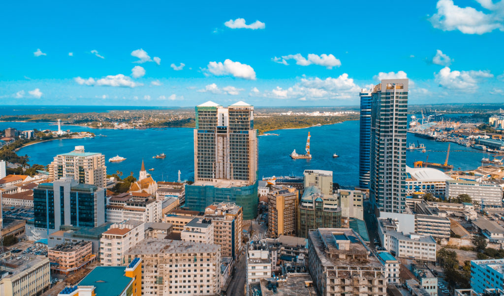
CORVI Risk Assessment: Dar es Salaam, Tanzania

…local levels of government.48Michal Nachmany, Policy Brief: Climate Change Governance in Tanzania—Challenges and Opportunities, Grantham Research Institute on Climate Change and the Environment, October 2018, https://www.lse.ac.uk/granthaminstitute/wp-content/uploads/2018/10/Climate-change-governance-in-Tanzania-challenges-and-opportunities.pdf. Furthermore, the city of…

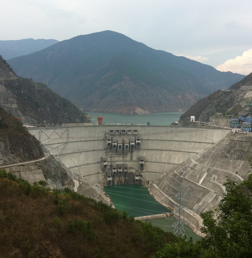
Mekong Dam Monitor Annual Report: 2022-2023

water coming from the Mekong mainstream. This indicates that as the Mekong rises, it acts like a kind of wall of water which prevents Tonle Sap rainfall water from leaving…

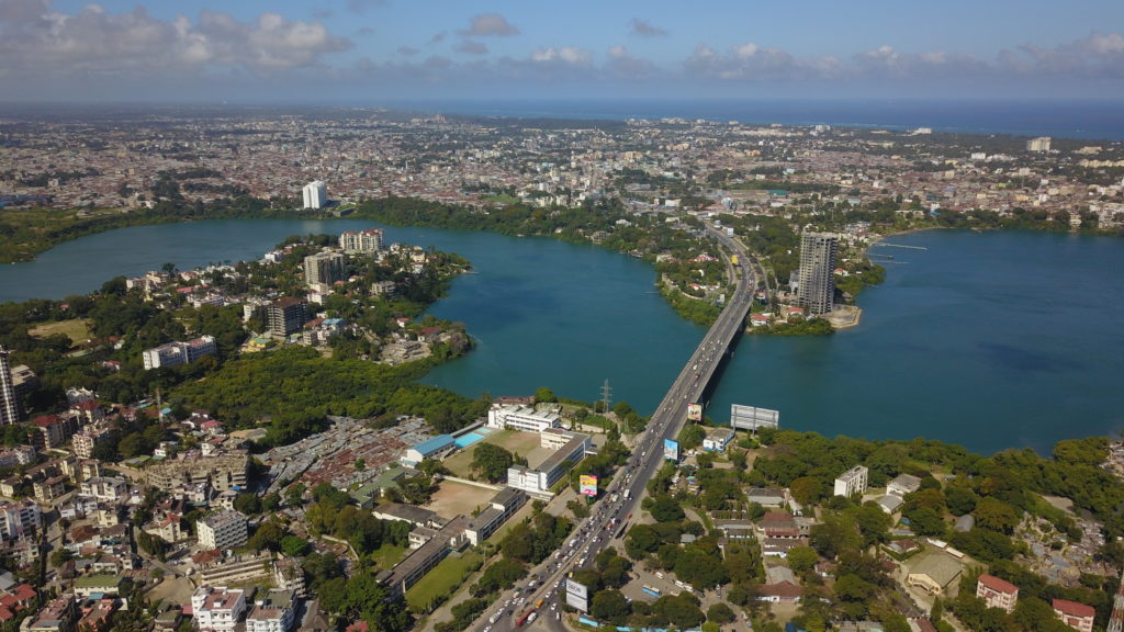
CORVI Risk Assessment: Mombasa, Kenya

Climate Change Adaptation Plan.39Grantham Research Institute on Climate Change and the Environment, “Climate Change Act, 2016,” last modified 2016, accessed July 11, 2021. https://climate-laws.org/geographies/kenya/laws/climate-change-act-2016. Despite these broad efforts, the MENR’s…

CORVI Risk Assessment: Basseterre, St. Kitts and Nevis

…natural environment that are being exacerbated by the impacts of climate change. Climate change continue increase threats to coastal cities. In this study, a climate and ocean risk vulnerability assessment was…

Climate Stress and Civilian Targeting in the Sahel: Between Violence and Opportunity

…2 (2008): 294–308. 8 Neela Banerjee, “Climate Change Will Increase Risk of Violent Conflict, Researchers Warn,” Inside Climate News, June 13, 2019, https://insideclimatenews.org/news/13062019/climate-change-global-security-violent-conflict-risk-study-military-threat-multiplier/; A. Evans, Resource Scarcity, Climate Change and the Risk of Violent Conflict 2010, Washington,…

Houay Lamphan Gnai

Owner/OperatorEDL-Gen
LocationChampasak, Laos
BasinSekong
Sub-basinBolaven
Dam head lat/long15.35615, 106.5011
Year of Operation2015
Dam Wall Height (m)79
Power Generation Capacity (MW)88
Operations CategorySeasonal Storage
Minimum observed level (masl)794.08
Normal service level (masl)820
Maximum observed level (masl)820.46
Active storage estimate (km3)0.108
Sekong Basin Active Storage %3.92%
3S Basin Active Storage %1.96%

The Houay Lampan Gnai Dam, located in the foothills of the northern edge of the Bolaven Plateau in Laos, began operations in 2015. The dam has a relatively small reservoir with an estimated active storage of 0.108 km3. The reservoir is operated as a seasonal storage dam, filling at the start of the wet season and releasing water for hydropower production during the dry season. Its operations did not appear to be affected by the wet season droughts of 2019-2022 and the reservoir likely gradually achieved higher and higher levels from its initial filling through the end of wet season 2021 to achieve its current normal service level of around 820 masl. Daily reservoir level and storage volumes are reported on the EDL-Gen Water Availability website.

A Luoi Dam

Owner/OperatorCentral Region Hydropower JSC
LocationThừa Thiên Huế, Vietnam
BasinSekong
Sub-basinSekong
Dam head lat/long16.19762, 107.1619
Year of Operation2012
Dam Wall Height (m)50.5
Power Generation Capacity (MW)170
Operations CategorySeasonal Storage
Minimum observed level (masl)547.29
Normal service level (masl)553.4
Maximum observed level (masl)555.39
Active storage estimate (km3)0.028
Sekong Basin Active Storage %0.85%
3S Basin Active Storage %0.42%

The A Luoi Dam (2012) is located at the headwaters of the Sekong mainstream in Thua Thien Hue, Vietnam.

It is the only large Sekong Basin Dam in Vietnam. Its active storage is estimated at 0.028 km3, making it the smallest reservoir of dams monitored in the Sekong Basin. At times, the operations curve appears as a storage dam which draws down its reservoir in the dry season and fills during the late months of the wet season. Its operations curve tends to be erratic during the wet season, suggesting the dam operator is responding to local electricity demand needs.

There are instances, typically during the dry season when the operator draws the reservoir down five meters or more over a one-week period. This could be related to storm risks as part of emergency management procedures. A Luoi Dam operators issued an early warning for sudden drawdowns in April 2022 due to an easterly storm.

Xenamnoy Reservoir

Owner/OperatorXe-Pian Xe-Namnoy Power Co. Ltd.
LocationAttapeu, Lao PDR
BasinSekong
Sub-basinBolaven
Dam head lat/long14.94638, 106.6274
Year of Operation2019
Dam Wall Height (m)73.7
Power Generation Capacity (MW)410
Operations CategorySeasonal Storage
Minimum observed level (masl)756.6
Normal service level (masl)786
Maximum observed level (masl)786
Active storage estimate (km3)0.662
Sekong Basin Active Storage %21.69%
3S Basin Active Storage %10.82%


The Xenamnoy Reservoir is the major reservoir at the Xepian-Xenamnoy Hydropower Project on the Bolaven Plateau in Laos. It was originally slated to begin operations in 2018 year, but this was delayed by a saddle dam failure in July 2018 which caused the temporary  displacement of more than 7000 people downstream of the dam in Laos and the death or disappearance of 72.1Ian G. Baird (2021) Catastrophic and slow violence: thinking about the impacts of the Xe Pian Xe Namnoy dam in southern Laos, The Journal of Peasant Studies, 48:6, 1167-1186, DOI: 10.1080/03066150.2020.1824181

The dam began producing electricity in late 2019, and its seasonal storage reservoir has filled gradually over the last four years to reach its estimated normal service level of 786 masl. This is the 2nd largest reservoir in the Sekong basin and the 4th largest in the 3S Basin with an estimated active storage of 0.662 km3. This storage reservoir fills during the wet season and releases most of its active storage over the course of the dry season. In March 2022, an accident at a spill gate on the replaced saddle dam caused the reservoir to gradually lose 30% of its active storage over the course of three weeks until the situation was resolved.

Houay Ho Dam

Owner/OperatorGlow Co. Ltd.
LocationChampasak, Laos
BasinSekong
Sub-basinBolaven
Dam head lat/long15.05946, 106.7644
Year of Operation1999
Dam Wall Height (m)79
Power Generation Capacity (MW)152
Operations CategorySeasonal Storage
Minimum observed level (masl)867.86
Normal service level (masl)876
Maximum observed level (masl)879.49
Active storage estimate (km3)0.225
Sekong Basin Active Storage %6.83%
3S Basin Active Storage %3.41%


The Houay Ho Dam (1999) was the first dam built in the Sekong Basin and was the only major hydropower project in the Sekong until 2014. It is located north of the Xepian-Xenamnoy HPP on the Bolaven Plateau and, like that dam, has its intake at the back of the reservoir and a powerhouse located at the bottom of the Bolaven escarpment several hundred meters below.

It is the 5th largest reservoir in the basin, holding an estimated .225 km3 of water or approximately 7.08% of total active storage in the Sekong Basin. The dam operates as a seasonal storage dam, filling in the wet season and releasing water during the dry season for hydropower production. A large spike in wet season storage volume level is visible after a particularly rainy wet season in 2018. The reservoir’s level was lower than normal during the drought years of 2020-2021.

Xekaman 1

Owner/OperatorViet-Lao Power JSC
LocationAttapeu, Lao PDR
BasinSekong
Sub-basinXe Kaman
Dam head lat/long14.96072, 107.1563
Year of Operation2015
Dam Wall Height (m)120
Power Generation Capacity (MW)290
Operations CategorySeasonal Storage
Minimum observed level (masl)222.97
Normal service level (masl)238
Maximum observed level (masl)239.229
Active storage estimate (km3)1.538
Sekong Basin Active Storage %46.73%
3S Basin Active Storage %23.31%


The Xekaman 1 reservoir is the largest reservoir in (1.538 km3) in the entire 3S Basin, accounting for almost half of the Sekong’s current active storage and 23.92% of the active storage in the 3S Basin. Its active storage is 48% larger than the next largest reservoir in the 3S Basin, the Lower Sesan 2. It ranks within the top 10 largest reservoirs in the Mekong system. The Xekaman 1 is the most downstream of a planned four-dam cascade on the Xe Kaman River. Currently, only the smaller Xekaman 3 upstream has been completed. The reservoir is operated as a seasonal storage reservoir, typically filling in the early wet season and releasing water for hydropower production in the early dry season. Its operations do not appear to be significantly affected by the wet season droughts of 2019-2021, although it did reach lower levels than previously observed during this three-year period. During the wet season of 2022, which was slightly wetter than normal, its reservoir appears not to have filled to its normal service level. The Xekaman-Sanxay Dam downstream of the Xekaman 1 is a small dam which is designed to re-regulate flows from the upstream cascade.

Xekaman 3

Owner/OperatorViet-Lao Power JSC
LocationXekong, Lao PDR
BasinSekong
Sub-basinXe Kaman
Dam head lat/long15.42519, 107.3626
Year of Operation2014
Dam Wall Height (m)101.5
Power Generation Capacity (MW)250
Operations CategorySeasonal Storage
Minimum observed level (masl)947.59
Normal service level (masl)955
Maximum observed level (masl)957.257
Active storage estimate (km3)0.034
Sekong Basin Active Storage %1.0%
3S Basin Active Storage %0.50%

The Xekaman 3 Reservoir (2014) is the most upstream reservoir planned in the four dam Xekaman cascade. Currently, the large Xekaman 1 Dam is the only other dam completed in this cascade. The dam is operated as a seasonal storage dam, releasing water through the dry season and filling during the wet season. However, due to its relatively small reservoir (.034 km3) and erratic storms in its upstream watershed, the reservoir volume can fluctuate significantly in both the wet and dry seasons. This fluctuation could also be related to demand for water in the Xekaman 1 Reservoir below. The dam began operations in 2014, however it appears to not have reached its full operational potential until 2019. Of nine reservoirs monitored, it has the second smallest reservoir in the Sekong basin.

Nam Kong 1

Owner/OperatorElectricite du Laos, China International Water & Electric Corp.
LocationAttapeu, Lao PDR
BasinSekong
Sub-basinNam Kong
Dam head lat/long14.5438, 106.7443
Year of Operation2021
Dam Wall Height (m)80
Power Generation Capacity (MW)150
Operations CategoryUnknown
Minimum observed level (masl)306.84
Normal service level (masl)Unknown
Maximum observed level (masl)315
Active storage estimate (km3)0.109
Sekong Basin Active Storage %3.31%
3S Basin Active Storage %1.65%


Nam Kong 1 is the most downstream dam of the three dam Nam Kong Cascade operated by Chaleun Sekong Energy, Ltd. It has only recently gone into operation with two wet season fill levels estimated in 2021 and 2022. This reservoir is likely still filling, so its category of operation and normal service level cannot be defined. So far, the reservoir has an estimated active storage of 0.109 km3 and comprises 3.43% of the Sekong Basin’s total active storage. A spike in reservoir level was observed in December, likely due to unexpected rainfall in December in southern Laos.

Nam Kong 2

Owner/OperatorChaleun Sekong Energy Co.
LocationAttapeu, Lao PDR
BasinSekong
Sub-basinNam Kong
Dam head lat/long14.4946, 106.8567
Year of Operation2018
Dam Wall Height (m)65
Power Generation Capacity (MW)66
Operations Category 
Minimum observed level (masl)421.73
Normal service level (masl)436
Maximum observed level (masl)437.56
Active storage estimate (km3)0.047
Sekong Basin Active Storage %1.43%
3S Basin Active Storage %0.71%


The Nam Kong 2 reservoir is the smallest of the three reservoirs in the three dam Nam Kong cascade operated by Chaleun Sekong Energy, Ltd. With an estimated active storage of 0.047 km3, it ranks second smallest among the nine Sekong Basin reservoirs monitored. It began operations in 2018 and appears to operate as a quasi-seasonal storage dam, yet its reservoir is subject to significant fluctuations likely related to its position between two other dams in the cascade. In late January 2023, its reservoir dropped 10 meters to shed most of its active storage and similar sudden drawdowns are observed across the dataset. It is not known how this sudden drawdown impacted communities downstream of this dam.

Nam Kong 3

Owner/OperatorChaleun Sekong Energy Co.
LocationAttapeu, Lao PDR
BasinSekong
Sub-basinNam Kong
Dam head lat/long14.5722, 106.9198
Year of Operation2021
Dam Wall Height (m)80
Power Generation Capacity (MW)150
Operations CategoryUnclear
Minimum observed level (masl)528.83
Normal service level (masl)Unknown
Maximum observed level (masl)550.84
Active storage estimate (km3)0.469
Sekong Basin Active Storage %14.25%
3S Basin Active Storage %7.11%


The reservoir at the Nam Kong 3 dam appears to still be filling. Currently, its maximum observed level translates to an active storage of .469 km3, which already registers this reservoir as the 4th largest of nine monitored reservoirs in the Sekong Basin. However, this reservoir could fill to higher levels in subsequent wet seasons, so its estimated active storage could increase. The Nam Kong 3 is the most upstream dam in the three dam Nam Kong cascade operated by Chaleun Sekong Energy, Ltd. The two downstream reservoirs are multiple times smaller than the Nam Kong 3. After two years of observations, the dam appears to be operated as a seasonal storage dam, common for the most upstream dams in a small cascade.

Lower Sesan 2

Owner/OperatorHydrolancang International Energy Co.
LocationStung Treng, Cambodia
BasinLower Sesan
Sub-basinSesan
Dam head lat/long13.5554, 106.254
Year of Operation2018
Dam Wall Height (m)75
Power Generation Capacity (MW)400
Operations CategoryModified Run-of-River
Minimum observed level (masl)147.86
Normal service level (masl)88
Maximum observed level (masl)154.97
Active storage estimate (km3)1.037
Sekong Basin Active Storage %38.48%
3S Basin Active Storage %15.72%
 

The Lower Sesan 2 Reservoir (1.037 km3) is the 10th largest in the Mekong Basin, 2nd largest in the 3S Basin, and the largest reservoir in the Sesan Basin. The reservoir sits just below the confluence of the Sesan and the Srepok Rivers and as such receives discharge from a total of 10 large reservoirs on the Upper Sesan and Upper Srepok cascades in Vietnam. The dam is designed as a run-of-river scheme, and river level observations suggest it fluctuates largely within a band of about two meters in elevation change. However, within that core 2 meters of fluctuation sits around 0.500 km3 of water which can introduce significant change to the river. The data suggest that at times, the dam is not operated as a run-of-river scheme. In both April 2020 and April 2022, the data suggest the reservoir shed most of its active storage over periods of only one-week each. The sudden release resulted in a remarkable rise in Mekong mainstream level downstream, causing the Kratie gauge to spike by more than 1 meter for an extended period in 2022. Sudden releases from the Lower Sesan 2 Dam in the dry season, when coinciding with sudden releases from upstream dams, could cause even more significant dry season spikes in flow.

Sesan 4A

Owner/OperatorVietnam Electricity
LocationKon Tum, Vietnam
BasinSesan
Sub-basinUpper Sesan
Dam head lat/long13.9333, 107.4668
Year of Operation2008
Dam Wall Height (m)NA
Power Generation Capacity (MW)360
Operations CategoryHydropeak/Regulation
Minimum observed level (masl)147.86
Normal service level (masl)NA
Maximum observed level (masl)154.97
Active storage estimate (km3)0.005
Sekong Basin Active Storage %0.22%
3S Basin Active Storage %0.09%
 

The Sesan 4a Dam is the smallest dam in the entire 3S system in terms of active storage (0.005 cubic kilometers). It is the most downstream of the six-dam cascade on the Upper Sesan. The time series above suggests the dam is operated as a re-regulation dam to smooth out sudden releases and restrictions from dams upstream. However, downstream data still suggests not all sudden releases or restrictions are smoothed out. Some reservoir indicators including reservoir level are reported on the EVN website on an hourly basis. Storage volumes are not reported.

Sesan 4

Owner/OperatorVietnam Electricity
LocationKon Tum, Vietnam
BasinSesan
Sub-basinUpper Sesan
Dam head lat/long13.9682, 107.4952
Year of Operation2009
Dam Wall Height (m)74
Power Generation Capacity (MW)360
Operations CategorySeasonal Storage
Minimum observed level (masl)210.45
Normal service level (masl)214.7
Maximum observed level (masl)215.045
Active storage estimate (km3)0.167
Sekong Basin Active Storage %6.23%
3S Basin Active Storage %2.55%
 

The Sesan 4 dam (2009) is the 5th in position from upstream to downstream of the six-dam Upper Sesan cascade. Data suggests that the dam is operated as a quasi-seasonal storage dam, releasing water for hydropower production during the dry season and filling during the wet season. At times, the reservoir is drawn down during the wet season, likely either to respond to hydropower needs or to accommodate for upstream dam releases from the larger Yali Falls and Plei Krong Dam. Among the remaining four dams in the cascade, the Sesan 4 is the only one which operates as a seasonal storage dam, as the others (Sesan 3, Sesan 3a, and Sesan 4a) have historically operated as hydropeaking or re-regulating dams. Its reservoir is significantly larger than the other three dams listed in the previous sentence at 0.167 km3. Some reservoir indicators including reservoir level are reported on the EVN website on an hourly basis. Storage volumes are not reported.

Sesan 3A

Owner/OperatorVietnam Electricity (EVN)
LocationKon Tum, Vietnam
BasinSesan
Sub-basinUpper Sesan
Dam head lat/long14.1064, 107.6578
Year of Operation2007
Dam Wall Height (m)NA
Power Generation Capacity (MW)108
Operations CategoryRe-regulation
Minimum observed level (masl)233.26
Normal service level (masl)NA
Maximum observed level (masl)243.89
Active storage estimate (km3)0.088
Sekong Basin Active Storage %3.27%
3S Basin Active Storage %1.33%
 

The Sesan 3a has a relatively small reservoir (0.088 km3) and is operated in coordination with the Sesan 3 dam above it and likely other dams in the six-dam Upper Sesan cascade in Vietnam. It is 4th in position from upstream to downstream of the Upper Sesan cascade of dams. The reservoir appears to operate as a hydropeaking dam and at times experiences significant drawdowns or filling actions. The data suggests it can introduce or remove around 40 million cubic meters of water to/from the downstream on a weekly basis. Daily or sub-daily observations would likely reveal a more accurate hydropeaking pattern of releases and restrictions responding to diurnal patterns of electricity demand. Some reservoir indicators including reservoir level are reported on the EVN website on an hourly basis. Storage volumes are not reported.

Sesan 3

Owner/OperatorVietnam Electricity
LocationKon Tum, Vietnam
BasinSesan
Sub-basinUpper Sesan
Dam head lat/long14.2158, 107.7221
Year of Operation2006
Dam Wall Height (m)79
Power Generation Capacity (MW)260
Operations CategoryHydropeaking
Minimum observed level (masl)302.5
Normal service level (masl)305
Maximum observed level (masl)306.98
Active storage estimate (km3)0.014
Sekong Basin Active Storage %0.52%
3S Basin Active Storage %0.21%


The Sesan 3 dam (.014 km3) has a small reservoir and is operated in coordination with the slightly larger Sesan 3a reservoir downstream and likely the entire upper Sesan cascade of dams. Its reservoir is the second smallest in the Sesan Basin, and the data suggests it operates as a hydropeaking dam, likely in coordination with the two larger storage dams (Yali Falls and Plei Krong) upstream of it. The data suggest it has the ability to introduce or remove around 10 million cubic meters of water to/from the downstream on a weekly basis. Daily/sub-daily observations would likely reveal a hydropeaking pattern of releases and restrictions responding to diurnal patterns of electricity demand. The Sesan 3 dam began operations in 2006. Some reservoir indicators (including reservoir level) are reported on the EVN website on an hourly basis. Storage volumes are not reported. It is 3rd in position from upstream to downstream on the six-dam Upper Sesan cascade.

Yalli Falls

Owner/OperatorVietnam Electricity (EVN)
LocationGia Lai, Vietnam
BasinSesan
Sub-basinUpper Sesan
Dam head lat/long14.2274, 107.8294
Year of Operation2001
Dam Wall Height (m)65
Power Generation Capacity (MW)720
Operations CategorySeasonal Storage
Minimum observed level (masl)498.31
Normal service level (masl)512
Maximum observed level (masl)514.2
Active storage estimate (km3)0.0358
Sekong Basin Active Storage %15.03%
3S Basin Active Storage %6.14%


The Yali Falls reservoir (0.358 km3) is the second largest in the Upper Sesan cascade and the third largest in the Sesan Basin. It was the first large hydropower project built on the upper Sesan and Cambodian communities downstream voiced concern about transboundary impacts to fisheries and water availability downstream when it was being constructed. After construction, communities have consistently pointed to flash floods from what they assume were sudden releases of water from the reservoir. The reservoir is operated as a seasonal storage reservoir, filling during the wet season and releasing during the dry season. Its releases begin a few months earlier in the dry season than the operations of the nearly three-times larger Plei Krong Dam upstream of Yali Falls. The operations of the Plei Krong and Yali Falls dams follow similar patterns, suggesting cascade operations coordination, which is expected of EVN. Some reservoir indicators, including reservoir level, are reported on the EVN website on an hourly basis. Storage volumes are not reported.

Plei Krong

Owner/OperatorVietnam Electricity (EVN)
LocationKon Tum, Vietnam
BasinSesan
Sub-basinUpper Sesan
Dam head lat/long 
Year of Operation2009
Dam Wall Height (m)NA
Power Generation Capacity (MW)100
Operations CategorySeasonal Storage
Minimum observed level (masl)536.14
Normal service level (masl)570
Maximum observed level (masl)574.04
Active storage estimate (km3)0.977
Sekong Basin Active Storage %36.25%
3S Basin Active Storage %14.81%
 

The Plei Krong Dam (2009) located in Kon Tum, Vietnam is the most upstream in the cascade of upper Sesan mainstream dams. With an estimated active storage of .977 cubic kilometers, it has the largest reservoir on the upper cascade. It is slightly smaller than the Lower Sesan 2 reservoir far downstream, making it the second largest in the Sesan Basin and the third largest in the 3S Basin. It is the 11th largest of 55 reservoirs monitored in the Mekong Basin. The Plei Krong is operated as a seasonal storage dam, releasing its active storage in the dry season and recharging to a normal service level in the wet season. Its operations do not appear to have been affected by the string of 2019-2021 wet season droughts, but its reservoir levels did fall to lower than normal levels during that time. Current reservoir levels, inflow, and outflow indicators are reported on the EVN website on an hourly basis. Storage volumes are not reported.

Srepok 4

Owner/OperatorVietnam Electricity
LocationDak Lak, Vietnam
BasinSrepok
Sub-basinSrepok
Dam head lat/long12.80733, 107.8553
Year of Operation2010
Dam Wall Height (m)NA
Power Generation Capacity (MW)80
Operations CategoryHydropeaking
Minimum observed level (masl)198.47
Normal service level (masl)NA
Maximum observed level (masl)204.42
Active storage estimate (km3)0.008
Sekong Basin Active Storage %1.31%
3S Basin Active Storage %0.12%
 

The Srepok 4 Dam has the smallest reservoir in the Srepok Basin and the 2nd smallest in the 3S system in terms of active storage (0.008 km3). It is the most downstream of the four-dam cascade on the Upper Srepok. The time series above suggests the dam is either operated as a hydropeaking dam or a regulation dam to regulate fluctuation coming out of the four dams above it. Given the erratic changes from week to week, the dam is most likely operated as a hydropeaking dam—although daily or sub-daily estimates could paint a clearer picture. Some reservoir indicators including reservoir level are reported on the EVN website on an hourly basis. Storage volumes are not reported.

Srepok 3

Owner/OperatorVietnam Electricity
LocationDak Lak, Vietnam
BasinSrepok
Sub-basinSrepok
Dam head lat/long12.7523, 107.8768
Year of Operation1990
Dam Wall Height (m)52.2
Power Generation Capacity (MW)220
Operations CategoryHydropeaking
Minimum observed level (masl)268
Normal service level (masl)NA
Maximum observed level (masl)271.82
Active storage estimate (km3)0.058
Sekong Basin Active Storage %9.51%
3S Basin Active Storage %0.88%
 

The Srepok 3 dam (1990) is the 3rd in position from upstream to downstream of the four-dam Upper Srepok cascade. Data suggests that the dam is operated as a hydropeaking dam, but a seasonal release trend is observable among the weekly fluctuations in the time series above. At times, the reservoir is drawn down during the wet season, likely either to respond to hydropower needs or to accommodate dam releases from the larger Buon Tarah Dam upstream. Its reservoir is relatively small (0.058 km3). Some reservoir indicators including reservoir level are reported on the EVN website on an hourly basis. Storage volumes are not reported.

Buon Kuop

Owner/OperatorVietnam Electricity
LocationDak Nong, Vietnam
BasinSrepok
Sub-basinSrepok
Dam head lat/long12.5250, 107.9258
Year of Operation2009
Dam Wall Height (m)NA
Power Generation Capacity (MW)280
Operations CategoryHydropeaking
Minimum observed level (masl)408.79
Normal service level (masl)NA
Maximum observed level (masl)411.84
Active storage estimate (km3)0.009
Sekong Basin Active Storage %2.30%
3S Basin Active Storage %0.21%
 

The Buon Kuop Dam (2009) has a very small reservoir (0.009 km3) and is likely operated in coordination with both the larger Buon Tarah above it and other dams in the four-dam Upper Srepok cascade in Vietnam. It is 2nd in position from upstream to downstream of the Upper Srepok cascade of dams. The reservoir is likely a hydropeaking dam and at times experiences significant drawdowns or filling actions, although its sudden releases and restrictions are minimal due to its small reservoir. Daily or sub-daily observations would reveal a more accurate hydropeaking pattern of releases and restrictions responding to diurnal patterns of electricity demand. Some reservoir indicators including reservoir level are reported on the EVN website on an hourly basis. Storage volumes are not reported.

Buon Tarah

Owner/OperatorVietnam Electricity (EVN)
LocationDak Nong, Vietnam
BasinSrepok
Sub-basinSrepok
Dam head lat/long12.2821, 108.0413
Year of Operation2009
Dam Wall Height (m)NA
Power Generation Capacity (MW)86
Operations CategorySeasonal Storage
Minimum observed level (masl)462.28
Normal service level (masl)486
Maximum observed level (masl)489.36
Active storage estimate (km3)0.530
Sekong Basin Active Storage %86.89%
3S Basin Active Storage %8.03%


The Buon Tarah Dam located in Dak Nong, Vietnam is the most upstream of the four-dam cascade on the Upper Srepok in Vietnam. Its reservoir (0.530 km3) is multiple times larger than the other three and is the 5th largest in the 3S Basin. Its reservoir holds an estimated 87.6% of the total active storage of the Srepok Basin and about 8.24% of the total active storage in the 3S Basin. The reservoir is operated as a seasonal storage reservoir, releasing most of its active storage during the dry season for hydropower production and filling during the wet season. Wet season filling patterns do not appear to be affected by the wet season droughts of 2019-2021. In 2018, a peculiar release and re-fill pattern is observed in the active storage estimate timetable above for unknown reasons. Releases began earlier than normal that year compared to other years in the time series.