Executive Summary
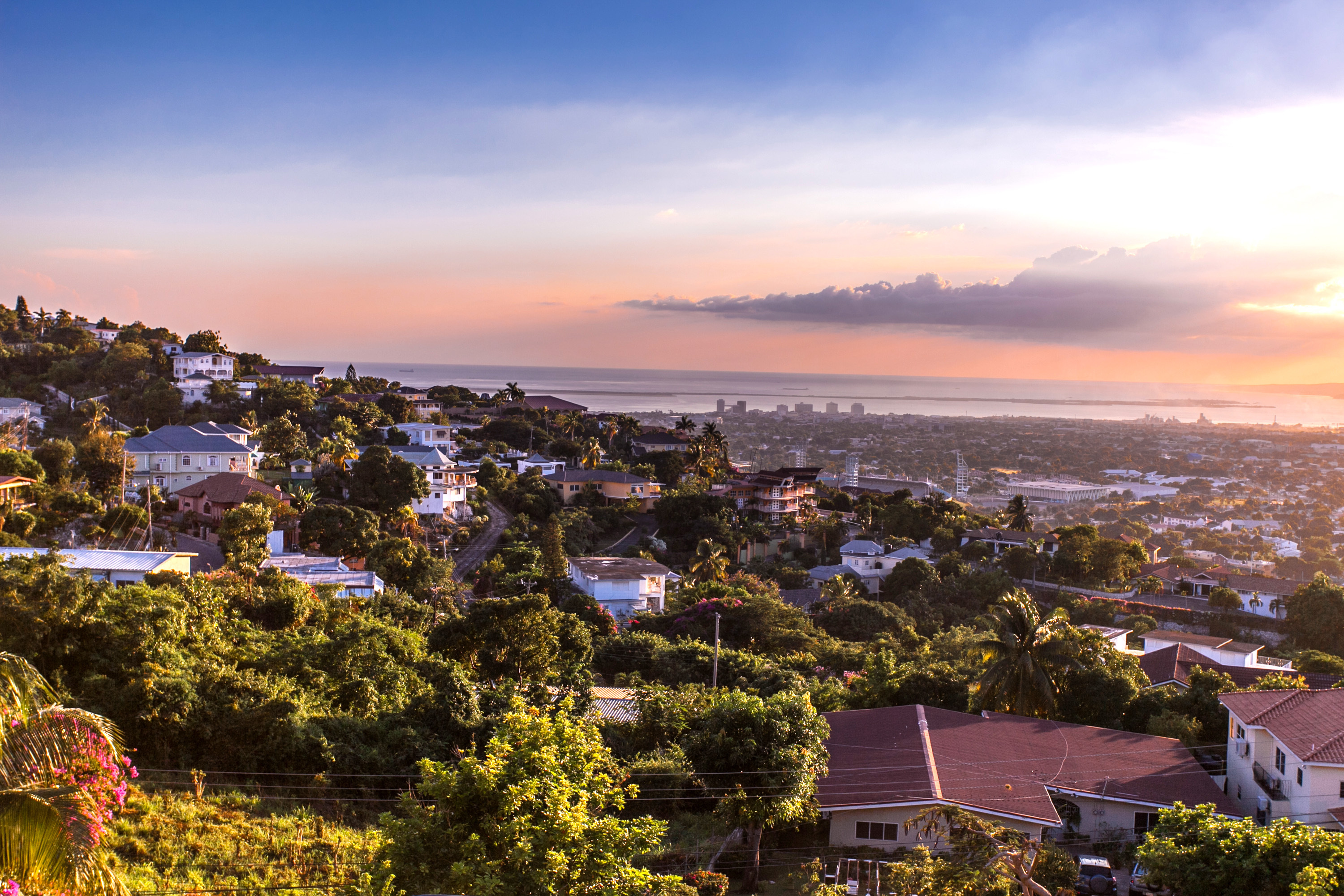
Located in a one of the world’s deepest natural harbors and backed by the Blue Mountains, Kingston is the focal point for Jamaica’s commercial, industrial, and service sectors. Similar to other coastal cities the Caribbean, Kingston has experienced urbanization over the last few decades. 1Doneika Simms, “The Effects of Urbanization on Natural Resources in Jamaica,” 44th ISOCARP Congress, 2008.To fully capture climate and ocean risks in Kingston, the study area was expanded to include the neighboring city of Portmore, as the majority of its residents work in Kingston. The population of this study area is 765,000, or 26 percent of the population of Jamaica.
The CORVI risk profile shows that climate and ocean risks to Kingston are spread across multiple categories. Ecosystems services such as coral reefs, sea grass beds, and mangrove forests scored highest for risk, which impacts Kingston’s ability to combat climate risks. In addition, flooding after rainfall is made worse by degraded watersheds surrounding the city and by poor waste management practices within the city. These risks are further compounded by increasing extreme weather events such as hurricanes.
CORVI findings show that Kingston’s diverse economy lowers its vulnerability to extreme weather events, as it is not as dependent on one industry for its economic security. However, risks including relatively high levels of unplanned settlements and squatter communities, as well as poor construction practices, lessen Kingston’s ability to recover from extreme weather events. Relatively high levels of crime in certain neighborhoods of Kingston are reflected in indicators which measure social cohesion. In response, the Government of Jamaica declared a state of emergency in parts of Kingston and continues to work to tackle these social issues. However, in the event of an extreme storm, these resources could be diverted, potentially increasing the risk of social instability. Finally, climate change is negatively impacting certain agricultural sectors, such as coffee growing in the Blue Mountains on the outskirts of Kingston.
The Government of Jamaica has been recognized globally for its leadership in building resilience to climate change. Its national development plan, encompassed in the Vision 2030 Report, identifies hazard risk reduction and adaptation to climate change as critical areas for development. 2PIOJ, “Vision 2030 Jamaica: National Development Plan,” Planning Institute of Jamaica, 2009. While overall CORVI results show Kingston is well placed to combat the effects of climate change, the CORVI risk profile identifies three priority areas for action:
- Build resilience in marine ecosystems and city watersheds
- Improve urban city planning
- Continue to address social issues related to vulnerability and integrate them into disaster response planning
With these targeted efforts and implementation of its Vision 2030 Plan, Kingston can continue to guard against growing climate risks.
Ecological Risk
In common with many low-lying coastal cities, Kingston’s metro area is at risk from flooding. 3Arpita Nandi, Arpita Mandal, Matthew Wilson, and David Smith, “Flood Hazard Mapping in Jamaica Using Principal Component Analysis and Logistic Regression,” Environmental Earth Sciences 75, no. 6 (2016): 465. The risk is exacerbated by degraded watersheds and lost wetlands, which heightens the impact of hurricanes and other extreme weather in the study area.
- In the Ecosystems category (expert weighted avg 5.78) high risk scores are recorded in sea grass beds (8.13) and mangrove (7.91) coverage, as well as the health of existing coral reefs (7.86).
- The Climate category (expert weighted avg 5.33) shows that while Kingston is highly vulnerable to hurricanes (7.65) it has been successful at limiting the impact of extreme weather on city residents, as reflected in the medium risk score for people affected by extreme weather (3.21).
- In the Fisheries category (expert weighted avg 5.16), there are medium-high scores in offshore fish stock status (6.95), a lack of fisheries that are certified as sustainable by the marine stewardship council (6.95), and increases in incidences of foreign vessels fishing (6.25), all of which demonstrate growing risks to the fishing sector.
- While there are data gaps in the Geology/Water category (expert weighted avg 4.48), data did show a high percent of metro area at risk from flooding (5.98) which is identified as medium-high risk. 4Five indicators in the Geology/Water category did not pass the data quality threshold. These indicators are GW3 Degree of Soil Salinity in Arable Lands; GW5 Rate of Coastal Erosion; GW6 Degree of Saltwater Intrusion in Coastal Aquifers; GW7 Piped Water Supply; and GW8 Proportion of Bodies of Water with High Water Quality.
Ensuring watersheds drain correctly is crucial for building resilience against flood risk. However, urban development in Kingston, coupled with the removal of ecosystems such as forests and vegetation, has increased flood risk across the study area. This effect is exacerbated by intense storms, as well as poor waste management practices and drainage systems that have not kept pace with the development of the city. Of the seven major gully systems in the study area, only one is designed to accommodate massive flood discharge, making the city more vulnerable to flooding. 5R. Ahmad, “Protecting Built Environment in a Natural Hazard-Prone City,” (Kingston: U.W.I. Press, 2005). The negative impact of degraded watersheds was also highlighted in expert interviews, which noted that urban planning did not adequately consider its impact on watershed management.
Marine ecosystems that provide vital services to the study area, have experienced significant degradation over the past decades, as captured in high CORVI risk scores across ecosystem services. Coral reefs, mangrove forests, and seagrass beds offer two primary benefits to Kingston. By acting as a natural barrier between the urban area and ocean risks, nature-based defenses lessen the power of extreme weather events and reduce the risk of storm surge and associated flooding. Ecosystems also play a critical role in supporting fisheries in Jamaica’s exclusive economic zone. They also provide habitats to commercially caught fish in the early stages of their life cycle.
Within the study area, marine ecosystem services are concentrated in two locations: Portmore and the Palisadoes Peninsula. In part due to Kingston’s urbanization, the municipality of Portmore was expanded to ease the burden on Kingston city and reduce urban density. While this was successful, the expansion of the urban area led to the removal of mangrove forests from the Portmore coastline. 6B Wade and D Webber, “Coastal Zone Management,” in Ivan Goodbody and Elizabeth Thomas-Hope (eds.) Natural Resource Management for Sustainable Development in the Caribbean (Kingston: Canoe Press, 2002). The Palisadoes Peninsula, a thin spit of land that protects Kingston Harbour, has also suffered from ecosystem degradation. It was once covered in mangroves, but the development and expansion of critical infrastructure such as Norman Manley International Airport has led to a significant reduction in mangroves coverage. This has increased soil erosion because mangrove roots are critical for stabilizing sandy soil. 7P Williams, “Palisadoes in Peril: U.W.I., N.E.P.A. Replanting Mangroves,” The Jamaican Sunday Gleaner Archive, 2008. Moreover, coastal erosion threatens the road that connects the airport to the city.
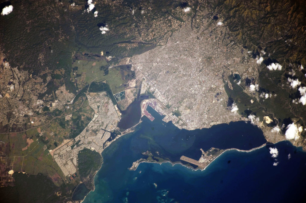
Coral reefs and seagrass beds have also declined nationally across Jamaica. The reduction is driven by a combination of urban pollution, rising sea temperatures, and damage from hurricanes. 8“Coastal Capital: Jamaica The Economic Contribution of Jamaica’s Coral Reefs,” Coastal Capital project in the Caribbean. The World Resources Institute, n.d. Despite declines in national coral cover from a high of 50 percent in 1970 to less than five percent by 19909 “Coral Reefs of Jamaica Status and Trends 2007” Jamaica’s National Report: Ecosystems Management Branch National Environment and Planning Agency, March 2018. , recent assessments by the National Environment and Planning Agency assess the Palisadoes Port Royal Protected Area as “fair” on the Coral Reef Index. 10NEPA, “Coral Reefs of Jamaica, An Evaluation of Ecosystem Health: 2013,” The National Environment and Planning Agency, 2014: 15. However, coral reefs in the study area continue to be at risk, which is reflected in the high risk for health of existing coral reefs (7.86) indicator.
Recognizing the cost effectiveness of ecosystem-based defenses compared to physical infrastructure such as sea dykes and levees, the Government of Jamaica has invested in a series of restoration projects to protect and restore mangrove forests. Kingston has restored some mangrove ecosystems in the study area, as reflected in the lower CORVI score in current mangrove health (5.16) as compared to mangrove coverage (7.91). One recent example of these efforts is the Palisadoes Mangrove Planting Project. 11NWA “The Palisadoes Mangrove Replanting Project,” National Works Agency, (August 4, 2015), accessed August 20, 2019, https://www.nwa.gov.jm/news/ palisadoes-mangrove-replanting-project. This project, which has the goal of planting 6,000 mangrove saplings, along with measures to improve dune based coastal defenses, are part of larger efforts to better balance environmental and economic considerations in Kingston Harbour.
Overall, seagrass beds, mangrove forests, and coral reefs are important to Kingston as they provide coastal protection, maintain fisheries, and mediate runoff. Improvements to maintain ecosystem health decrease the risk of further loss of coverage in the future and they strengthen the ecosystems’ ability to provide crucial ecosystem services of habitat and storm protection.
While of secondary importance to the economic and food security of Kingston, fisheries remain an important component of resilience. Nearshore fisheries around Jamaica are overfished. 12K Aiken and G.A. Kong, “The Marine Fisheries of Jamaica,” The ICLARM Quarterly 23, no. 1 (January 2000). Jamaica has sought to build resilience in their fisheries sector by strengthening fisheries management capacity through the recently revised 2018 Fisheries Act and expanding fish sanctuaries. This new Act will increase fines for violating fishery management regulations. However, it remains unclear whether monitoring and enforcement capacity will match the law’s intent.13FAO, “Jamaica Passes New Fisheries Act,” United Nations Food and Agricultural Organization, (October 26, 2018), accessed November 1, 2019, https://www.fao.org/jamaica-bahamas-and-belize/ news/detail-events/en/c/1184193/. Furthermore, maintaining accurate data for coral reef fisheries remains a challenge for effective long-term fisheries management.14Daniel Pauly and Dirk Zeller, “Accurate Catches and the Sustainability of Coral Reef Fisheries,” Current Opinion in Environmental Sustainability 7 (April 2014): 44–51.
Financial Risk
In comparison to other coastal cities in the region, Kingston’s economic diversity is a strength, as it does not rely on any one sector for its economic security. However, with 90 percent of its national economy produced in coastal zones, Jamaica remains economically vulnerable.
- The Economics category (expert weighted avg 5.85) highlights medium-high scores in national GDP per capita (7.00), urban unemployment (6.80), and public debt (6.50), all of which limit the capacity of Kingston to build resilience against climate change.
- In the Infrastructure category (expert weighted avg 5.14), a high risk score for unplanned settlement construction (8.25), as well as medium-high risk scores in level of commercial damage from extreme weather events (6.00) and level of grid resilience (5.20) represent key risk areas which need to be integrated into city planning. Separately, while insufficient data was collected to produce a CORVI risk score for the airport resilience indicator, multiple experts identified Norman Manley International Airport as at risk from growing climate and ocean risks. 15Seven indicators in the infrastructure category did not pass the data quality threshold. These indicators are I1 Percent of Low-Income Housing in Relation to Flood Zones; I4 Level of Housing Damage from Extreme Weather Events; I5 Level of Shoreline Development; I9 Level of Water Distribution Infrastructure Resilience; I10 Proportion of Wastewater Safely Treated; I13 Level of resilience for Airports; and I14 Level of Resilience for Ports and Shipping.
- Findings from the Major Industries category (expert weighted avg 4.55) show that Jamaica’s economy is diverse, with only one medium-high score for percent of economy based in agriculture (5.57), while other important industries, such as tourism (4.80), offshore fishing (3.80), nearshore fishing (3.20), scored medium risk. 16Two indicators in the Major Industries category. These indicators are MI5 Percent of National Economy Based in Port and Shipping Industries and MI6 Diversity of Lodging Types.
Over the past 25 years, the impact of extreme weather on Jamaica’s GDP has greatly increased. Between 1990 and 2000, damages from disasters in Jamaica cost an estimated 12.6 percent of GDP. 17Jamaica Social Investment Fund, “Jamaica Disaster Vulnerability Reduction Project,” Jamaica Disaster Vulnerability Reduction Project, n.d., accessed December 4, 2019, https://www.jsif.org/content/ jamaica-disaster-vulnerability-reduction-project. Between 2001 and 2010, the loss has tripled compared to the previous decade. During this period, there were ten major events with far-reaching impacts, affecting approximately 80 percent of the national population and causing nearly $1.21 billion in damages. 18Ibid.
The economic diversity of Kingston is a source of resilience, yet specific sectors are more at risk from climate change than others. In Jamaica, the negative impacts of climate change to the tourist sector are concentrated outside the study area, such as in Montego Bay. Nevertheless, with many tourist firms headquartered in Kingston, as well as the importance of tourism for foreign exchange earnings, the threat posed by climate change to tourism still presents a risk to Kingston. The agricultural sector is also threatened by rising temperatures and droughts. This is compounded by the fact that the agricultural sector in Jamaica is heavily reliant on rainfall for irrigation. 19Jeff Popke, Scott Curtis, and Douglas W. Gamble, “A Social Justice Framing of Climate Change Discourse and Policy: Adaptation, Resilience and Vulnerability in a Jamaican Agricultural Landscape,” Geoforum 73 (July 2016): 70–80. Relevant to the study area, coffee growing in the Blue Mountains located on the outskirts of Kingston, is increasingly under threat from climate change. The sector almost entirely relies on rainfall, which has become increasingly erratic, threatening the economic security of farmers. 20Anne-Teresa Birthwright, “Jamaica’s Coffee Farmers Are Resisting Climate Change,” Food Tank, (October 14, 2017), accessed September 3, 2019, https:// foodtank.com/news/2017/10/bcfn-jamaica-climate-resilience/.
The risk of flooding in Kingston due to degraded watersheds is also a concern. While this is indicated in the ecological risk indicators, it also impacts financial risk. Flooding in the metropolitan area represents a risk both to human health and economic activity. 21Chris Burgess, Michael Taylor, Tannecia Stephenson, Arpita Mandal, and Lesiska Powell, “A Macro-Scale Flood Risk Model for Jamaica with Impact of Climate Variability,” Natural Hazards 78, no. 1 (2015): 231-256. Not only is flood damage costly to repair, it can make it more difficult for businesses to recover, leading to suppressed long-term economic growth. 22K.J. Tierney, “Businesses and Disasters: Vulnerability, Impacts, and Recovery,” in Handbook of Disaster Research. Handbooks of Sociology and Social Research (New York: Springer, 2007).
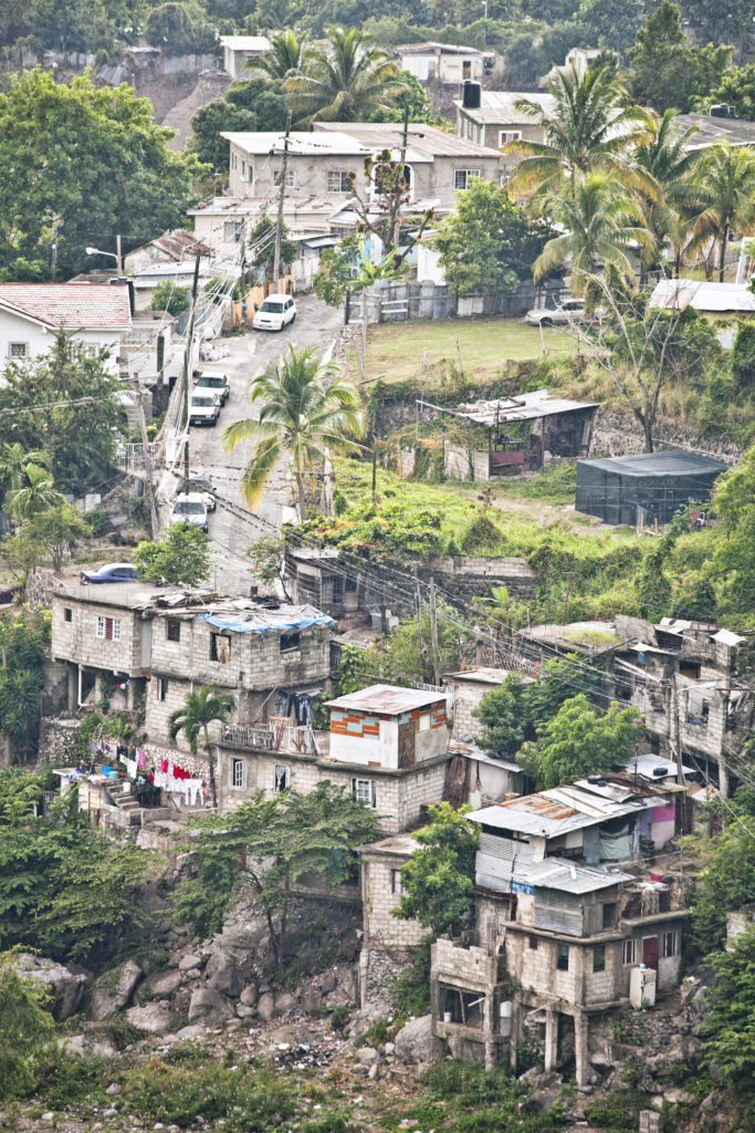
Finally, critical transport infrastructure such as roads, Kingston Port, and Norman Manley International Airport are at risk from extreme weather events. For example, during Hurricane Ivan in 2004, the greatest financial cost from the extreme weather event was borne by infrastructure, accounting for 45 percent of the overall costs, largely due to destruction to roads and bridges. 23Jamaica Social Investment Fund, “Jamaica Disaster Vulnerability Reduction Project,” Jamaica Disaster Vulnerability Reduction Project, n.d., accessed December 4, 2019, https://www.jsif.org/content/ jamaica-disaster-vulnerability-reduction-project. Moreover, in recent decades informal settlement construction has increased across the study area. This has added stress to the delivery of social services and compounded the risk of flooding. 24Interview with Ministry of Industry, Commerce, Agriculture, and Fisheries and the Rural Agricultural Development Authority. Interviews conducted in May 2019. Such development tends to be located around gullies and riverbanks which are often more vulnerable to extreme weather events as flood waters are funneled to these areas.
Infrastructure risks also intersect with high risk economic indicators including relatively high levels of urban unemployment, informal economic activity, and low-income levels. Informal housing settlements are expanding, which is the result of unemployment, poverty, and a lack of alternative housing. This is further exacerbated by residents needing to be closer to urban work opportunities. 25David Williams, María Máñez Costa, Catherine Sutherland, Louis Celliers, and Jürgen Scheffran, “Vulnerability of Informal Settlements in the Context of Rapid Urbanization and Climate Change,” Environment and Urbanization 31, no. 1 (January 28, 2019): 157–76. In response, the Jamaican Government has sought to invest in low-income housing developments in Kingston. 26Alecia Smith, “Informal Settlements to Be Regularised,” Jamaica Information Service, (February 24, 2017), accessed October 2, 2019, https://jis.gov.jm/informal-settlements-regularised/. However, syncing these development measures with ecological considerations such as watershed management, identified in the ecological risk section, remains a challenge.
Due to data gaps, the research team was unable to quantify the resilience of freshwater infrastructure, seaports, and the airport. However, expert interviews were used to provide a broad assessment of risks in these areas. Norman Manley International Airport, located on Palisadoes, and the Kingston Container Terminal are both critical to the economic success of Kingston. The container terminal is the largest in the Caribbean and contributes significantly to the city’s economy. However, they are both at risk from flooding, a phenomenon made worse by climate change and ecosystem degradation. The Norman Manley International Airport sits on average, three meters above sea level, making it vulnerable to flooding. This risk has increased with the degradation of coastal ecosystems including coral reefs and mangroves, which can mitigate the impact of storms. 27Maria Fernanda Zermoglio and Owen Scott, “Vulnerability Assessment of Jamaica’s Transportation Sector,” ATLAS Task Order: Chemonics International, March 2018. Similarly, while access to the Kingston Container Terminal is less at risk of flooding, the terminal itself, particularly the storage area in the south terminal, sits less than one meter above sea level and is susceptible to storm surge. 28Ibid.
Political Risk
Like many small island developing states in the Caribbean, Jamaica has a democratically elected government. Jamaica has also been recognized as a leader in climate change adaptation in the Caribbean. Since the establishment of a Climate Change Unit in 2012, Jamaica has viewed climate change as an integral component of its development strategy, which was outlined in its national development plan and Vision 2030 development goals. 29USAID, “Progress Toward Climate Resilience in Jamaica,” ATLAS Task Order: USAID, June 2018. Jamaica’s National Development Plan and National Climate Change Policy Framework created coordination mechanisms through the establishment of Climate Change Focal Points in key national government ministries, departments, and agencies. 30Government of Jamaica, “Intended Nationally Determined Contribution of Jamaica Communicated to the UNFCCC, (November 25, 2015), accessed October 20, 2019: 7. However, there is still a need for greater mainstreaming of climate change considerations in national policy, planning, and implementation, particularly as it relates to land and natural resource use. 31Government of Jamaica, Climate Change Policy Framework for Jamaica, 2015.
- In the Social/Demographics category (expert weighted avg 5.46) a large (8.20) and young (7.60) urban population were highlighted as high-risk areas.
- The Governance category (expert weighted avg 5.38) highlighted concerns related to access to healthcare (6.73), and a lack of perceived transparency (5.64) as key issues which could undermine trust in government institutions.
- The Stability category (expert weighted avg 4.43) was the lowest scoring category, reflecting Jamaica’s diverse employment across multiple industries. The only one medium-high score was incidences of instability (6.00) which reflects higher levels of crime in certain city neighborhoods. 32One indicator in the stability category did not pass the quality threshold. This indicator is S3 Percent of People Employed in Port and Shipping Industries.
Jamaica’s vulnerability to multiple natural and human-induced hazards, such as hurricanes and floods, and the negative impact of these hazards to social and economic systems, has posed a significant impediment to sustainable development. 33PAHO, “Jamaica: Health in the Americas 2017,” Pan American Health Organization, (2017), accessed December 4, 2019, https://www.paho.org/salud-en-las-americas-2017/?p=2457.
Demographic shifts in Kingston have impacted its ability to build capacity against climate and ocean risks. Coastal migration continues to compound ecological and financial risks, such as informal building construction and flood risk, which reduces the capacity of individuals to adequately respond to extreme weather events. This is reflected in high CORVI risk scores for urban population (8.20) and a medium-high urbanization score (6.60). Moreover, a high dependency ratio (7.00) increases social vulnerability to extreme weather events. 34Dependency ratio is defined as the ratio of dependents (people younger than 15 or older than 64) to the working-age population (those ages 15-64). World Bank. https://datacatalog.worldbank.org/age-dependency-ratio-working-age-population The population over the age of 65 is the fastest growing age group in the country. This raises concerns about access to healthcare which will need to be factored into future climate adaptation planning as this population cannot respond as easily to extreme weather events and will need greater medical attention. 35PIOJ, “Vision 2030 Jamaica: National Development Plan,” Planning Institute of Jamaica, 2009: 40.
Medium-high and high scores in other social indicators such as urban population below the age of 30 (7.60), rule of law (5.82), and incidences of civil unrest (6.00) are exacerbated by relatively high levels of crime in certain neighborhoods in Kingston. 36Overseas Security Advisory Council, “Jamaica 2019 Crime & Safety Report,” U.S. Department of State, (2019), accessed January 12, 2020, https://www.osac.gov/Country/Jamaica/Content/Detail/Report/1d98b2df-fd4b-485f-aa62-15f4aed245ef. Fears of crime led the Jamaican Government to enact a state of emergency in 2019, which included parts of Kingston. 37Caribbean National Weekly, “State of Emergency Declared in Kingston, Jamaica,” (July 7, 2019), accessed January 12, 2020, https://www.caribbeannationalweekly.com/uncategorized/state-of-emergency-declared-in-kingston-jamaica/. In an event of extreme weather such as a hurricane, overstretched law enforcement and disaster officials might not be able to continue these operations to combat crime, which could increase the risk of social tension. While to date this has not been seen in Kingston, evidence from Puerto Rico and Saint Martin suggests that such a scenario should be contemplated and integrated into climate resilience planning. 38Azam Ahmed and Kirk Semple, “Desperation Mounts in Caribbean Islands: ‘All the Food Is Gone’,” New York Times, (September 10, 2017), accessed January 5, https://www.nytimes.com/2017/09/10/world/americas/irma-caribbean-st-martin.html?mcubz=0.
Ultimately, there needs to be greater appreciation of the interrelationship between environmental protection and management, and economic development to ensure that climate fragility risks are effectively addressed.
Recommended Action Areas
CORVI results show that Kingston has had success in building resilience to climate and ocean risks. The incorporation of adaptation planning into Jamaica’s national development goals and its economic diversity are both important aspects of its resilience strategy. The CORVI risk profile shows that risk is spread across multiple medium-high category scores.
However, high risk scores in indicators such as sea grass (8.13) and mangrove (7.91) coverage, informal settlements construction (8.25), and a large urban population (8.20) have the potential to stress current adaptation strategies.
Based on the CORVI assessment of three cross-cutting areas: ecosystem resilience, city planning and reducing social vulnerability were identified from the highest scoring categories and indicators.
Building Resilience in Marine Ecosystems
Declining ecosystem health was identified both through CORVI risk results and expert interviews as a key risk factor contributing to increased climate and ocean risk.
Ecosystem services were among the highest scoring indicators in the CORVI assessment. Limited nature-based coastal defenses increase storm surge risk across the study area. Specific risks were prevalent in Portmore and Norman Manley International Airport. Despite recent attempts to restore ecosystems across the study area, these efforts are comparatively small-scale and pollution continues to pose a significant threat. Reducing urban pollution through improved waste management, especially in housing and informal settlements that border key watersheds, would improve ecosystem health across the study area. The protection and promotion of these natural defenses would not only improve the resilience of Kingston to extreme weather events, but also provide marine ecosystem benefits to Kingston Harbour.
Building ecosystem resilience will also benefit nearshore fisheries. However, such efforts should be matched by adequate funding resources to implement the new Fisheries Act. In particular, capacity to monitor and protect areas from IUU fishing should be prioritized.
Improved Urban Planning
Coastal expansion has led to the degradation of mangroves and wetlands in and around the Kingston and Portmore metropolitan area. This has in turn increased the vulnerability of informal housing, commercial, and public infrastructure to flooding as water can no longer drain effectively or benefit sufficiently from the protective capacity provided by mangrove forests. With flood risks from increased precipitation, storm surge, and hurricanes, improved urban planning which incorporates the sustainable management of watersheds and ecosystems should be prioritized.
One barrier to improved urban planning, noted by several expert interviews, is a lack of accessible and comparable data. Data is needed to inform resilience planning and ensure that such investment is integrated across the different areas of risk. Significant data is being collected on climate risks to physical infrastructure, such as the airport and seaport, and ecosystems, such as coral reefs and mangroves. However, these efforts are often dispersed and uncoordinated, and are often only available within the ministry or agency that developed them. Harmonizing dissemination mechanisms into a central database, that integrates climatic geophysical, social, and infrastructure data is vital to ensure investments are climate sensitive. 39Maria Fernanda Zermoglio and Owen Scott, “Vulnerability Assessment of Jamaica’s Transportation Sector,” ATLAS Task Order: Chemonics International, March 2018: 8.
Addressing the Social Component
For Kingston, social and demographic changes underpin many of the risk dynamics highlighted in the CORVI assessment. The physical risk that climate change poses to the city is compounded by social and demographic dynamics such as urbanization and the construction of informal settlements on unstable land, which increases the study area’s vulnerability to flood risk and freshwater pollution, as well as contributes to degraded ecosystems.
Moreover, social vulnerability stemming from crime and youth unemployment places an additional burden on government ministries, which are often at the forefront of disaster response. Working to lower crime levels and expand employment opportunities will decrease the risk of social tension in the aftermath of an extreme weather event. Continuing to address these risks should be prioritized if resilience gains in other areas are to be sustained.
Enhancing access to social protection schemes for vulnerable populations, to include skills education and reducing urban poverty, can improve the capacity of these residents to respond to extreme weather events. Further investment in the social components of climate change resilience can help Kingston build and integrate resilience across these three areas.
Appendix
CORVI Weighting
The final score for each category depends on how much each indicator contributes to the overall score. The weighting procedure incorporates three different elements: a minimum data threshold, data confidence, and indicator importance.
- Indicators must reach a minimum data threshold to be included in the final risk category score. To meet the criteria an indicator must have at least one of the following: empirical data source or at least 3 expert surveys. If an indicator does not meet this minimum criterion, it is excluded. However, it is important to note that these data gaps are still noted in the final report and expert interviews are used to describe risks where CORVI scores are not available. Highlighting these data gaps also acts as a signpost for future data collection.
- Indicators that contain more robust data are weighted more heavily. Robust data is measured by the quality of the empirical data source and by the number of expert surveys.
- Indicators are weighted within each risk category using subject matter expert responses. Survey respondents are asked to identify the two most important and the two least important indicators for understanding risk in each. These two criteria are combined into an overall weight for each indicator.
Data Sources
Empirical data sources used to construct the 1-10 risk scales.
| Category | Data Sources |
|---|---|
| Geology/Water | Individual Country Statistic Offices; Global Fatal Landslide Database; World Bank; UN Environment; |
| Climate | EM-DAT International Disaster Dataset; National Aeronautics and Space Administration; National Oceanic and Atmospheric Administration; Pan American Health Organization |
| Ecosystems | Global Fatal Landslide Database; Ocean Health Index; Coral Reef Health Index; World Resources Institute |
| Social/Demographics | CIA World Factbook; Individual Country Statistic Offices; UN Population Division; World Bank |
| Economics | Individual Country Statistic Offices; International Labor Organization; UN Development Programme; World Bank |
| Major Industries | World Bank; Caribbean Regional Fisheries Mechanism Statistics; World Travel and Tourism Council |
| Fisheries | Individual Country Statistic Offices; Ocean Health Index; Environmental Performance Index; UN Food and Agriculture Organization; Sea Around Us Dataset |
| Infrastructure | Environmental Performance Index; International Energy Agency; Notre Dame Global Adaptation Initiative; United Nations Human Settlements Programme; World Bank; World Health Organization |
| Governance | Corruption Perceptions Index (Transparency International); INFORM Index for Risk Management; International Institute for Democracy and Electoral Assistance; Notre Dame Global Adaptation Initiative; Rule of Law Index (World Justice Project); World Bank |
| Stability | Caribbean Regional Fisheries Mechanism; International Labor Organization; Sea Around Us Dataset; UN Food and Agriculture Organization; World Travel and Tourism Council |
List of Organizations which provided expert surveys
Expert surveys were submitted by individuals from these organizations. In addition, some organizations opted to complete surveys as an institution. 22 surveys were collected for the Kingston assessment.
| Kingston, Jamaica |
|---|
| Caribbean Coastal Area Management Foundation |
| George Mason University, Center for Ocean-Land-Atmosphere Studies |
| Ministry of Economic Growth and Job Creation |
| National Environment and Planning Agency |
| Office of Disaster Preparedness and Emergency Management |
| Rutgers University, Department of Geography |
| Jamaica’s South East Regional Health Authority |
| The Nature Conservancy in Jamaica |
| University of West Indies, Centre for Marine Sciences |
Notes
- 1Doneika Simms, “The Effects of Urbanization on Natural Resources in Jamaica,” 44th ISOCARP Congress, 2008.
- 2PIOJ, “Vision 2030 Jamaica: National Development Plan,” Planning Institute of Jamaica, 2009.
- 3Arpita Nandi, Arpita Mandal, Matthew Wilson, and David Smith, “Flood Hazard Mapping in Jamaica Using Principal Component Analysis and Logistic Regression,” Environmental Earth Sciences 75, no. 6 (2016): 465.
- 4Five indicators in the Geology/Water category did not pass the data quality threshold. These indicators are GW3 Degree of Soil Salinity in Arable Lands; GW5 Rate of Coastal Erosion; GW6 Degree of Saltwater Intrusion in Coastal Aquifers; GW7 Piped Water Supply; and GW8 Proportion of Bodies of Water with High Water Quality.
- 5R. Ahmad, “Protecting Built Environment in a Natural Hazard-Prone City,” (Kingston: U.W.I. Press, 2005).
- 6B Wade and D Webber, “Coastal Zone Management,” in Ivan Goodbody and Elizabeth Thomas-Hope (eds.) Natural Resource Management for Sustainable Development in the Caribbean (Kingston: Canoe Press, 2002).
- 7P Williams, “Palisadoes in Peril: U.W.I., N.E.P.A. Replanting Mangroves,” The Jamaican Sunday Gleaner Archive, 2008.
- 8“Coastal Capital: Jamaica The Economic Contribution of Jamaica’s Coral Reefs,” Coastal Capital project in the Caribbean. The World Resources Institute, n.d.
- 9“Coral Reefs of Jamaica Status and Trends 2007” Jamaica’s National Report: Ecosystems Management Branch National Environment and Planning Agency, March 2018.
- 10NEPA, “Coral Reefs of Jamaica, An Evaluation of Ecosystem Health: 2013,” The National Environment and Planning Agency, 2014: 15.
- 11NWA “The Palisadoes Mangrove Replanting Project,” National Works Agency, (August 4, 2015), accessed August 20, 2019, https://www.nwa.gov.jm/news/ palisadoes-mangrove-replanting-project.
- 12K Aiken and G.A. Kong, “The Marine Fisheries of Jamaica,” The ICLARM Quarterly 23, no. 1 (January 2000).
- 13FAO, “Jamaica Passes New Fisheries Act,” United Nations Food and Agricultural Organization, (October 26, 2018), accessed November 1, 2019, https://www.fao.org/jamaica-bahamas-and-belize/ news/detail-events/en/c/1184193/.
- 14Daniel Pauly and Dirk Zeller, “Accurate Catches and the Sustainability of Coral Reef Fisheries,” Current Opinion in Environmental Sustainability 7 (April 2014): 44–51.
- 15Seven indicators in the infrastructure category did not pass the data quality threshold. These indicators are I1 Percent of Low-Income Housing in Relation to Flood Zones; I4 Level of Housing Damage from Extreme Weather Events; I5 Level of Shoreline Development; I9 Level of Water Distribution Infrastructure Resilience; I10 Proportion of Wastewater Safely Treated; I13 Level of resilience for Airports; and I14 Level of Resilience for Ports and Shipping.
- 16Two indicators in the Major Industries category. These indicators are MI5 Percent of National Economy Based in Port and Shipping Industries and MI6 Diversity of Lodging Types.
- 17Jamaica Social Investment Fund, “Jamaica Disaster Vulnerability Reduction Project,” Jamaica Disaster Vulnerability Reduction Project, n.d., accessed December 4, 2019, https://www.jsif.org/content/ jamaica-disaster-vulnerability-reduction-project.
- 18Ibid.
- 19Jeff Popke, Scott Curtis, and Douglas W. Gamble, “A Social Justice Framing of Climate Change Discourse and Policy: Adaptation, Resilience and Vulnerability in a Jamaican Agricultural Landscape,” Geoforum 73 (July 2016): 70–80.
- 20Anne-Teresa Birthwright, “Jamaica’s Coffee Farmers Are Resisting Climate Change,” Food Tank, (October 14, 2017), accessed September 3, 2019, https:// foodtank.com/news/2017/10/bcfn-jamaica-climate-resilience/.
- 21Chris Burgess, Michael Taylor, Tannecia Stephenson, Arpita Mandal, and Lesiska Powell, “A Macro-Scale Flood Risk Model for Jamaica with Impact of Climate Variability,” Natural Hazards 78, no. 1 (2015): 231-256.
- 22K.J. Tierney, “Businesses and Disasters: Vulnerability, Impacts, and Recovery,” in Handbook of Disaster Research. Handbooks of Sociology and Social Research (New York: Springer, 2007).
- 23Jamaica Social Investment Fund, “Jamaica Disaster Vulnerability Reduction Project,” Jamaica Disaster Vulnerability Reduction Project, n.d., accessed December 4, 2019, https://www.jsif.org/content/ jamaica-disaster-vulnerability-reduction-project.
- 24Interview with Ministry of Industry, Commerce, Agriculture, and Fisheries and the Rural Agricultural Development Authority. Interviews conducted in May 2019.
- 25David Williams, María Máñez Costa, Catherine Sutherland, Louis Celliers, and Jürgen Scheffran, “Vulnerability of Informal Settlements in the Context of Rapid Urbanization and Climate Change,” Environment and Urbanization 31, no. 1 (January 28, 2019): 157–76.
- 26Alecia Smith, “Informal Settlements to Be Regularised,” Jamaica Information Service, (February 24, 2017), accessed October 2, 2019, https://jis.gov.jm/informal-settlements-regularised/.
- 27Maria Fernanda Zermoglio and Owen Scott, “Vulnerability Assessment of Jamaica’s Transportation Sector,” ATLAS Task Order: Chemonics International, March 2018.
- 28Ibid.
- 29USAID, “Progress Toward Climate Resilience in Jamaica,” ATLAS Task Order: USAID, June 2018.
- 30Government of Jamaica, “Intended Nationally Determined Contribution of Jamaica Communicated to the UNFCCC, (November 25, 2015), accessed October 20, 2019: 7.
- 31Government of Jamaica, Climate Change Policy Framework for Jamaica, 2015.
- 32One indicator in the stability category did not pass the quality threshold. This indicator is S3 Percent of People Employed in Port and Shipping Industries.
- 33PAHO, “Jamaica: Health in the Americas 2017,” Pan American Health Organization, (2017), accessed December 4, 2019, https://www.paho.org/salud-en-las-americas-2017/?p=2457.
- 34Dependency ratio is defined as the ratio of dependents (people younger than 15 or older than 64) to the working-age population (those ages 15-64). World Bank. https://datacatalog.worldbank.org/age-dependency-ratio-working-age-population
- 35PIOJ, “Vision 2030 Jamaica: National Development Plan,” Planning Institute of Jamaica, 2009: 40.
- 36Overseas Security Advisory Council, “Jamaica 2019 Crime & Safety Report,” U.S. Department of State, (2019), accessed January 12, 2020, https://www.osac.gov/Country/Jamaica/Content/Detail/Report/1d98b2df-fd4b-485f-aa62-15f4aed245ef.
- 37Caribbean National Weekly, “State of Emergency Declared in Kingston, Jamaica,” (July 7, 2019), accessed January 12, 2020, https://www.caribbeannationalweekly.com/uncategorized/state-of-emergency-declared-in-kingston-jamaica/.
- 38Azam Ahmed and Kirk Semple, “Desperation Mounts in Caribbean Islands: ‘All the Food Is Gone’,” New York Times, (September 10, 2017), accessed January 5, https://www.nytimes.com/2017/09/10/world/americas/irma-caribbean-st-martin.html?mcubz=0.
- 39Maria Fernanda Zermoglio and Owen Scott, “Vulnerability Assessment of Jamaica’s Transportation Sector,” ATLAS Task Order: Chemonics International, March 2018: 8.

