 Alert: 02/22/2025
A sudden release of water at dams in China will cause the Mekong River to rise 0.50 meters at Chiang Saen, Thailand on February 24.
Alert: 02/22/2025
A sudden release of water at dams in China will cause the Mekong River to rise 0.50 meters at Chiang Saen, Thailand on February 24.
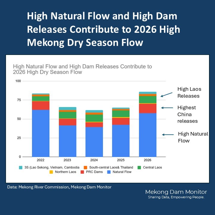
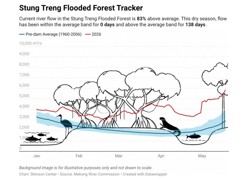
High Natural Flow and High Dam Releases Contribute to 2026 High Dry Season Mekong Flow.
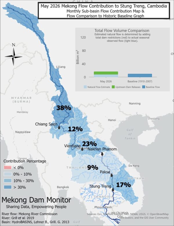
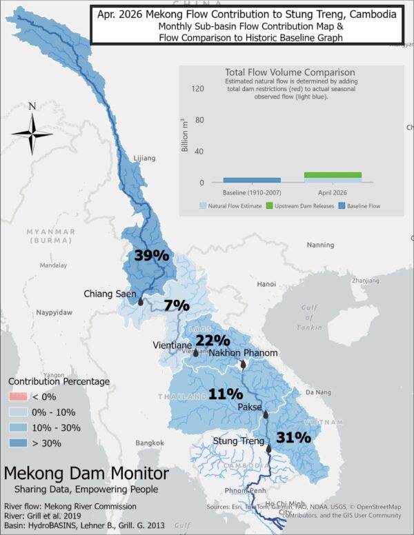
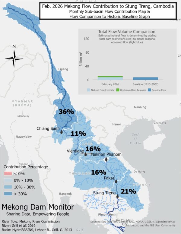
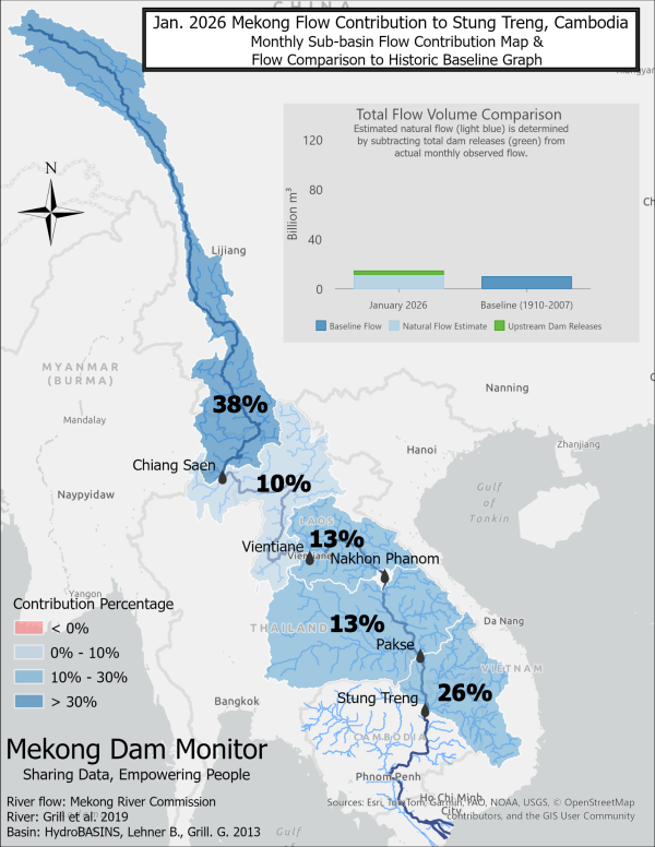
Dry season flow in 2026 exceeded 85 billion cubic meters—the highest in recent years—due to estimated high natural flow contributions (57 billion cubic meters) and high dam releases (28 billion cubic meters). China’s dam releases were the highest in the last five years with 12.5 billion cubic meters of water released from dams to produce hydropower between December and May. Large dams located in the central parts of Laos—Nam Ngum 1-2, Nam Theun 2, Theun Hinboun Expansion, to name a few— also released a relatively large quantity of water (9.7 billion cubic meters) for hydropower production. The high volumes of releases are likely due to a relatively rainy wet season in 2025 which filled major reservoirs and also the energy crunches delivered by the Hormuz Strait crisis. These releases combined with estimated higher-than-normal natural flow mostly coming from flow contributions in December (2025), January, and February from the 3S Basin in Laos and Vietnam—conditions which made for exceptionally high river levels throughout the Mekong’s dry season. High river levels create ecological risks throughout the basin and prevent natural resource access to communities who rely on low dry season river levels.
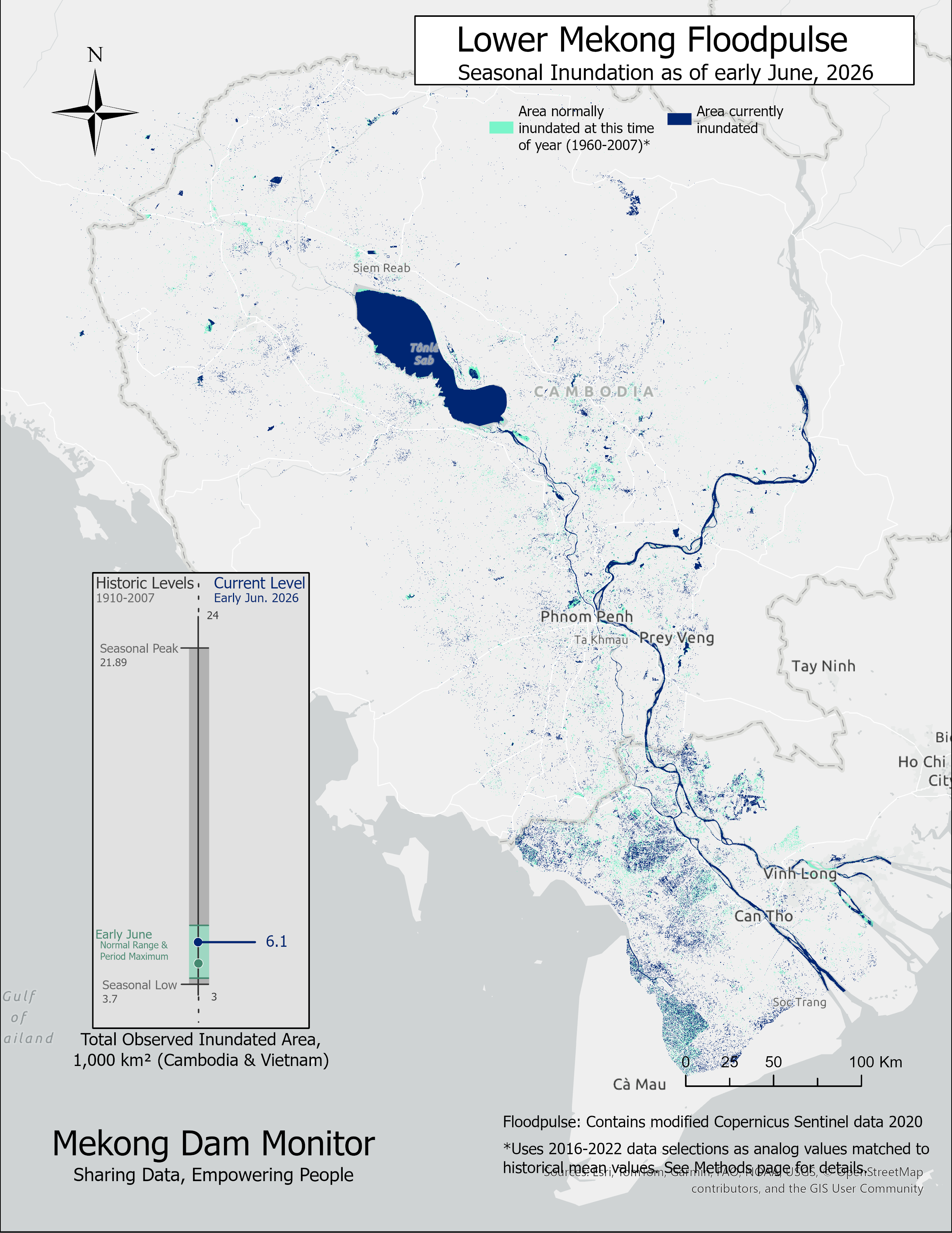
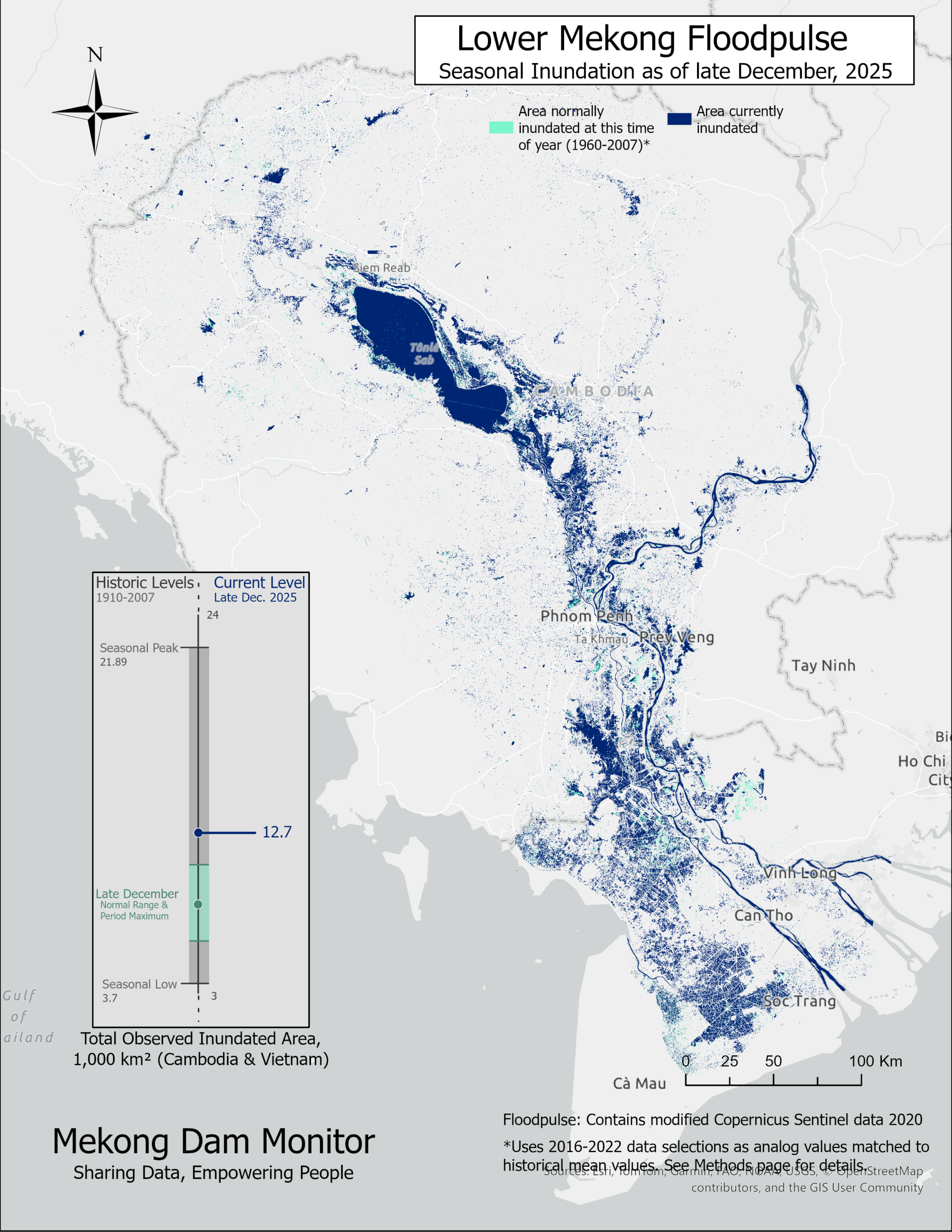
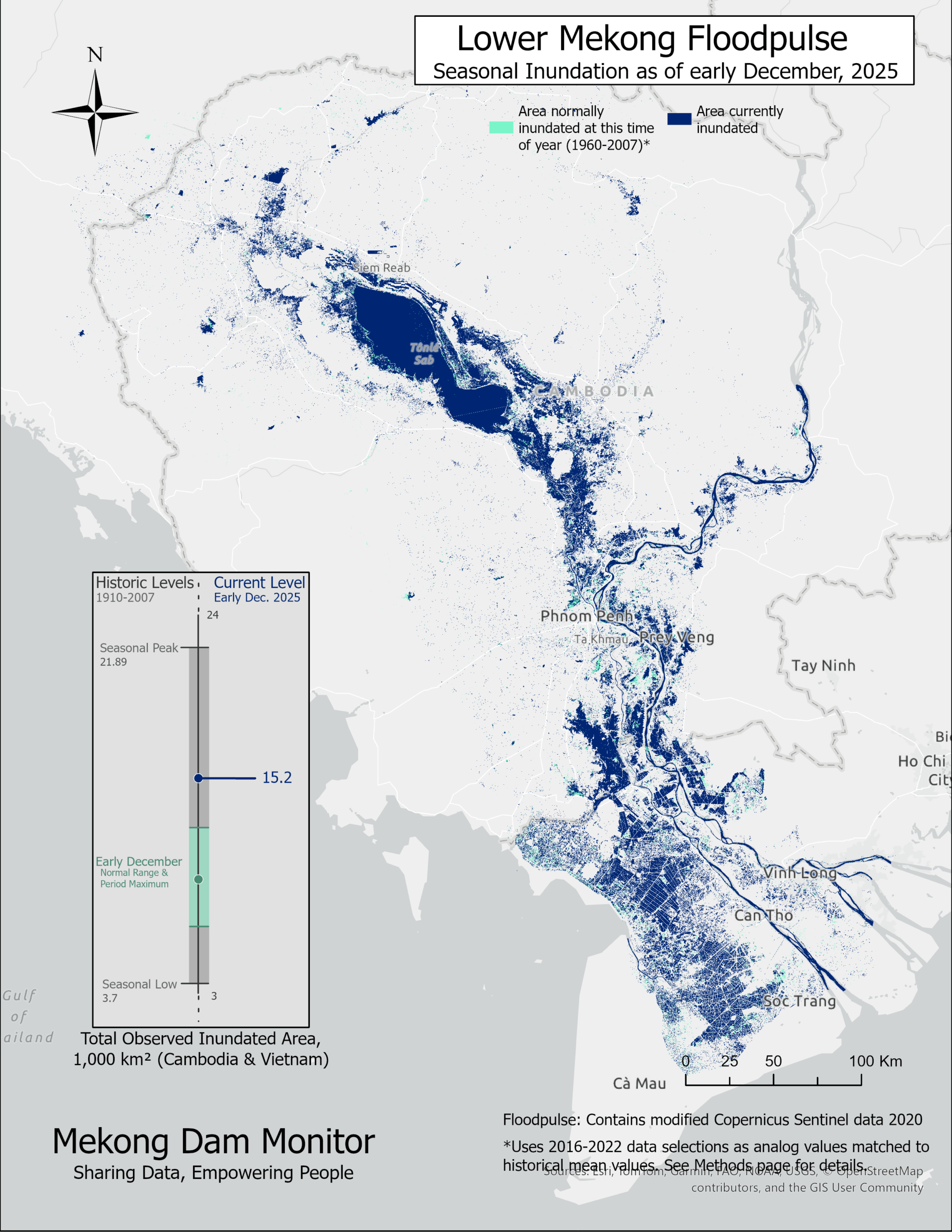
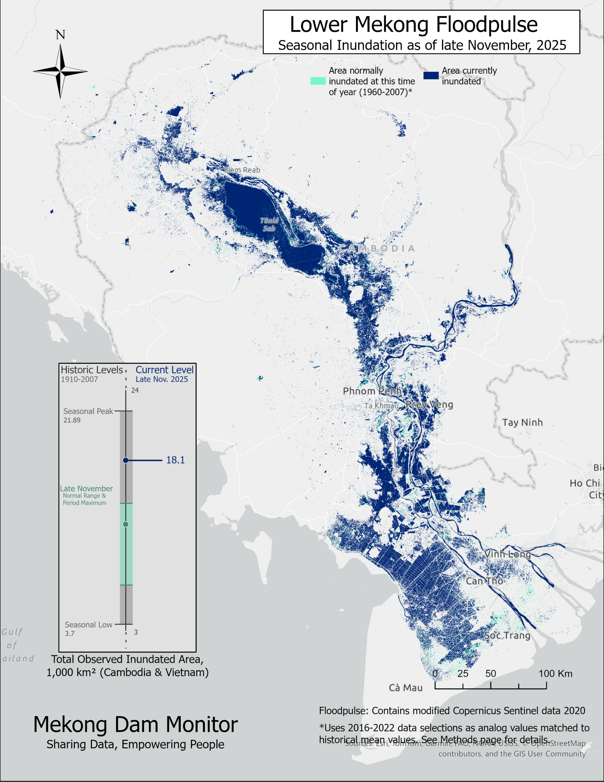
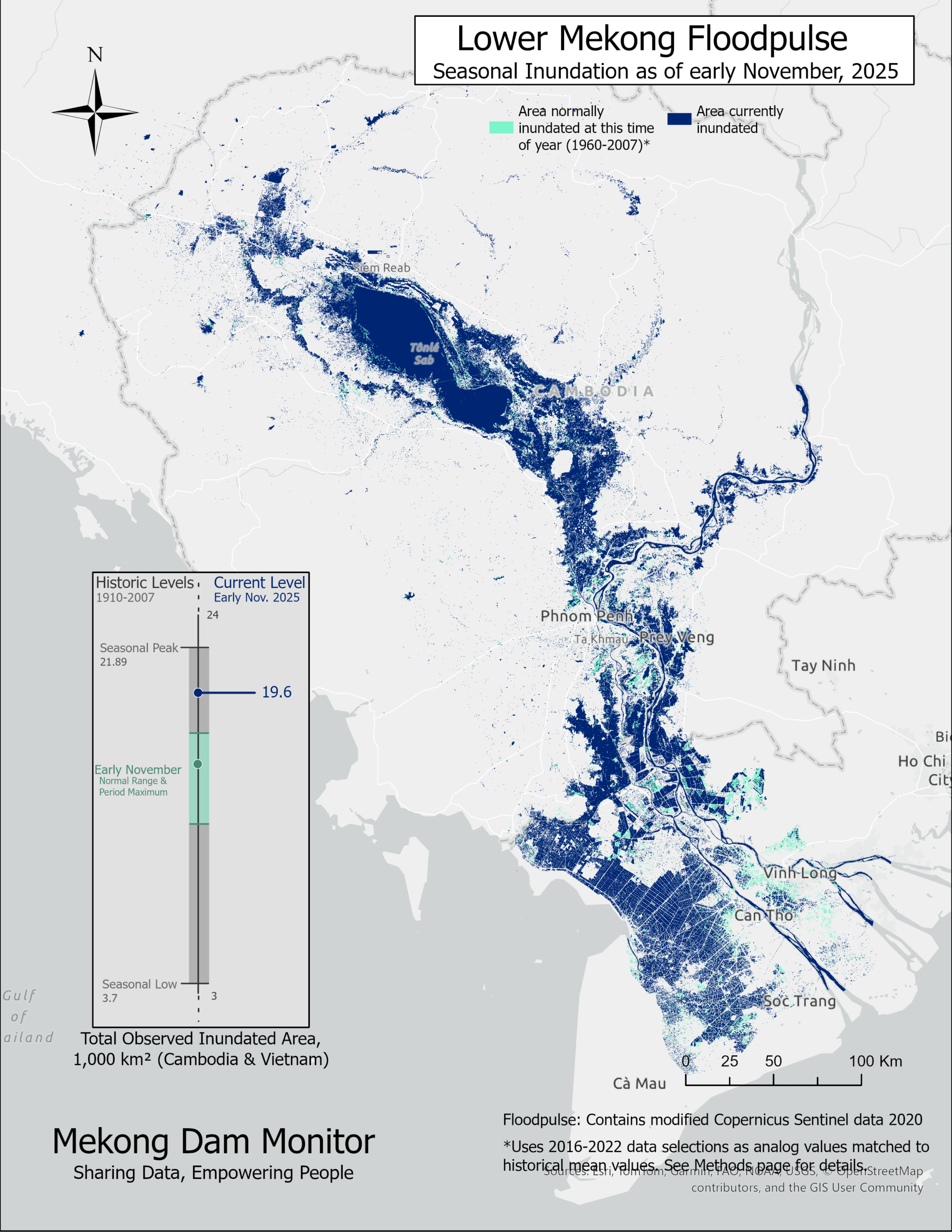
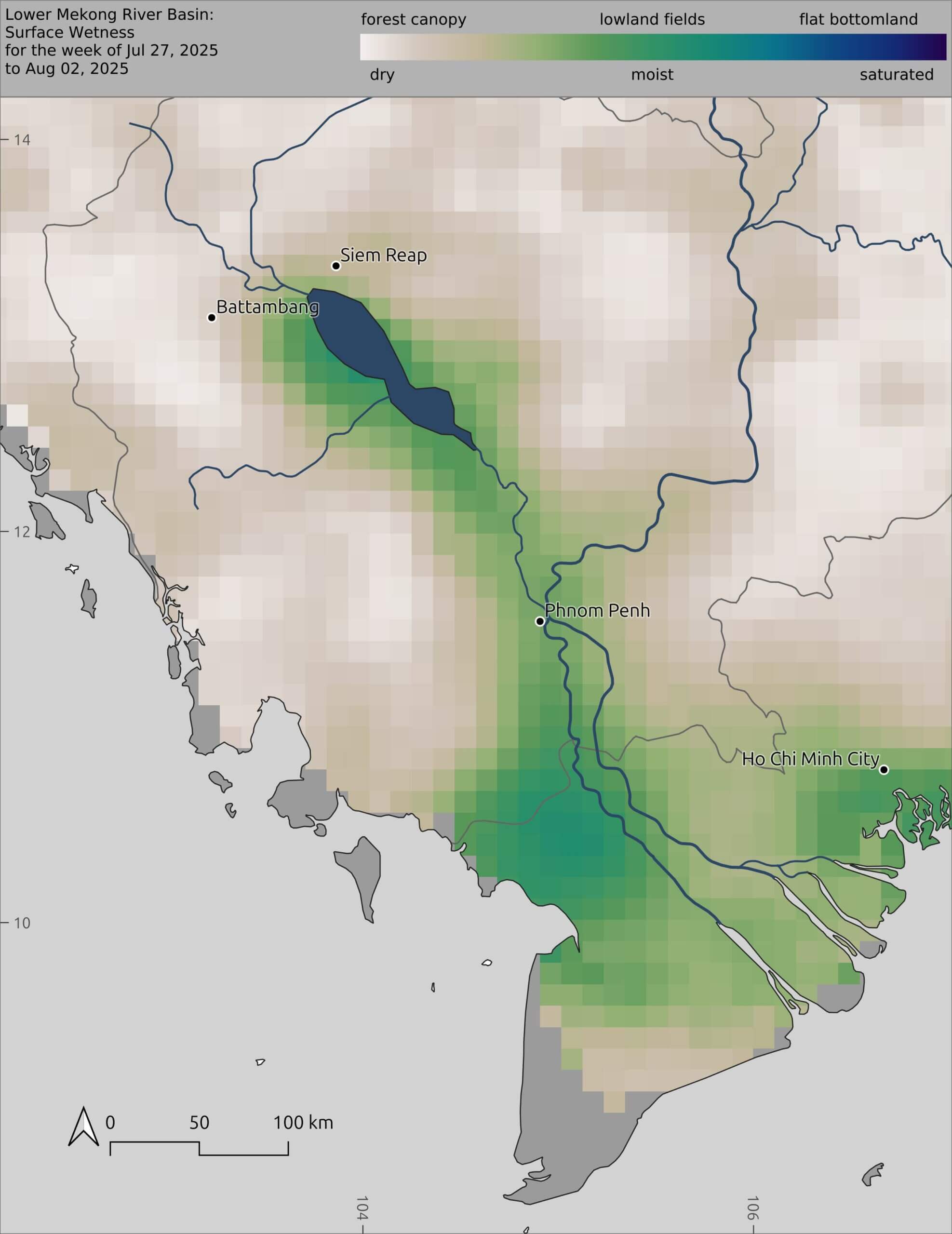
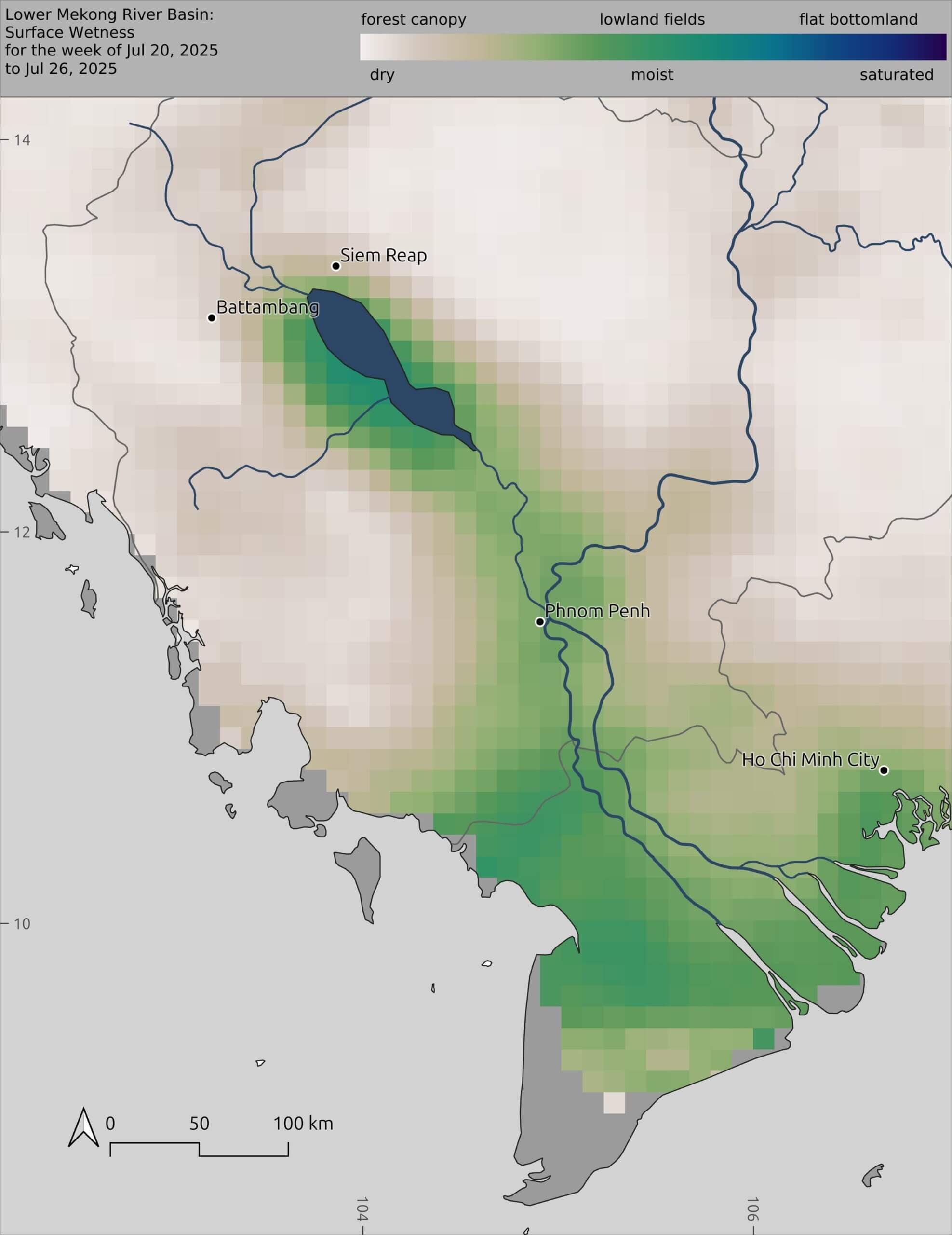
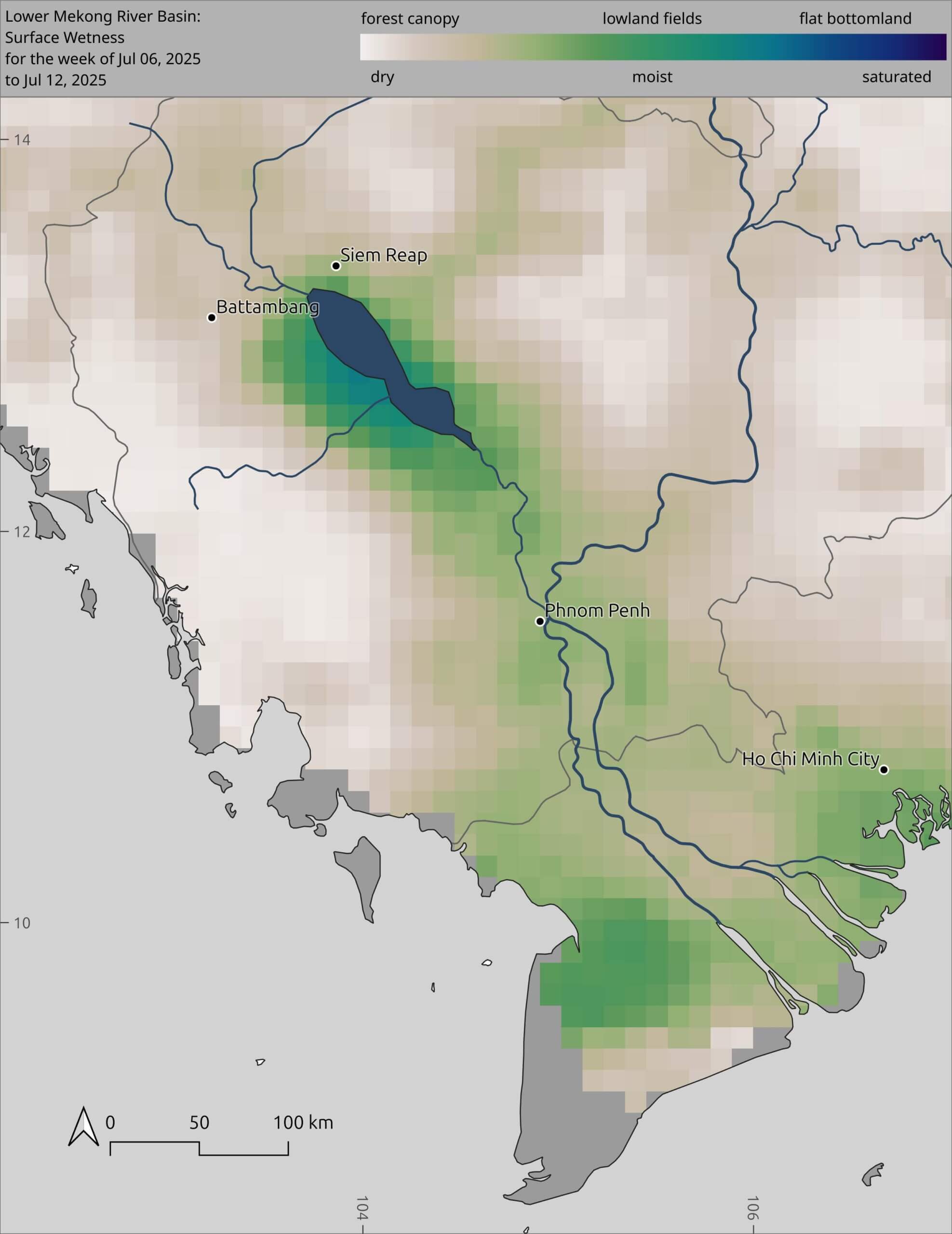
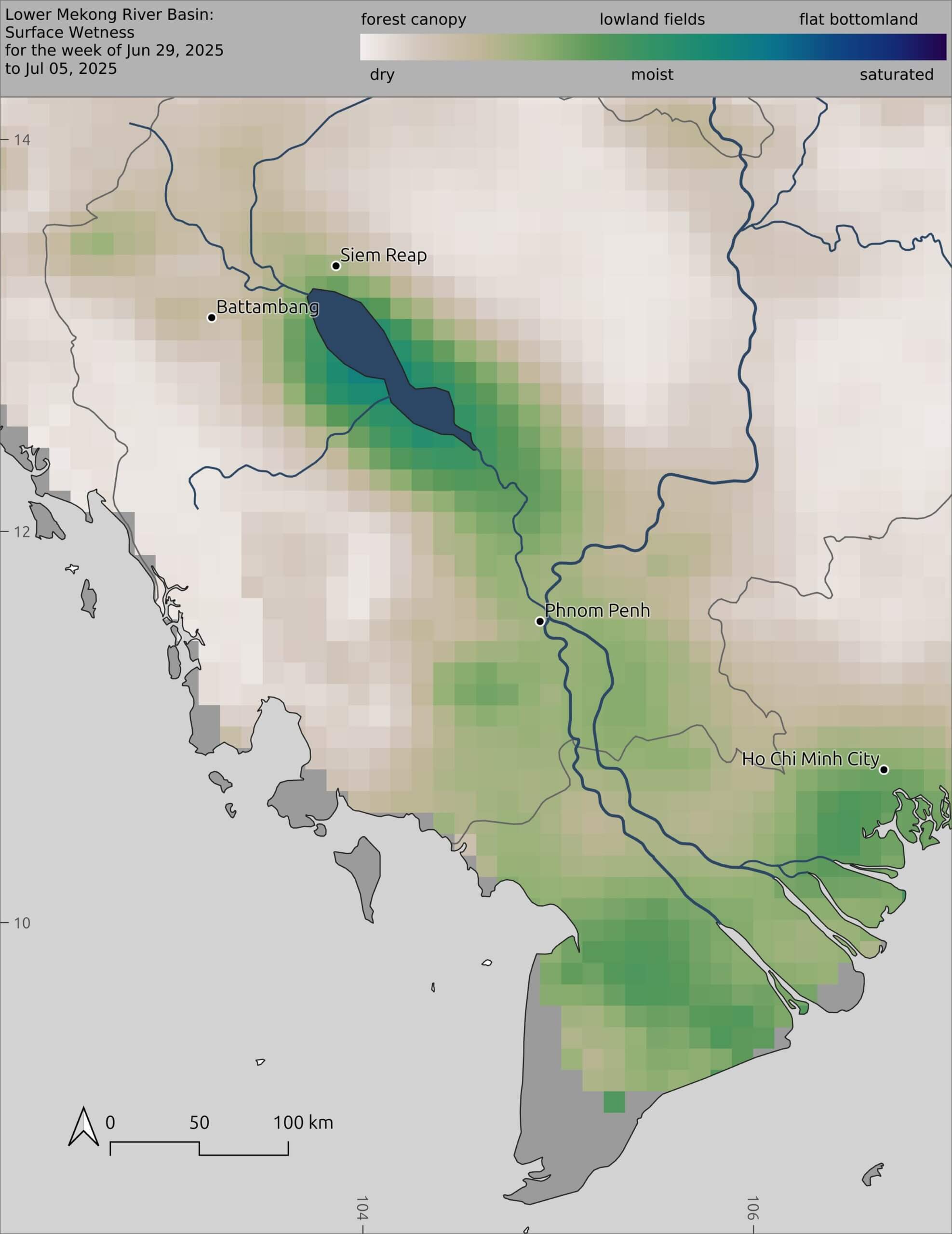
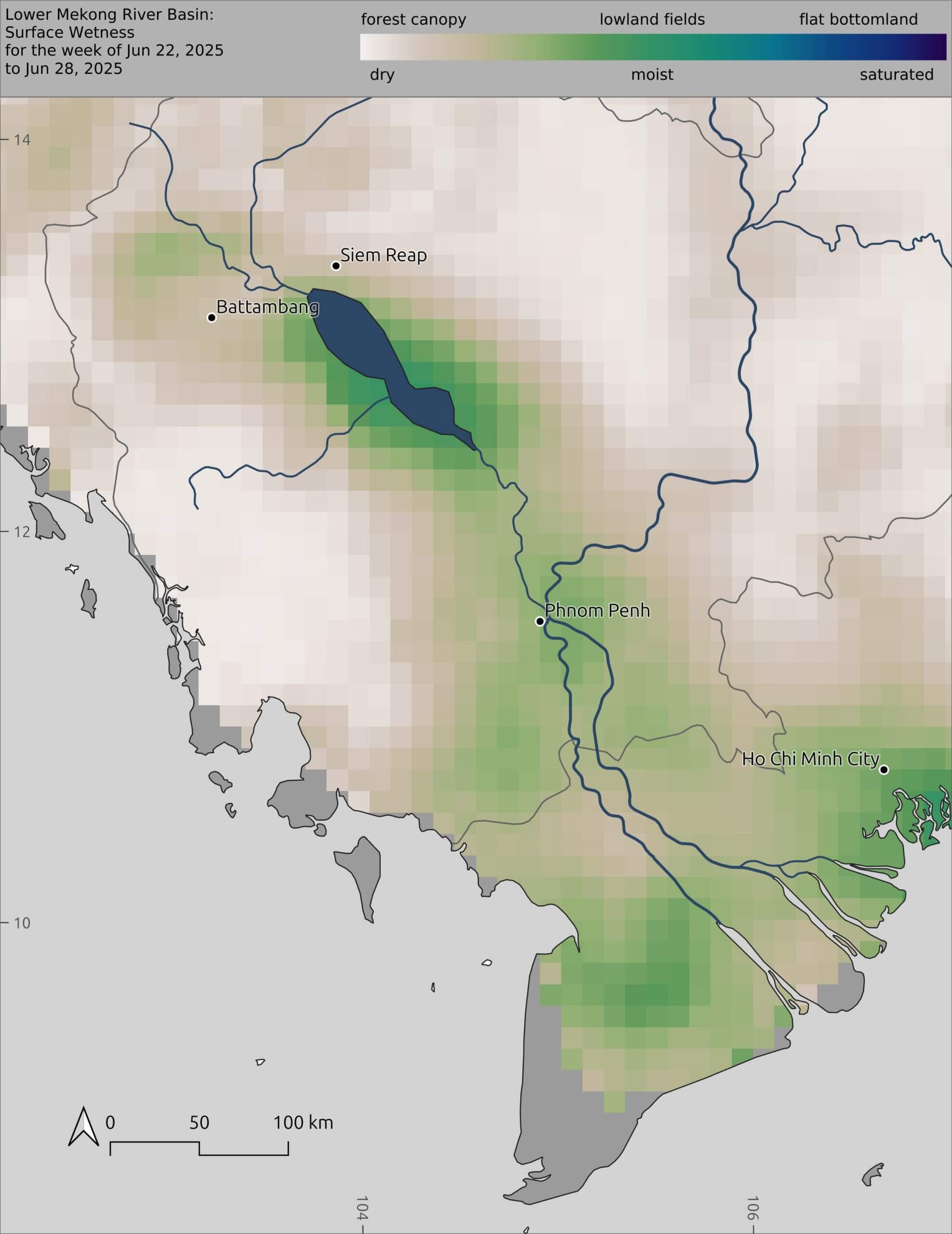
2026 Floodpulse is Normal for This Time of Year.
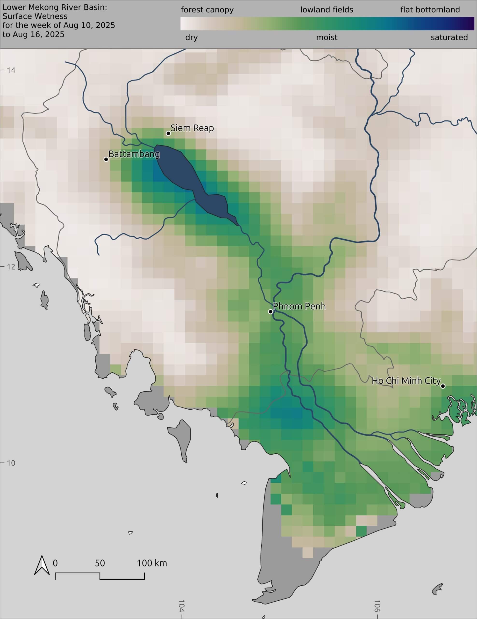
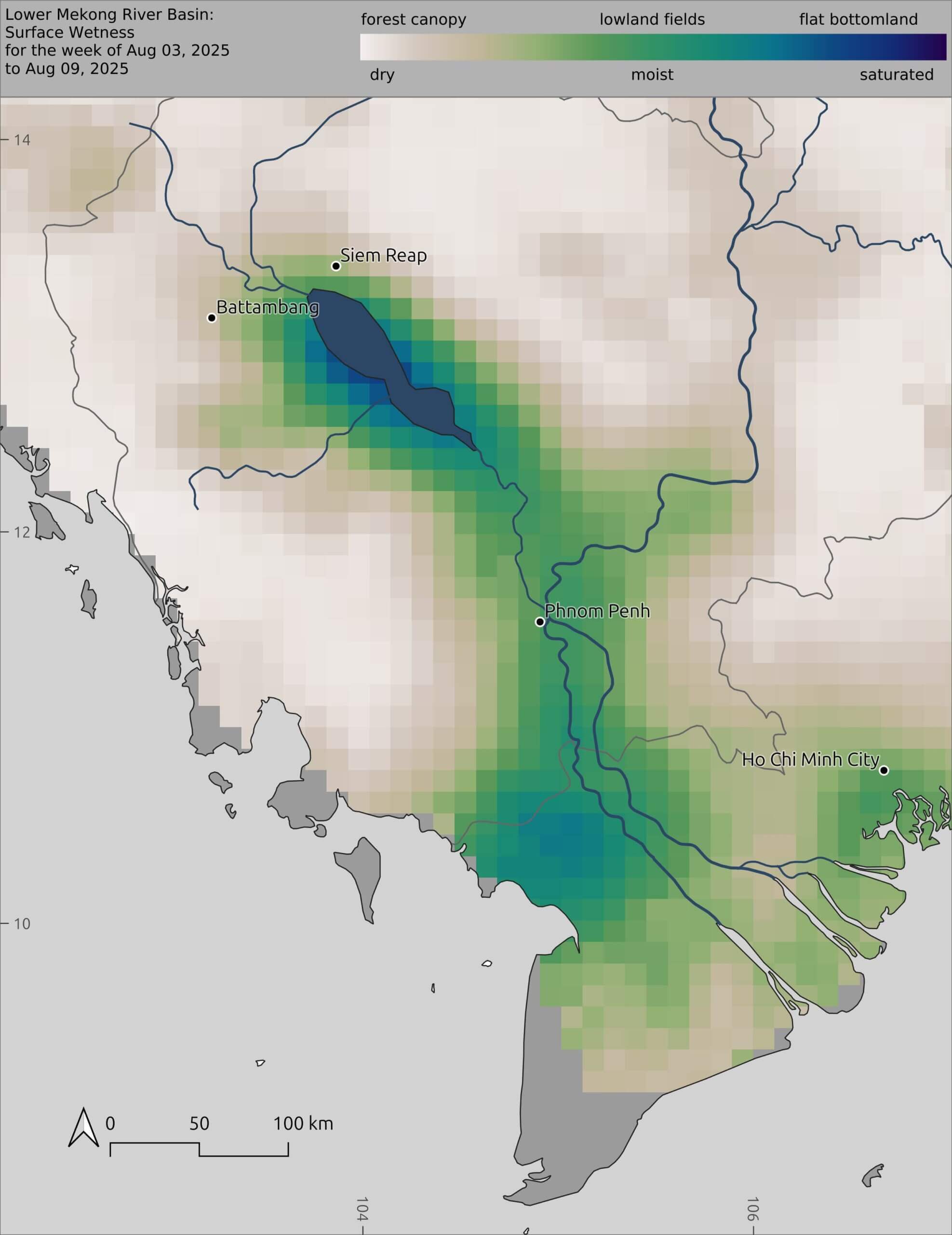
Our first floodpulse map for the 2026 Mekong wet season shows seasonal inundation to be within the normal range for this time of year. Much of the inundation (blue) seen on the map is from irrigation efforts in Vietnam and not from natural inundation. As the wet season deepens, the large floodplain around the Tonle Sap Lake should become inundated, and with the seasonal flooding will come fish larvae from the Mekong mainstream and upstream tributaries. The floodplain around the Tonle Sap will act as a natural incubation zone for the Tonle Sap’s massive fish catch estimated at about 600,000 tons per year on average.
Current volume (billion cubic meters) of usable water across the 45 largest reservoirs in the Mekong Basin.
For more info, click Natural River Flow Models in the top menu.
For more information, click Compare Maps and Data in the top menu.
Reservoirs with an estimated change of more than 50 million cubic meters (m³) of water over last 7 days.
For more info, click Virtual Gauges in the top menu.
For more info, click Virtual Gauges in the top menu.